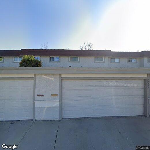
11255 Knott Ave
11255 Knott Ave
Cypress, CA 90630
2 Weeks Ago
Favorites
11255 Knott Ave

Favorites
Check Back Soon for Upcoming Availability
Location
Get Directions
California dreaming is pretty accurate when describing the city of Cypress. Its proximity to major cities and destinations makes it a premier location to settle down with your family! This tight-knit, urban community is filled with a variety of single-family homes and apartments for rent, and the school system is well-respected. The Cypress School District thrives in this city, along with Cypress College.
What are the conveniences that make this city so grand, you ask? Cypress is situated just eight miles west of Anaheim, 25 miles southeast of Los Angeles, and about 15 miles northeast of Long Beach and other nearby sandy shorelines. And as for entertainment destinations, Los Alamitos Race Course is situated in the city, and just a few miles outside of town, you’ll discover Adventure City and the famous Knott’s Berry Farm, a theme park known for its fried chicken.
Learn more about living in Cypress
Education
| Colleges & Universities | Distance | ||
|---|---|---|---|
| Colleges & Universities | Distance | ||
| Drive: | 7 min | 3.2 mi | |
| Drive: | 11 min | 4.9 mi | |
| Drive: | 13 min | 8.5 mi | |
| Drive: | 19 min | 10.0 mi |
11255 Knott Ave is within 7 minutes or 3.2 miles from Cypress College. It is also near Golden West College and Cal State Long Beach.
Transportation options available in Cypress include Norwalk, located 12.5 miles from 11255 Knott Ave. 11255 Knott Ave is near Long Beach (Daugherty Field), located 10.8 miles or 18 minutes away, and John Wayne/Orange County, located 13.7 miles or 22 minutes away.
| Transit / Subway | Distance | ||
|---|---|---|---|
| Transit / Subway | Distance | ||
|
|
Drive: | 17 min | 12.5 mi |
| Commuter Rail | Distance | ||
|---|---|---|---|
| Commuter Rail | Distance | ||
|
|
Drive: | 14 min | 7.7 mi |
|
|
Drive: | 15 min | 8.6 mi |
| Drive: | 16 min | 8.7 mi | |
|
|
Drive: | 19 min | 10.8 mi |
|
|
Drive: | 20 min | 11.1 mi |
| Airports | Distance | ||
|---|---|---|---|
| Airports | Distance | ||
|
Long Beach (Daugherty Field)
|
Drive: | 18 min | 10.8 mi |
|
John Wayne/Orange County
|
Drive: | 22 min | 13.7 mi |
Time and distance from 11255 Knott Ave.
| Shopping Centers | Distance | ||
|---|---|---|---|
| Shopping Centers | Distance | ||
| Walk: | 6 min | 0.3 mi | |
| Walk: | 7 min | 0.4 mi | |
| Walk: | 8 min | 0.4 mi |
11255 Knott Ave has 3 shopping centers within 0.4 mile, which is about a 8-minute walk. The miles and minutes will be for the farthest away property.
| Parks and Recreation | Distance | ||
|---|---|---|---|
| Parks and Recreation | Distance | ||
|
El Dorado East Regional Park
|
Drive: | 13 min | 6.4 mi |
|
El Dorado Nature Center
|
Drive: | 11 min | 6.4 mi |
|
Los Cerritos Wetlands Trust
|
Drive: | 15 min | 8.8 mi |
|
Earl Burns Miller Japanese Garden
|
Drive: | 15 min | 9.3 mi |
|
Sunset Harbour
|
Drive: | 17 min | 9.3 mi |
11255 Knott Ave has 5 parks within 9.3 miles, including El Dorado Nature Center, El Dorado East Regional Park, and Earl Burns Miller Japanese Garden.
| Hospitals | Distance | ||
|---|---|---|---|
| Hospitals | Distance | ||
| Drive: | 6 min | 3.3 mi | |
| Drive: | 7 min | 3.9 mi | |
| Drive: | 10 min | 5.3 mi |
11255 Knott Ave has 3 hospitals within 5.3 miles, the nearest is West Anaheim Medical Center which is 3.3 miles away and a 6 minute drive.
| Military Bases | Distance | ||
|---|---|---|---|
| Military Bases | Distance | ||
| Drive: | 7 min | 2.2 mi |
11255 Knott Ave is 2.2 miles and a 7 minute drive from Los Alamitos Army Airfield.
You May Also Like
Similar Rentals Nearby
-
-
-
-
-
-
1 / 50

-
-
-
-


What Are Walk Score®, Transit Score®, and Bike Score® Ratings?
Walk Score® measures the walkability of any address. Transit Score® measures access to public transit. Bike Score® measures the bikeability of any address.
What is a Sound Score Rating?
A Sound Score Rating aggregates noise caused by vehicle traffic, airplane traffic and local sources