$1,710
/ Month
1111 N Los Robles Ave
Pasadena, CA 91104
Favorites
1111 N Los Robles Ave

Favorites
Check Back Soon for Upcoming Availability
| Beds | Baths | Average SF |
|---|---|---|
| 1 Bedroom 1 Bedroom 1 Br | 1 Bath 1 Bath 1 Ba | 650 SF |
Fees and Policies
The fees listed below are community-provided and may exclude utilities or add-ons. All payments are made directly to the property and are non-refundable unless otherwise specified.
About This Property
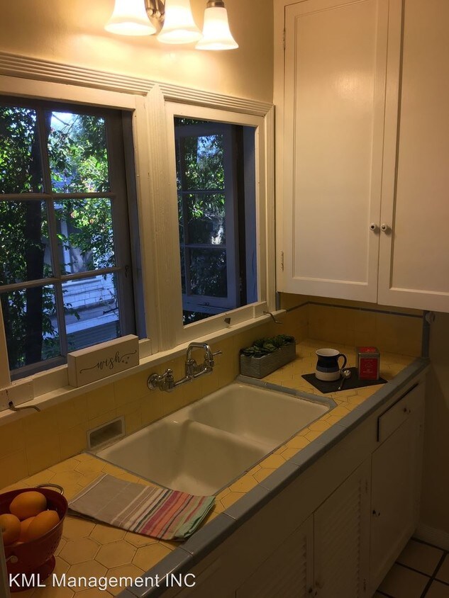
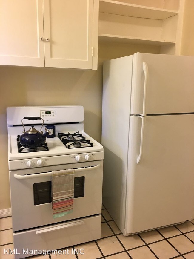
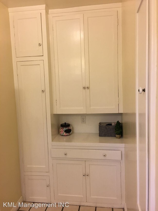
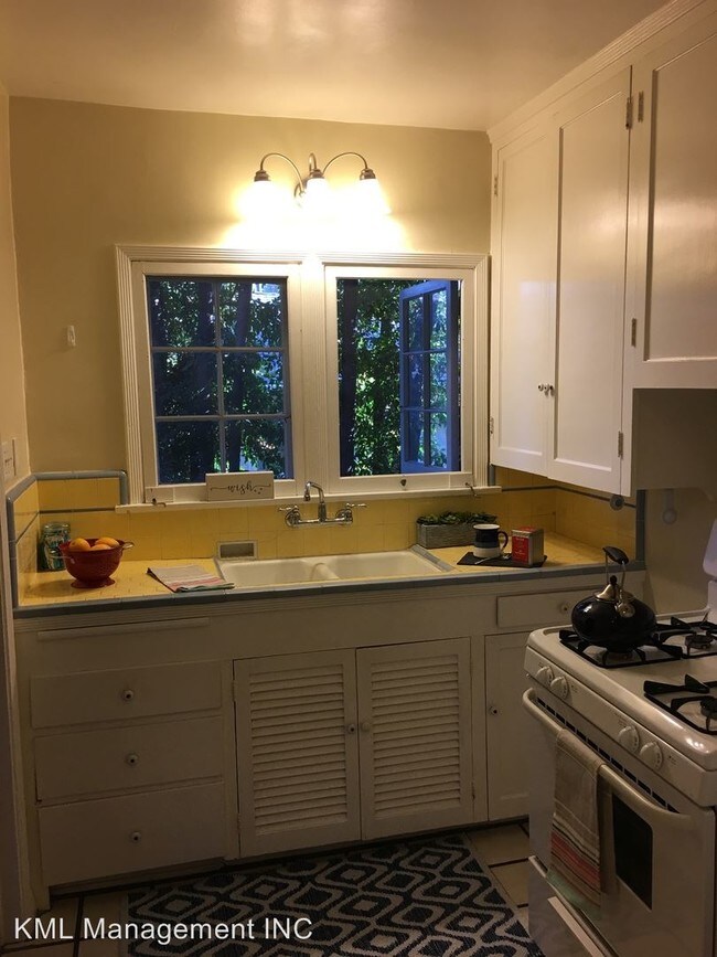
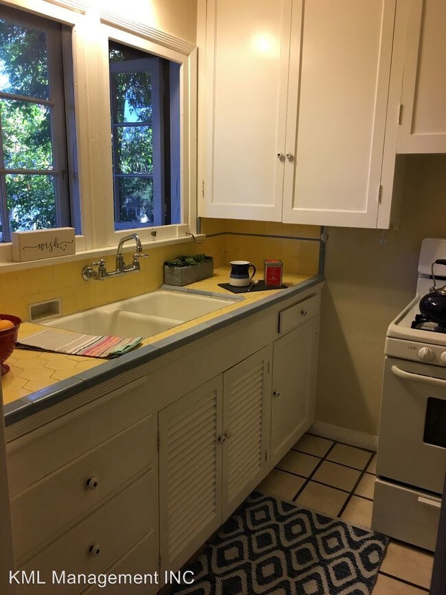
(626) 388-2111 - Spacious Craftsman Apt =1+1, Natural Hardwood, Vintage Style, A/C, Cat Friendly, - Welcome Home to this Historic Craftsman Home converted into apartments (eight in total) . The property is listed on National Register of Historic Homes. The kitchen features vintage tile counters, gas range, and refrigerator. Stay cool all summer and warm all winter with wall a/c in the living room and separate unit in the bedroom. The back yard features a community garden area and outdoor eating/lounge for residents use. This 2nd floor apartment is conveniently located near all that Pasadena has to offer. Quick access to frwys, bus line, and metro. We are cat friendly (one cat) with no additional deposit or pet rent. 12 month lease. No smoking.+ 15/mo. common area utility fee for additional occupant. 650 sq. ft. is an estimate. Good credit (FICO +680) and income equivalent to 2.75x rental value required for approval along with verifiable income and good tenant references. No Dogs Allowed (RLNE4340729) Other Amenities: Parking, Other (on-site laundry (coin)). Appliances: Air Conditioning, Refrigerator, Range. Pet policies: Cats Allowed, No Dogs Allowed.
1111 N Los Robles Ave is an apartment community located in Los Angeles County and the 91104 ZIP Code.
Unique Features
- No Dogs Allowed, Amenities - on-site laundry (coin)
Features
- Air Conditioning
1111 N Los Robles Ave,
Pasadena,
CA
91104
Near the San Gabriel Mountains, where I-210 meets State Route 134 and becomes the Foothill Freeway, rests Pasadena’s Garfield Heights neighborhood. Primarily a residential area, Garfield Heights contains a number of markets, churches, and temples. Garfield Heights residents enjoy access to neighboring parks such as La Pintoresca Park and City of Pasadena Robinson Park.
There are a host of amenities located within close proximity to Garfield Heights. Among the many amenities are the Rose Bowl Stadium, Kidspace Children’s Museum, Norton Simon Museum, Brookside Golf and Country Club, Pasadena Convention Center, Paseo Colorado, and the California Institute of Technology.
Served by several Metro Local lines and Pasadena Transit routes, getting around Garfield Height is a breeze.
Learn more about living in Garfield HeightsBelow are rent ranges for similar nearby apartments
Amenities
- Air Conditioning
- No Dogs Allowed, Amenities - on-site laundry (coin)
Education
| Colleges & Universities | Distance | ||
|---|---|---|---|
| Colleges & Universities | Distance | ||
| Drive: | 3 min | 1.3 mi | |
| Drive: | 6 min | 2.8 mi | |
| Drive: | 7 min | 3.0 mi | |
| Drive: | 11 min | 3.8 mi |
1111 N Los Robles Ave is within 3 minutes or 1.3 miles from Fuller Theological Seminary. It is also near Pasadena City College and Caltech.
Transportation options available in Pasadena include Memorial Park Station, located 1.7 miles from 1111 N Los Robles Ave. 1111 N Los Robles Ave is near Bob Hope, located 17.7 miles or 24 minutes away, and Los Angeles International, located 26.4 miles or 42 minutes away.
| Transit / Subway | Distance | ||
|---|---|---|---|
| Transit / Subway | Distance | ||
|
|
Drive: | 4 min | 1.7 mi |
|
|
Drive: | 5 min | 2.0 mi |
|
|
Drive: | 4 min | 2.1 mi |
|
|
Drive: | 4 min | 2.6 mi |
|
|
Drive: | 6 min | 2.8 mi |
| Commuter Rail | Distance | ||
|---|---|---|---|
| Commuter Rail | Distance | ||
|
|
Drive: | 14 min | 10.1 mi |
|
|
Drive: | 19 min | 11.3 mi |
|
|
Drive: | 21 min | 11.4 mi |
|
|
Drive: | 21 min | 11.6 mi |
| Drive: | 23 min | 15.4 mi |
| Airports | Distance | ||
|---|---|---|---|
| Airports | Distance | ||
|
Bob Hope
|
Drive: | 24 min | 17.7 mi |
|
Los Angeles International
|
Drive: | 42 min | 26.4 mi |
Walkability Near 1111 N Los Robles Ave Pasadena, CA 91104
Getting Around
 What do Walkability, Transit, Drivability, and Bikeability mean?
Walkability measures the walking distance to day-to-day needs.
Transit measures access to public transportation.
Drivability measures congestion, parking availability, and access to major roads.
Bikeability measures the suitability for cycling.
How It Works
What do Walkability, Transit, Drivability, and Bikeability mean?
Walkability measures the walking distance to day-to-day needs.
Transit measures access to public transportation.
Drivability measures congestion, parking availability, and access to major roads.
Bikeability measures the suitability for cycling.
How It Works
Moderately Walkable
Walkability
70
/ 100
Some Public Transit
Transit
40
/ 100
Exceptionally Drivable
Drivability
90
/ 100
Fairly Bikeable
Bikeability
50
/ 100
Scores provided by
-
Soundscore™
-
/ 100
Traffic
-Airport
-Businesses
-Scores provided by
HowLoud What is a Sound Score Rating? A Sound Score Rating aggregates noise caused by vehicle traffic, airplane traffic and local sources. How It WorksTime and distance from 1111 N Los Robles Ave.
| Shopping Centers | Distance | ||
|---|---|---|---|
| Shopping Centers | Distance | ||
| Walk: | 10 min | 0.5 mi | |
| Walk: | 12 min | 0.6 mi | |
| Walk: | 15 min | 0.8 mi |
1111 N Los Robles Ave has 3 shopping centers within 0.8 mile, which is about a 15-minute walk. The miles and minutes will be for the farthest away property.
| Parks and Recreation | Distance | ||
|---|---|---|---|
| Parks and Recreation | Distance | ||
|
Kidspace Children's Museum
|
Drive: | 5 min | 2.2 mi |
|
Jet Propulsion Laboratory
|
Drive: | 6 min | 2.8 mi |
|
Eaton Canyon Nature Center
|
Drive: | 8 min | 3.5 mi |
|
Huntington Botanical Gardens
|
Drive: | 10 min | 4.1 mi |
|
Descanso Gardens
|
Drive: | 11 min | 6.3 mi |
1111 N Los Robles Ave has 5 parks within 6.3 miles, including Kidspace Children's Museum, Jet Propulsion Laboratory, and Eaton Canyon Nature Center.
| Hospitals | Distance | ||
|---|---|---|---|
| Hospitals | Distance | ||
| Drive: | 5 min | 2.6 mi | |
| Drive: | 6 min | 3.1 mi | |
| Drive: | 8 min | 4.5 mi |
1111 N Los Robles Ave has 3 hospitals within 4.5 miles, the nearest is Huntington Memorial Hospital which is 2.6 miles away and a 5 minute drive.
| Military Bases | Distance | ||
|---|---|---|---|
| Military Bases | Distance | ||
| Drive: | 39 min | 28.0 mi | |
| Drive: | 48 min | 31.3 mi | |
| Drive: | 53 min | 38.8 mi |
1111 N Los Robles Ave has 3 military bases within 38.8 miles, the nearest is Los Angeles Air Force Base which is 28.0 miles away and a 39 minute drive.
You May Also Like
Similar Rentals Nearby
-
-
1 Bed$2,443+2 Beds$3,342+Total Monthly PriceTotal Monthly Price NewPrices include base rent and required monthly fees of $45. Variable costs based on usage may apply.Base Rent:1 Bed$2,397+2 Beds$3,296+2 Months Free
Pets Allowed Fitness Center Pool In Unit Washer & Dryer Clubhouse Balcony
-
-
-
-
-
-
-
-
1 Bed$3,161+2 Beds$4,611+Total Monthly Price12 Month LeaseTotal Monthly Price NewPrices include base rent and required monthly fees of $15. Variable costs based on usage may apply.Base Rent:1 Bed$3,145+2 Beds$4,595+2 Months Free
Pets Allowed Fitness Center Pool Maintenance on site High-Speed Internet Controlled Access EV Charging


What Are Walk Score®, Transit Score®, and Bike Score® Ratings?
Walk Score® measures the walkability of any address. Transit Score® measures access to public transit. Bike Score® measures the bikeability of any address.
What is a Sound Score Rating?
A Sound Score Rating aggregates noise caused by vehicle traffic, airplane traffic and local sources.

1111 N Los Robles Ave
Pasadena, CA 91104