$1,800
/ Month
111 N Soto St Unit 111
Los Angeles, CA 90033
Today
|
Edit
Favorites
213-999-0073
-
Bedrooms
1
-
Bathrooms
1
-
Square Feet
8,437 sq ft
-
Available
Available Dec 4
111 N Soto St Unit 111

Favorites
About This Home
12 Month Lease,
$1,800 deposit,
Available Dec 4
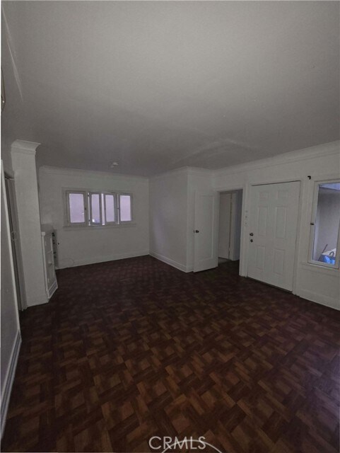
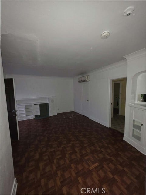
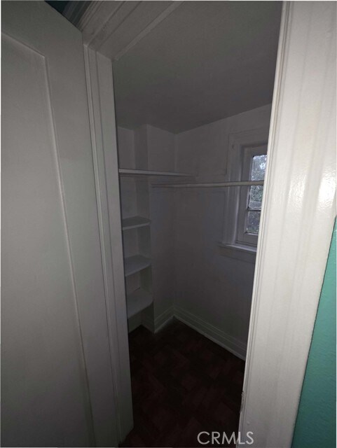
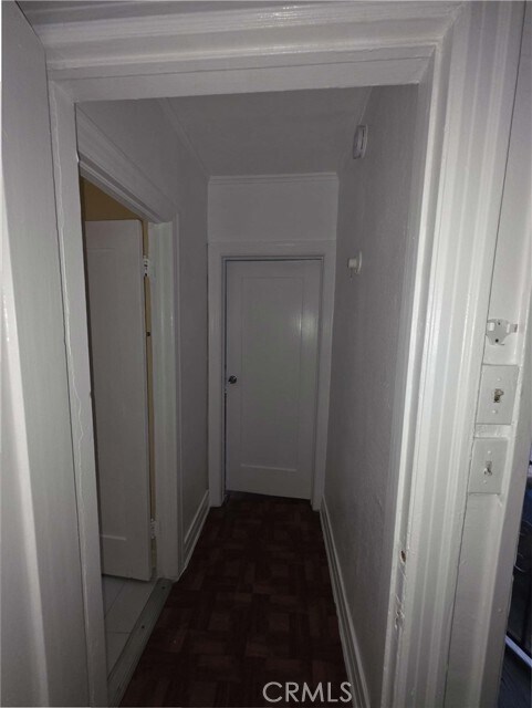
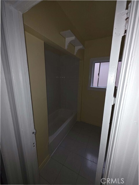
1BD/1BA PRIME BOYLE HEIGHTS! STEPS TO METRO E LINE! Vibrant urban living at 111 N Soto Street in historic Boyle Heights. Charming 1 Bed, 1 Bath apartment located steps from the major intersection of 1st & Soto St. Unbeatable commuter location: Short walk to Metro E Line (Gold Line) Soto Station for instant access to DTLA. Immerse yourself in the rich culture, dynamic local eateries, and community spirit of East LA. Excellent walkability! A commuter's dream home. MLS# CV25269652
111 N Soto St is an apartment community located in Los Angeles County and the 90033 ZIP Code.
* Price shown is base rent. Excludes user-selected optional fees and variable or usage-based fees and required charges due at or prior to move-in or at move-out. Price, availability, fees, and any applicable rent special are subject to change without notice.
* Square footage definitions vary. Displayed square footage is approximate.
Fees and Policies
The fees below are based on community-supplied data and may exclude additional fees and utilities.
- One-Time Basics
- Due at Move-In
- Security Deposit - RefundableCharged per unit.$1,800
- Due at Move-In
- Street Parking
Property Fee Disclaimer: Based on community-supplied data and independent market research. Subject to change without notice. May exclude fees for mandatory or optional services and usage-based utilities.
Details
Utilities Included
-
Water
Lease Options
-
12 Months
Features
- Washer/Dryer Hookup
- Air Conditioning
- Vinyl Flooring
Contact
- Listed by Eric Chavez | CAREBF INC
- Phone Number
- Contact
-
Source
 California Regional Multiple Listing Service
Copyright 2025 © California Regional MLS. All rights reserved.
Location
Get Directions
Amenities
- Washer/Dryer Hookup
- Air Conditioning
- Vinyl Flooring
Expenses
Utilities Included
Water
Included
Southeast Los Angeles is directly south of the Fashion District and east of the University of Southern California (USC). This large neighborhood is minutes from downtown Los Angeles, Hollywood, and Beverly Hills, with easy access to the 110 Freeway. This great location places you near sunny beaches, nature trails, and a bevy of leading employers. Students can access both USC and California State University Long Beach from their Southeast LA apartment.
This densely populated, diverse neighborhood features everything from food trucks and corner markets to wide sidewalks and residential areas filled with bungalows, ranch, and Spanish Colonial architecture. Southeast LA features palm trees and mountain views, tampered with gritty undertones to give it a cool, funky vibe.
As for outdoor fun, take your pick between Catalina Island, Venus Beach, or the Santa Monica Pier. Nearby, you’ll find more sunny beaches like White Point, Cabrillo, and Long Beach.
Learn more about living in Southeast Los Angeles
Education
| Colleges & Universities | Distance | ||
|---|---|---|---|
| Colleges & Universities | Distance | ||
| Drive: | 3 min | 1.5 mi | |
| Drive: | 6 min | 3.4 mi | |
| Drive: | 7 min | 4.0 mi | |
| Drive: | 7 min | 4.0 mi |
111 N Soto St Unit 111 is within 3 minutes or 1.5 miles from USC, Health Sciences Campus. It is also near Cal State Los Angeles and Golden Gate Univ, Los Angeles.
Transportation options available in Los Angeles include Soto, located 0.1 mile from 111 N Soto St Unit 111. 111 N Soto St Unit 111 is near Bob Hope, located 17.4 miles or 24 minutes away, and Los Angeles International, located 18.1 miles or 29 minutes away.
| Transit / Subway | Distance | ||
|---|---|---|---|
| Transit / Subway | Distance | ||
|
|
Walk: | 2 min | 0.1 mi |
|
|
Walk: | 12 min | 0.6 mi |
|
|
Walk: | 19 min | 1.0 mi |
|
|
Drive: | 2 min | 1.3 mi |
|
|
Drive: | 6 min | 2.2 mi |
| Commuter Rail | Distance | ||
|---|---|---|---|
| Commuter Rail | Distance | ||
|
|
Drive: | 4 min | 2.1 mi |
|
|
Drive: | 6 min | 2.2 mi |
| Drive: | 8 min | 6.0 mi | |
|
|
Drive: | 13 min | 7.1 mi |
|
|
Drive: | 12 min | 7.8 mi |
| Airports | Distance | ||
|---|---|---|---|
| Airports | Distance | ||
|
Bob Hope
|
Drive: | 24 min | 17.4 mi |
|
Los Angeles International
|
Drive: | 29 min | 18.1 mi |
Time and distance from 111 N Soto St Unit 111.
| Shopping Centers | Distance | ||
|---|---|---|---|
| Shopping Centers | Distance | ||
| Walk: | 9 min | 0.5 mi | |
| Walk: | 14 min | 0.8 mi | |
| Walk: | 16 min | 0.9 mi |
111 N Soto St Unit 111 has 3 shopping centers within 0.9 mile, which is about a 16-minute walk. The miles and minutes will be for the farthest away property.
| Parks and Recreation | Distance | ||
|---|---|---|---|
| Parks and Recreation | Distance | ||
|
Hollenbeck Lake
|
Walk: | 11 min | 0.6 mi |
|
Vista Hermosa Natural Park
|
Drive: | 7 min | 3.7 mi |
|
Echo Park Lake
|
Drive: | 6 min | 3.7 mi |
|
Elysian Park
|
Drive: | 12 min | 4.9 mi |
|
Chavez Ravine Arboretum
|
Drive: | 9 min | 5.7 mi |
111 N Soto St Unit 111 has 5 parks within 5.7 miles, including Hollenbeck Lake, Vista Hermosa Natural Park, and Echo Park Lake.
| Hospitals | Distance | ||
|---|---|---|---|
| Hospitals | Distance | ||
| Drive: | 3 min | 1.4 mi | |
| Drive: | 3 min | 1.6 mi | |
| Drive: | 5 min | 2.4 mi |
111 N Soto St Unit 111 has 3 hospitals within 2.4 miles, the nearest is LAC + USC Medical Center which is 1.4 miles away and a 3 minute drive.
| Military Bases | Distance | ||
|---|---|---|---|
| Military Bases | Distance | ||
| Drive: | 27 min | 18.7 mi |
111 N Soto St Unit 111 is 18.7 miles and a 27 minute drive from Los Angeles Air Force Base.
You May Also Like
Similar Rentals Nearby


 - Violet on Virgil")


What Are Walk Score®, Transit Score®, and Bike Score® Ratings?
Walk Score® measures the walkability of any address. Transit Score® measures access to public transit. Bike Score® measures the bikeability of any address.
What is a Sound Score Rating?
A Sound Score Rating aggregates noise caused by vehicle traffic, airplane traffic and local sources

111 N Soto St
Los Angeles, CA 90033