$3,100
/ Month
1106 Carbondale Way
Gambrills, MD 21054
Today
Favorites
410-975-9610
-
Bedrooms
3
-
Bathrooms
3
-
Square Feet
2,528 sq ft
-
Available
Available Now
Highlights
- Open Floorplan
- Colonial Architecture
- Recreation Room
- Vaulted Ceiling
- Wood Flooring
- Attic
1106 Carbondale Way

Favorites
About This Home
Available Now
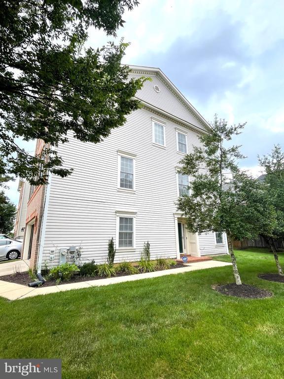
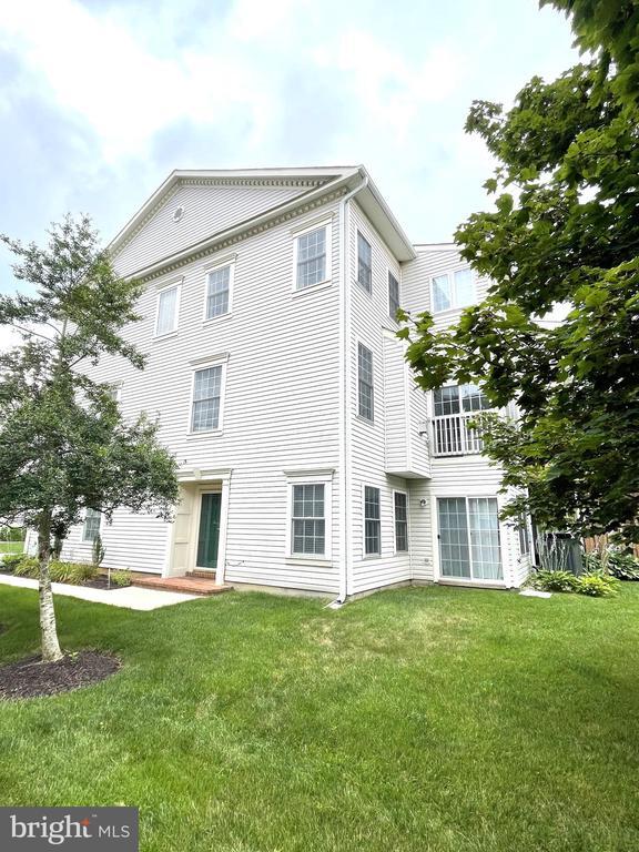
FANTASTIC SPACIOUS END UNIT TOWNHOME WITH BUMP OUT ON ALL 3 LEVELS**BEAUTIFUL HARDWOOD FLOORS**UPGRADED COUNTERS, STAINLESS STEEL APPLIANCES**LUXURIOUS PRIMARY SUITE WITH VAULTED CEILING, SUPER BATH, AND WALK-IN CLOSET**PREFER NO SMOKING & NO PETS, WILL CONSIDER CASE BY CASE THOUGH**
1106 Carbondale Way is a townhome located in Anne Arundel County and the 21054 ZIP Code. This area is served by the Anne Arundel County Public Schools attendance zone.
* Price shown is base rent. Excludes user-selected optional fees and variable or usage-based fees and required charges due at or prior to move-in or at move-out. Price, availability, fees, and any applicable rent special are subject to change without notice.
* Square footage definitions vary. Displayed square footage is approximate.
Home Details
Home Type
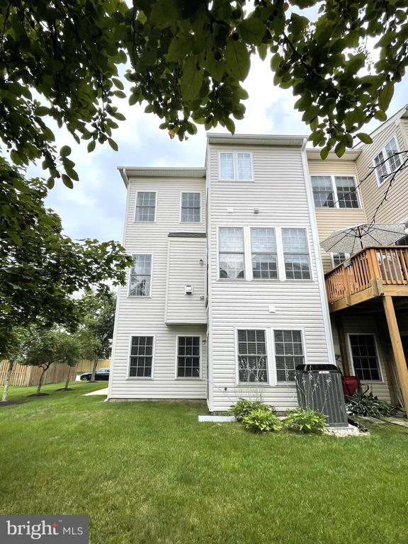
End Unit Townhome
Year Built
Built in 2002
Bedrooms and Bathrooms
Soaking Tub
Walk-In Closet
Bathtub with Shower
En-Suite Primary Bedroom
Walk-in Shower
4 Bathrooms
En-Suite Bathroom
3 Bedrooms
Flooring
Wood
Ceramic Tile
Carpet
Home Design
Colonial Architecture
Architectural Shingle Roof
Brick Front
Vinyl Siding
Asphalt Roof
Slab Foundation
Home Security
Alarm System
Fire Sprinkler System
Interior Spaces
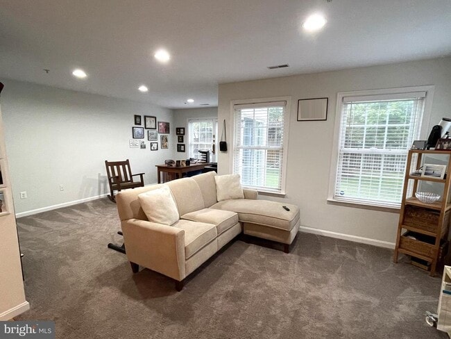
Open Floorplan
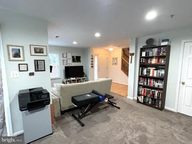
Recreation Room
Vaulted Ceiling
Sun or Florida Room
Sitting Room
Formal Dining Room
Family Room Off Kitchen
Chair Railings
Crown Molding
Recessed Lighting
Entrance Foyer
Sliding Doors
Ceiling Fan
Utility Room
Window Screens
Insulated Doors
Six Panel Doors
Gas Fireplace
2,528 Sq Ft Home
Fireplace With Glass Doors
Fireplace Mantel
Property has 3 Levels
Insulated Windows
Casement Windows
Double Hung Windows
Kitchen
Upgraded Countertops
Breakfast Room
Stainless Steel Appliances
Eat-In Kitchen
Gas Oven or Range
Ice Maker
Built-In Microwave
Dishwasher
Disposal
Laundry
Laundry Room
Laundry on upper level
Stacked Washer and Dryer
Listing and Financial Details
Security Deposit $3,100
Requires 1 Month of Rent Paid Up Front
12-Month Lease Term
Available 9/18/25
$50 Application Fee
Assessor Parcel Number 020218490212816
Tenant pays for appliances/equipment - some, cable TV, cooking fuel, electricity, exterior maintenance, gas, gutter cleaning, heat, hot water, insurance, lawn/tree/shrub care, light bulbs/filters/fuses/alarm care, minor interior maintenance, pest control, sewer, all utilities, water
The owner pays for real estate taxes, trash collection
Rent includes trash removal
$175 Repair Deductible
Residential Lease
Lot Details
2,200 Sq Ft Lot
Property is in good condition
Backs To Open Common Area
Sprinkler System
Parking
2 Car Direct Access Garage
Parking Storage or Cabinetry
Front Facing Garage
Unassigned Parking
Lighted Parking
Off-Street Parking
Garage Door Opener
Driveway
Schools
Nantucket Elementary School
Crofton Middle School
Utilities
Forced Air Heating and Cooling System
Water Dispenser
Cable TV Available
Phone Available
Natural Gas Water Heater
200+ Amp Service
120/240V
Vented Exhaust Fan
Community Details
Amenities
Common Area
Overview
Property has a Home Owners Association
Built by U.S. HOME
Crofton Farms Subdivision, Aberdeen Floorplan
Crofton Farms Townhome Condominium Inc. Condos
Crofton Farms Recreation Association Inc. HOA
Property Manager
Pet Policy
Pets allowed on a case-by-case basis
Recreation
Community Playground
Contact
- Listed by Frank W Burnett | RE/MAX Executive
- Phone Number
- Contact
-
Source
 Bright MLS, Inc.
Copyright © 2025 Bright MLS, Inc.
Location
Get Directions
Amenities
- Fireplace
- Dishwasher
Gambrills is a tranquil community nestled in Anne Arundel County. Vast expanses of green space characterize the largely residential area, offering locals a secluded feel. However, Gambrills is far from isolated—three prominent cities are within easy driving distance: Annapolis, Baltimore, and Washington, DC.
Gambrills is also convenient to exciting attractions such as Autobahn Indoor Speedway, Patuxent Research Refuge, and Six Flags America. Quick access to I-97 and Baltimore Washington International Thurgood Marshall Airport makes commuting and traveling from Gambrills a breeze.
Learn more about living in Gambrills
Education
| Colleges & Universities | Distance | ||
|---|---|---|---|
| Colleges & Universities | Distance | ||
| Drive: | 20 min | 9.6 mi | |
| Drive: | 21 min | 12.2 mi | |
| Drive: | 25 min | 15.2 mi | |
| Drive: | 28 min | 18.1 mi |
1106 Carbondale Way is within 20 minutes or 9.6 miles from Bowie State University. It is also near Anne Arundel Community College and United States Naval Academy.
Schools


Public Elementary School
Grades PK-5
709 Students
Attendance Zone
Public Elementary School
Grades PK-5
671 Students
Nearby
Public Middle School
Grades 6-8
1,374 Students
Attendance Zone
Public High School
Grades 9-12
1,617 Students
Attendance Zone
Private Elementary School
Grades PK-4
Nearby
Private Elementary & Middle School
Grades PK-8
736 Students
Nearby
Private Elementary, Middle & High School
Grades K-12
335 Students
Nearby
School data provided by
 The GreatSchools Rating helps parents compare schools within a state based on a variety of school quality indicators and provides a helpful picture of how effectively each school serves all of its students. Ratings are on a scale of 1 (below average) to 10 (above average) and can include test scores, college readiness, academic progress, advanced courses, equity, discipline and attendance data. We also advise parents to visit schools, consider other information on school performance and programs, and consider family needs as part of the school selection process.
View GreatSchools Rating Methodology
Data provided by GreatSchools.org © 2025. All rights reserved.
View GreatSchools Rating Methodology
Data provided by GreatSchools.org © 2025. All rights reserved.
Transportation options available in Gambrills include Cromwell Station/Glen Burnie, located 11.6 miles from 1106 Carbondale Way. 1106 Carbondale Way is near Baltimore/Washington International Thurgood Marshall, located 15.3 miles or 24 minutes away, and Ronald Reagan Washington Ntl, located 30.1 miles or 45 minutes away.
| Transit / Subway | Distance | ||
|---|---|---|---|
| Transit / Subway | Distance | ||
|
|
Drive: | 16 min | 11.6 mi |
| Commuter Rail | Distance | ||
|---|---|---|---|
| Commuter Rail | Distance | ||
|
|
Drive: | 11 min | 5.3 mi |
|
Bowie State Marc Nb
|
Drive: | 20 min | 9.6 mi |
|
Bowie State Marc Sb
|
Drive: | 19 min | 11.0 mi |
|
|
Drive: | 24 min | 11.8 mi |
|
|
Drive: | 23 min | 15.1 mi |
| Airports | Distance | ||
|---|---|---|---|
| Airports | Distance | ||
|
Baltimore/Washington International Thurgood Marshall
|
Drive: | 24 min | 15.3 mi |
|
Ronald Reagan Washington Ntl
|
Drive: | 45 min | 30.1 mi |
Time and distance from 1106 Carbondale Way.
| Shopping Centers | Distance | ||
|---|---|---|---|
| Shopping Centers | Distance | ||
| Walk: | 7 min | 0.4 mi | |
| Walk: | 49 min | 2.5 mi | |
| Walk: | 86 min | 4.5 mi |
1106 Carbondale Way has 3 shopping centers within 4.5 miles, which is about a 86-minute walk. The miles and minutes will be for the farthest away property.
| Parks and Recreation | Distance | ||
|---|---|---|---|
| Parks and Recreation | Distance | ||
|
Kinder Farm Park
|
Drive: | 17 min | 8.5 mi |
|
Patuxent Research Refuge - North Tract
|
Drive: | 22 min | 12.9 mi |
|
Howard Owens Science Center
|
Drive: | 24 min | 13.5 mi |
|
Historic London Town & Gardens
|
Drive: | 28 min | 16.2 mi |
|
Patuxent Research Refuge - South Tract
|
Drive: | 30 min | 16.7 mi |
1106 Carbondale Way has 5 parks within 16.7 miles, including Kinder Farm Park, Patuxent Research Refuge - North Tract, and Howard Owens Science Center.
| Hospitals | Distance | ||
|---|---|---|---|
| Hospitals | Distance | ||
| Drive: | 15 min | 9.3 mi | |
| Drive: | 19 min | 12.7 mi |
1106 Carbondale Way is 9.3 miles from University of Maryland Baltimore Washington Medical Center, and is convenient to other hospitals, including Anne Arundel Medical Center.
| Military Bases | Distance | ||
|---|---|---|---|
| Military Bases | Distance | ||
| Drive: | 18 min | 8.7 mi |
1106 Carbondale Way is 8.7 miles and a 18 minute drive from Fort George Meade.
You May Also Like
Similar Rentals Nearby


What Are Walk Score®, Transit Score®, and Bike Score® Ratings?
Walk Score® measures the walkability of any address. Transit Score® measures access to public transit. Bike Score® measures the bikeability of any address.
What is a Sound Score Rating?
A Sound Score Rating aggregates noise caused by vehicle traffic, airplane traffic and local sources

1106 Carbondale Way
Gambrills, MD 21054