1100 Vincent Way
Glendale, CA 91205
-
Bedrooms
2
-
Bathrooms
1
-
Square Feet
900 sq ft
-
Available
Available Jun 14
Highlights
- Pets Allowed
- Fenced Lot

About This Home
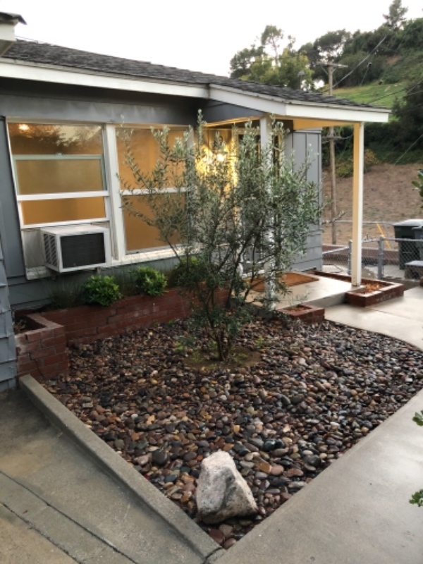
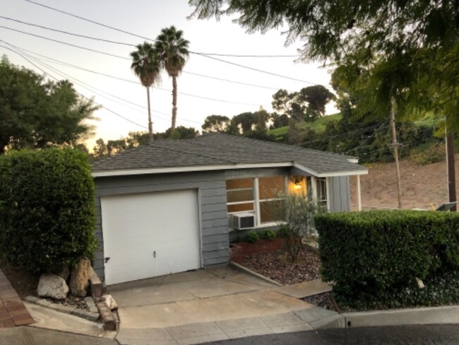
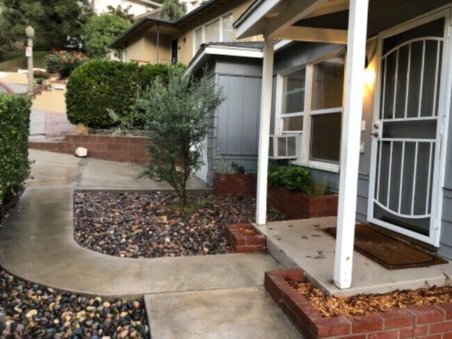
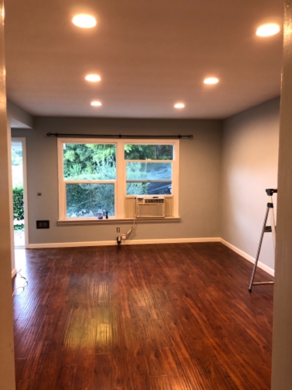
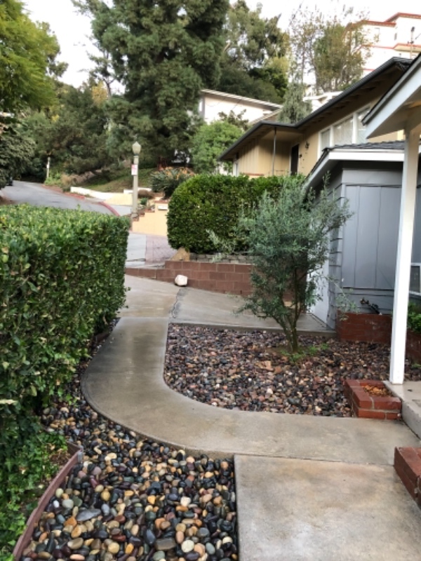
Property Id: 436574 NOT AVAILABLE UNTIL 6/15/25 SHOWING STARTING 6/03/25 Please fill out pre screener if interested 720+ credit score a must ! Extremely clean and charming 2 bed 1 bath with large living room and kitchen, built in closets with lots of storage , new ceiling fans in bedrooms and kitchen, hardwood cherry floors throughout all living spaces with ceramic tile in bathroom and shower, freshly painted with new dimmable recessed lighting in living room, central heating and air, new dual pane energy efficient/ quiet windows, new rang top stove, washer and dryer included . Highly desirable location situated 3 blocks from the 2 freeway and York Blvd, 15 minutes from downtown , Burbank, la Crescenta and minutes to grocery store and many convenient shopping locations and restaurants. Located as a corner lot with long time friendly neighbors that are very quiet and approachable, this is a family owned and maintained.
1100 Vincent Way is a house located in Los Angeles County and the 91205 ZIP Code. This area is served by the Glendale Unified attendance zone.
House Features
Washer/Dryer
Dishwasher
Disposal
Tile Floors
- Washer/Dryer
- Dishwasher
- Disposal
- Oven
- Tile Floors
- Vinyl Flooring
- Fenced Lot
Fees and Policies
The fees below are based on community-supplied data and may exclude additional fees and utilities.
- Dogs Allowed
-
Fees not specified
- Cats Allowed
-
Fees not specified
- Parking
-
Garage--
Contact
- Phone Number
- Contact
-
Source

- Washer/Dryer
- Dishwasher
- Disposal
- Oven
- Tile Floors
- Vinyl Flooring
- Fenced Lot
Glendale’s Adams Hill neighborhood is stunning. Spanish-style homes with tile roofs dot the palm-tree-laden hills with sculpted mountains visible in the background. This picture-perfect neighborhood is located on the south side of Downtown Glendale, roughly between Chevy Chase Drive and Cathedral Drive.
This neighborhood sits seven miles directly north of Downtown Los Angeles, with Interstate 5 leading right into the city. Griffith Park, home of the Los Angeles Zoo and several other renowned attractions, is to the west of the neighborhood.
The famous Forest Lawn Memorial Park is partially located here. This cemetery houses a world-renowned art museum, awe-inspiring statuary, and the Hall of the Crucifixion-Resurrection in addition to serving as the final resting place of several notable celebrities.
Learn more about living in Adams Hill| Colleges & Universities | Distance | ||
|---|---|---|---|
| Colleges & Universities | Distance | ||
| Drive: | 6 min | 2.1 mi | |
| Drive: | 7 min | 3.3 mi | |
| Drive: | 11 min | 6.0 mi | |
| Drive: | 15 min | 8.2 mi |

View GreatSchools Rating Methodology
Transportation options available in Glendale include Southwest Museum Station, located 3.5 miles from 1100 Vincent Way. 1100 Vincent Way is near Bob Hope, located 12.2 miles or 19 minutes away, and Los Angeles International, located 21.3 miles or 34 minutes away.
| Transit / Subway | Distance | ||
|---|---|---|---|
| Transit / Subway | Distance | ||
|
|
Drive: | 8 min | 3.5 mi |
|
|
Drive: | 8 min | 3.6 mi |
|
|
Drive: | 8 min | 4.1 mi |
|
|
Drive: | 10 min | 5.1 mi |
|
|
Drive: | 10 min | 5.2 mi |
| Commuter Rail | Distance | ||
|---|---|---|---|
| Commuter Rail | Distance | ||
|
|
Drive: | 5 min | 2.1 mi |
|
|
Drive: | 12 min | 6.8 mi |
|
|
Drive: | 14 min | 6.9 mi |
|
|
Drive: | 12 min | 7.3 mi |
| Drive: | 16 min | 11.3 mi |
| Airports | Distance | ||
|---|---|---|---|
| Airports | Distance | ||
|
Bob Hope
|
Drive: | 19 min | 12.2 mi |
|
Los Angeles International
|
Drive: | 34 min | 21.3 mi |
Time and distance from 1100 Vincent Way.
| Shopping Centers | Distance | ||
|---|---|---|---|
| Shopping Centers | Distance | ||
| Walk: | 10 min | 0.5 mi | |
| Walk: | 20 min | 1.1 mi | |
| Drive: | 3 min | 1.1 mi |
| Parks and Recreation | Distance | ||
|---|---|---|---|
| Parks and Recreation | Distance | ||
|
Elyria Canyon Park
|
Drive: | 7 min | 2.7 mi |
|
Marsh Park
|
Drive: | 7 min | 3.2 mi |
|
Audubon Center at Debs Park
|
Drive: | 9 min | 4.0 mi |
|
Chavez Ravine Arboretum
|
Drive: | 7 min | 4.3 mi |
|
Elysian Park
|
Drive: | 11 min | 5.1 mi |
| Hospitals | Distance | ||
|---|---|---|---|
| Hospitals | Distance | ||
| Drive: | 4 min | 1.9 mi | |
| Drive: | 6 min | 2.5 mi | |
| Drive: | 8 min | 4.7 mi |
| Military Bases | Distance | ||
|---|---|---|---|
| Military Bases | Distance | ||
| Drive: | 32 min | 22.9 mi |
You May Also Like
What Are Walk Score®, Transit Score®, and Bike Score® Ratings?
Walk Score® measures the walkability of any address. Transit Score® measures access to public transit. Bike Score® measures the bikeability of any address.
What is a Sound Score Rating?
A Sound Score Rating aggregates noise caused by vehicle traffic, airplane traffic and local sources

1100 Vincent Way
Glendale, CA 91205