
110 Sherman Rd
Chestnut Hill, MA 02467
-
Bedrooms
2
-
Bathrooms
1.5
-
Square Feet
984 sq ft
-
Available
Available Now
Highlight
- Pets Allowed

110 Sherman Rd is a townhome located in Suffolk County and the 02467 ZIP Code.
Townhome Features
- Washer/Dryer
Fees and Policies
The fees below are based on community-supplied data and may exclude additional fees and utilities.
- One-Time Move-In Fees
-
Broker Fee$0
- Dogs Allowed
-
Fees not specified
- Cats Allowed
-
Fees not specified
- Parking
-
Other$50/mo
Details
Utilities Included
-
Water
-
Heat
Contact
- Phone Number
- Contact
One of the more upscale communities in the Boston area, Chestnut Hill apartments deliver a stylish lifestyle and a beautiful atmosphere. Boston College’s campus is the main landmark on the northeast corner of the village, and the school’s museums, libraries, and other resources add considerable intellectual capital to the broader community—of course, Eagles games are quite popular as well. The shopping center known as “The Street” on Boylston Street provides a trendy retail experience in a unique setting. The area is loaded with parks and green spaces, particularly Hancock Woods in the south, Webster Conservation Area in the west, and Chestnut Hill Reservoir in the north.
Learn more about living in Chestnut Hill| Colleges & Universities | Distance | ||
|---|---|---|---|
| Colleges & Universities | Distance | ||
| Drive: | 11 min | 4.7 mi | |
| Drive: | 10 min | 4.9 mi | |
| Drive: | 11 min | 5.1 mi | |
| Drive: | 11 min | 5.5 mi |
Transportation options available in Chestnut Hill include Chestnut Hill Station, located 2.8 miles from 110 Sherman Rd. 110 Sherman Rd is near General Edward Lawrence Logan International, located 11.7 miles or 24 minutes away.
| Transit / Subway | Distance | ||
|---|---|---|---|
| Transit / Subway | Distance | ||
|
|
Drive: | 6 min | 2.8 mi |
|
|
Drive: | 8 min | 3.6 mi |
|
|
Drive: | 7 min | 3.7 mi |
|
|
Drive: | 8 min | 3.7 mi |
|
|
Drive: | 9 min | 4.3 mi |
| Commuter Rail | Distance | ||
|---|---|---|---|
| Commuter Rail | Distance | ||
|
|
Drive: | 5 min | 1.8 mi |
|
|
Drive: | 5 min | 2.2 mi |
|
|
Drive: | 6 min | 2.3 mi |
|
|
Drive: | 7 min | 3.1 mi |
|
|
Drive: | 7 min | 3.7 mi |
| Airports | Distance | ||
|---|---|---|---|
| Airports | Distance | ||
|
General Edward Lawrence Logan International
|
Drive: | 24 min | 11.7 mi |
Time and distance from 110 Sherman Rd.
| Shopping Centers | Distance | ||
|---|---|---|---|
| Shopping Centers | Distance | ||
| Walk: | 6 min | 0.3 mi | |
| Drive: | 6 min | 2.6 mi | |
| Drive: | 7 min | 2.7 mi |
| Parks and Recreation | Distance | ||
|---|---|---|---|
| Parks and Recreation | Distance | ||
|
Brook Farm Historic Site
|
Drive: | 4 min | 2.0 mi |
|
Arnold Arboretum of Harvard University
|
Drive: | 5 min | 2.3 mi |
|
Frederick Law Olmsted National Historic Site
|
Drive: | 7 min | 3.0 mi |
|
Hammond Pond Reservation
|
Drive: | 7 min | 3.3 mi |
|
Cutler Park Reservation
|
Drive: | 8 min | 4.0 mi |
| Hospitals | Distance | ||
|---|---|---|---|
| Hospitals | Distance | ||
| Walk: | 9 min | 0.5 mi | |
| Drive: | 6 min | 2.6 mi | |
| Drive: | 8 min | 3.4 mi |
| Military Bases | Distance | ||
|---|---|---|---|
| Military Bases | Distance | ||
| Drive: | 25 min | 13.5 mi | |
| Drive: | 31 min | 17.9 mi |
- Washer/Dryer
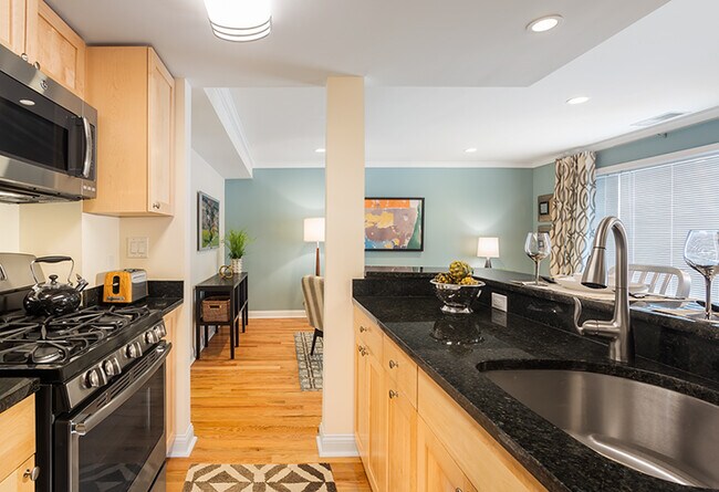
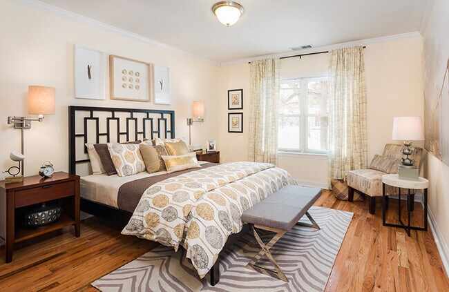
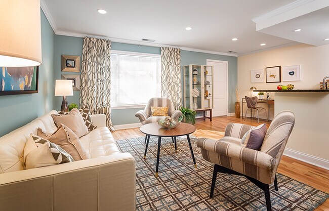
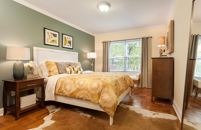
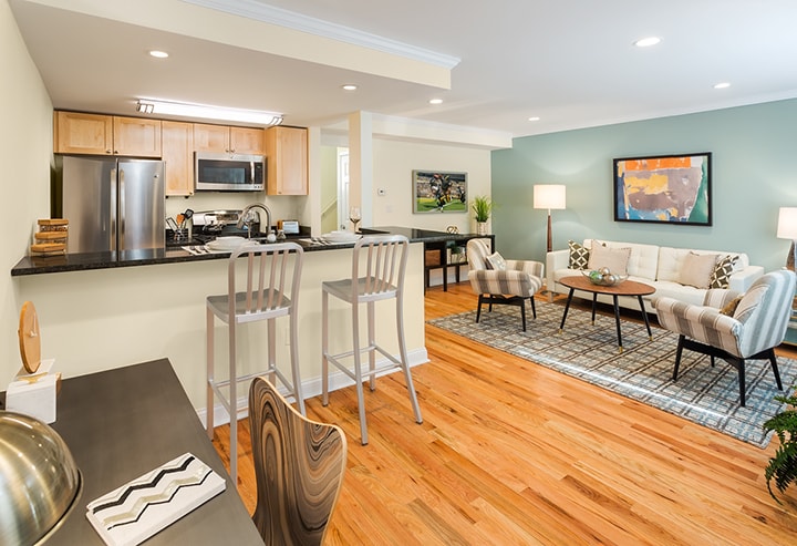
110 Sherman Rd Photos
What Are Walk Score®, Transit Score®, and Bike Score® Ratings?
Walk Score® measures the walkability of any address. Transit Score® measures access to public transit. Bike Score® measures the bikeability of any address.
What is a Sound Score Rating?
A Sound Score Rating aggregates noise caused by vehicle traffic, airplane traffic and local sources
110 Sherman Rd
Chestnut Hill, MA 02467