
$1,700
/ Month
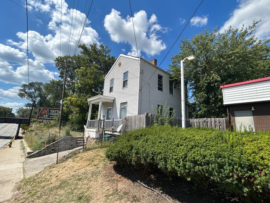
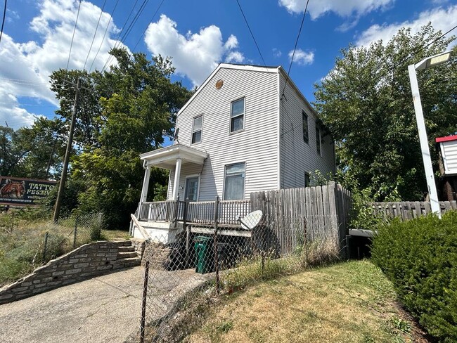
110 E Galbraith Rd
Cincinnati, OH 45216
Today
|
Edit
Favorites
513-855-8444
-
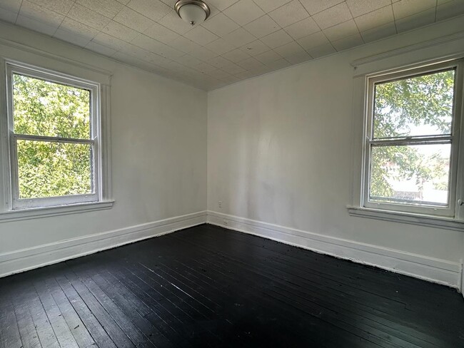
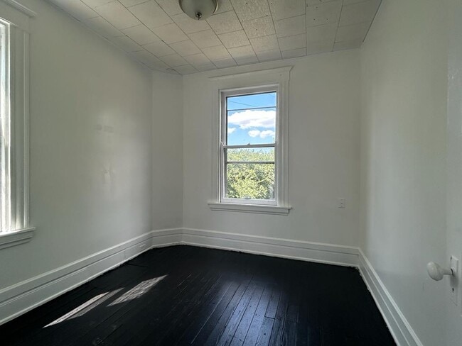
Bedrooms
3
-
Bathrooms
1
-
Square Feet
--
-
Available
Available Now
110 E Galbraith Rd

Favorites
About This Home
$1,700 deposit,
Available Now
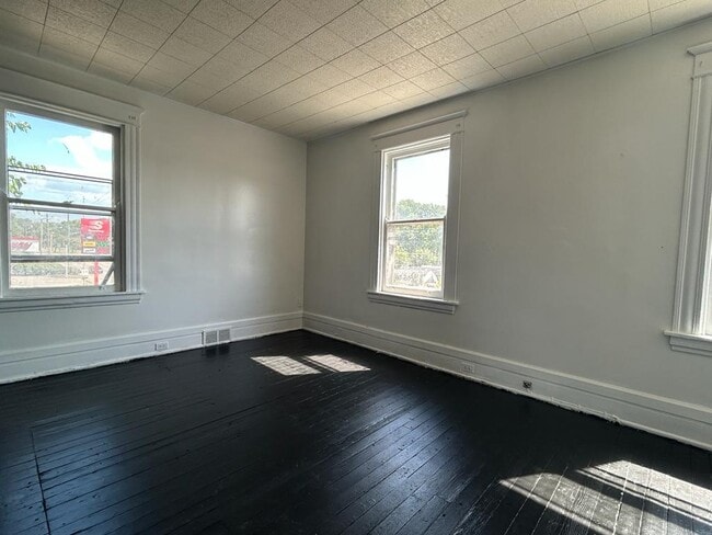
110 East Galbraith Road, Cincinnati, OH 45216 Section 8 Accepted 3bd/1 br RENT: $1700 NO EVICTION, or BANKRUPTCIES INCOME TO BE 3x OF THE RENT Click the link below for the rental application (?). Text . 110 East Galbraith Road, Cincinnati, OH 45216 Section 8 Accepted 3bd/1 br RENT: $1700 NO EVICTION, or BANKRUPTCIES INCOME TO BE 3x OF THE RENT Click the link below for the rental application (?). Text .
110 E Galbraith Rd is a house located in Hamilton County and the 45216 ZIP Code. This area is served by the Cincinnati Public Schools attendance zone.
* Price shown is base rent. Excludes user-selected optional fees and variable or usage-based fees and required charges due at or prior to move-in or at move-out. Price, availability, fees, and any applicable rent special are subject to change without notice.
* Square footage definitions vary. Displayed square footage is approximate.
Fees and Policies
The fees listed below are community-provided and may exclude utilities or add-ons. All payments are made directly to the property and are non-refundable unless otherwise specified. Use the Cost Calculator to determine costs based on your needs.
-
One-Time Basics
-
Due at Move-In
-
Security Deposit - RefundableCharged per unit.$1,700
-
-
Due at Move-In
Property Fee Disclaimer: Based on community-supplied data and independent market research. Subject to change without notice. May exclude fees for mandatory or optional services and usage-based utilities.
Contact
- Listed by Fortune Vine Realty
- Phone Number
- Contact
Location
Get Directions
The Hartwell neighborhood is eleven miles from Downtown Cincinnati, nestled between Interstate 75 and Route 126. First incorporated in 1876, the community has blossomed into a bustling business district, especially along Vine Street.
In addition to local companies, Vine Street is encompassed by the town community center, grocery stores, and quick-bites restaurants. Golfers living in Hartwell will appreciate the close proximity to The Wyoming Golf Club. Residents enjoy being just minutes from the Hamilton County Fairgrounds and great schools.
Hartwell residents pride themselves on their neighborhood spirit and close-knit community with neighbors.
Learn more about living in Hartwell
Education
| Colleges & Universities | Distance | ||
|---|---|---|---|
| Colleges & Universities | Distance | ||
| Drive: | 9 min | 3.9 mi | |
| Drive: | 11 min | 5.1 mi | |
| Drive: | 12 min | 5.9 mi | |
| Drive: | 14 min | 7.2 mi |
110 E Galbraith Rd is within 9 minutes or 3.9 miles from Cincinnati State, WDC. It is also near Xavier University and Univ. of Cincinnati, Blue Ash.
Schools


Public Elementary & Middle School
Grades 2-8
445 Students
Attendance Zone
Public Elementary, Middle & High School
Grades 2 & 6-12
503 Students
Attendance Zone
Public Elementary & Middle School
Grades PK-8
398 Students
Nearby
Private Elementary & Middle School
Grades K-8
183 Students
Nearby
Private Elementary, Middle & High School
Grades PK-12
305 Students
Nearby
Private High School
Grades 9-12
1,529 Students
Nearby
School data provided by
 The GreatSchools Rating helps parents compare schools within a state based on a variety of school quality indicators and provides a helpful picture of how effectively each school serves all of its students. Ratings are on a scale of 1 (below average) to 10 (above average) and can include test scores, college readiness, academic progress, advanced courses, equity, discipline and attendance data. We also advise parents to visit schools, consider other information on school performance and programs, and consider family needs as part of the school selection process.
View GreatSchools Rating Methodology
Data provided by GreatSchools.org © 2026. All rights reserved.
View GreatSchools Rating Methodology
Data provided by GreatSchools.org © 2026. All rights reserved.
Transportation options available in Cincinnati include Brewery District Station - Elm & Henry, located 10.1 miles from 110 E Galbraith Rd. 110 E Galbraith Rd is near Cincinnati/Northern Kentucky International, located 24.1 miles or 40 minutes away.
| Transit / Subway | Distance | ||
|---|---|---|---|
| Transit / Subway | Distance | ||
| Drive: | 16 min | 10.1 mi | |
| Drive: | 16 min | 10.2 mi | |
| Drive: | 16 min | 10.2 mi | |
| Drive: | 17 min | 10.3 mi | |
| Drive: | 17 min | 10.4 mi |
| Commuter Rail | Distance | ||
|---|---|---|---|
| Commuter Rail | Distance | ||
|
|
Drive: | 15 min | 10.0 mi |
| Airports | Distance | ||
|---|---|---|---|
| Airports | Distance | ||
|
Cincinnati/Northern Kentucky International
|
Drive: | 40 min | 24.1 mi |
Time and distance from 110 E Galbraith Rd.
| Shopping Centers | Distance | ||
|---|---|---|---|
| Shopping Centers | Distance | ||
| Drive: | 4 min | 1.6 mi | |
| Drive: | 4 min | 1.8 mi | |
| Drive: | 4 min | 1.9 mi |
110 E Galbraith Rd has 3 shopping centers within 1.9 miles, which is about a 4-minute drive. The miles and minutes will be for the farthest away property.
| Parks and Recreation | Distance | ||
|---|---|---|---|
| Parks and Recreation | Distance | ||
|
Caldwell Preserve
|
Drive: | 5 min | 2.7 mi |
|
French Park
|
Drive: | 8 min | 3.4 mi |
|
Gorman Heritage Farm
|
Drive: | 8 min | 3.7 mi |
|
Glenwood Gardens
|
Drive: | 9 min | 3.9 mi |
|
Avon Woods Natural Area/Preserve
|
Drive: | 8 min | 4.7 mi |
110 E Galbraith Rd has 5 parks within 4.7 miles, including Caldwell Preserve, French Park, and Gorman Heritage Farm.
| Hospitals | Distance | ||
|---|---|---|---|
| Hospitals | Distance | ||
| Drive: | 4 min | 1.9 mi | |
| Drive: | 10 min | 5.1 mi | |
| Drive: | 13 min | 5.3 mi |
110 E Galbraith Rd has 3 hospitals within 5.3 miles, the nearest is Summit Behavioral Healthcare which is 1.9 miles away and a 4 minute drive.
| Military Bases | Distance | ||
|---|---|---|---|
| Military Bases | Distance | ||
| Drive: | 58 min | 45.1 mi | |
| Drive: | 64 min | 50.2 mi | |
| Drive: | 66 min | 53.4 mi |
110 E Galbraith Rd has 3 military bases within 53.4 miles, the nearest is Gentile Air Force Station which is 45.1 miles away and a 58 minute drive.
You May Also Like
Similar Rentals Nearby
-
-
-

-

-

-

-

-
 3 Beds$2,375Total Monthly PriceTotal Monthly Price NewPrices include all required monthly fees.House for Rent
 -
 4 Beds$2,200Total Monthly PriceTotal Monthly Price NewPrices include all required monthly fees.House for Rent
 -
 3 Beds$2,155Total Monthly PriceTotal Monthly Price NewPrices include all required monthly fees.House for Rent

What Are Walk Score®, Transit Score®, and Bike Score® Ratings?
Walk Score® measures the walkability of any address. Transit Score® measures access to public transit. Bike Score® measures the bikeability of any address.
What is a Sound Score Rating?
A Sound Score Rating aggregates noise caused by vehicle traffic, airplane traffic and local sources

110 E Galbraith Rd
Cincinnati, OH 45216