
La Moraga Apartments
5822 Charlotte Dr,
San Jose, CA 95123
$2,979
2 Beds
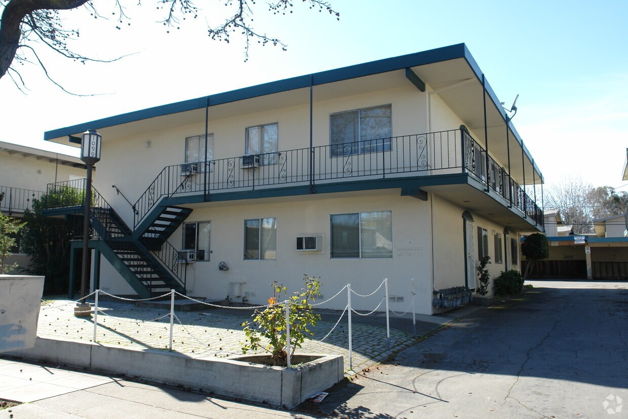
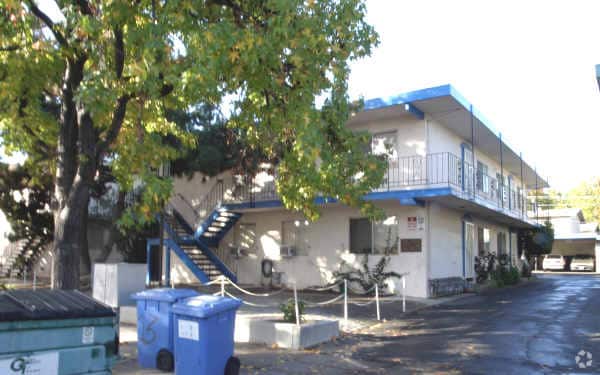
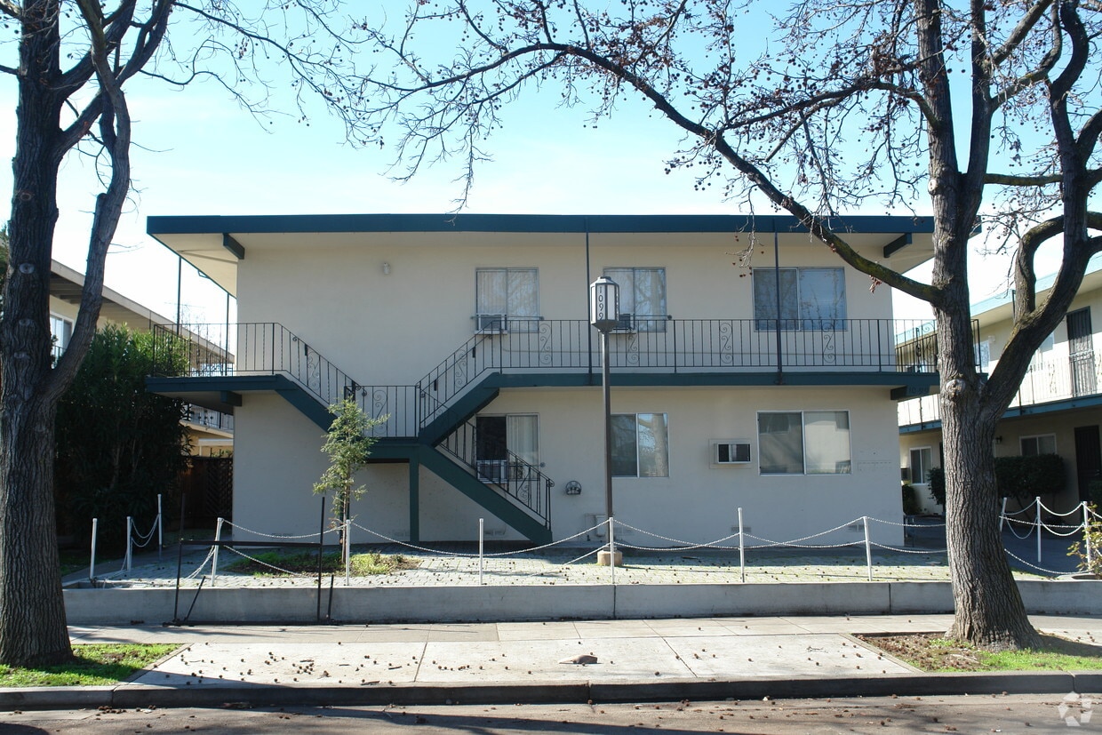

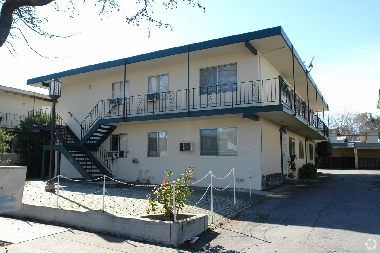
Check out 1099 Roewill Dr in San Jose, CA. Situated in the 95117 Zip code of San Jose on Roewill Dr., renters have easy connection to a mixture of great nearby highlights. Make a visit to see the current floorplan options. Here at this community, the professional leasing staff is ready and waiting to help you find your new place. Contact us or drop by the leasing office to check the current floorplan availability and find your new home at 1099 Roewill Dr.
1099 Roewill Dr is an apartment community located in Santa Clara County and the 95117 ZIP Code. This area is served by the Moreland School District attendance zone.
Located about seven miles southwest of Downtown San Jose, Anderson West is a small neighborhood known for its abundance of shopping options. There are a few shops and restaurants in Anderson West, but residents enjoy having easy access to a variety of restaurants and shopping centers like Westgate Center, Santana Row, and Westfield Valley Fair, three popular malls with a plethora of popular retailers and restaurants. Along with excellent schools, renters are attracted to Anderson West for its commutability. The neighborhood is convenient to several major tech companies including Adobe and Apple. The Lawrence Expressway, San Tomas Expressway, and Interstate 280 allow for travel throughout San Jose and other nearby cities. Anderson West has houses, apartments, and condos available for rent at various price points so it’s a great choice for renters seeking a new home in the Bay Area.
Learn more about living in Anderson WestCompare neighborhood and city base rent averages by bedroom.
| Anderson West | San Jose, CA | |
|---|---|---|
| Studio | $2,114 | $2,379 |
| 1 Bedroom | $1,924 | $2,750 |
| 2 Bedrooms | $2,712 | $3,459 |
| 3 Bedrooms | $3,111 | $4,221 |
| Colleges & Universities | Distance | ||
|---|---|---|---|
| Colleges & Universities | Distance | ||
| Drive: | 8 min | 3.4 mi | |
| Drive: | 12 min | 4.8 mi | |
| Drive: | 11 min | 4.8 mi | |
| Drive: | 11 min | 5.1 mi |


Transportation options available in San Jose include Hamilton Station, located 3.1 miles from 1099 Roewill Dr. 1099 Roewill Dr is near Norman Y Mineta San Jose International, located 5.5 miles or 12 minutes away, and San Francisco International, located 35.6 miles or 46 minutes away.
| Transit / Subway | Distance | ||
|---|---|---|---|
| Transit / Subway | Distance | ||
| Drive: | 6 min | 3.1 mi | |
| Drive: | 7 min | 3.3 mi | |
| Drive: | 7 min | 3.4 mi | |
|
|
Drive: | 8 min | 4.4 mi |
| Drive: | 8 min | 4.6 mi |
| Commuter Rail | Distance | ||
|---|---|---|---|
| Commuter Rail | Distance | ||
| Drive: | 10 min | 4.8 mi | |
| Drive: | 10 min | 4.9 mi | |
| Drive: | 11 min | 5.3 mi | |
| Drive: | 10 min | 6.3 mi | |
| Drive: | 11 min | 6.4 mi |
| Airports | Distance | ||
|---|---|---|---|
| Airports | Distance | ||
|
Norman Y Mineta San Jose International
|
Drive: | 12 min | 5.5 mi |
|
San Francisco International
|
Drive: | 46 min | 35.6 mi |
Scores provided by
Traffic
-Airport
-Businesses
-Scores provided by
HowLoud What is a Sound Score Rating? A Sound Score Rating aggregates noise caused by vehicle traffic, airplane traffic and local sources. How It WorksTime and distance from 1099 Roewill Dr.
| Shopping Centers | Distance | ||
|---|---|---|---|
| Shopping Centers | Distance | ||
| Walk: | 9 min | 0.5 mi | |
| Walk: | 18 min | 0.9 mi | |
| Drive: | 3 min | 1.2 mi |
| Parks and Recreation | Distance | ||
|---|---|---|---|
| Parks and Recreation | Distance | ||
|
John D. Morgan Park
|
Drive: | 6 min | 3.0 mi |
|
Jack Fischer Park
|
Drive: | 9 min | 3.4 mi |
|
Orchard City Green
|
Drive: | 7 min | 3.5 mi |
|
Los Gatos Creek Trail
|
Drive: | 7 min | 3.9 mi |
|
Edith Morley Park
|
Drive: | 9 min | 4.6 mi |
| Hospitals | Distance | ||
|---|---|---|---|
| Hospitals | Distance | ||
| Drive: | 6 min | 3.1 mi | |
| Drive: | 7 min | 3.6 mi | |
| Drive: | 8 min | 3.7 mi |
| Military Bases | Distance | ||
|---|---|---|---|
| Military Bases | Distance | ||
| Drive: | 21 min | 12.6 mi | |
| Drive: | 63 min | 47.9 mi | |
| Drive: | 64 min | 48.1 mi |
Fitness Center Pool In Unit Washer & Dryer High-Speed Internet Stainless Steel Appliances Package Service
What Are Walk Score®, Transit Score®, and Bike Score® Ratings?
Walk Score® measures the walkability of any address. Transit Score® measures access to public transit. Bike Score® measures the bikeability of any address.
What is a Sound Score Rating?
A Sound Score Rating aggregates noise caused by vehicle traffic, airplane traffic and local sources.
1099 Roewill Dr
San Jose, CA 95117


