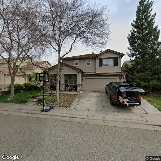
109 Candlewood Ct
109 Candlewood Ct
Lincoln, CA 95648
2 Weeks Ago
|
Edit
Favorites
109 Candlewood Ct

Favorites
Check Back Soon for Upcoming Availability
109 Candlewood Ct,
Lincoln,
CA
95648
Lincoln is a small city located about ten miles north of Roseville and thirty miles north of Sacramento. Primarily a residential suburb, much of the city’s landscape consists of low-key neighborhoods surrounding Lincoln Hills Golf Club. The cozy Downtown district along Lincoln Boulevard exhibits a classic small-town aesthetic, with locally-owned favorites like Awful Annie’s Country Harvest Bakery operating out of historic storefronts.
Small public parks dot the community, ensuring that virtually everyone has a tranquil greenspace within just a few blocks of home. The close proximity to Roseville allows you to easily take advantage of the more extensive shopping, dining, and entertainment options in the neighboring city, and the state capital is at your fingertips as well.
Learn more about living in Lincoln
Education
| Colleges & Universities | Distance | ||
|---|---|---|---|
| Colleges & Universities | Distance | ||
| Drive: | 19 min | 12.0 mi | |
| Drive: | 30 min | 19.8 mi | |
| Drive: | 40 min | 23.2 mi | |
| Drive: | 40 min | 28.1 mi |
109 Candlewood Ct is within 19 minutes or 12.0 miles from Sierra College, Rocklin Campus. It is also near American River College and Folsom Lake College, Folsom.
Walkability Near 109 Candlewood Ct Lincoln, CA 95648
Getting Around
 What do Walkability, Transit, Drivability, and Bikeability mean?
Walkability measures the walking distance to day-to-day needs.
Transit measures access to public transportation.
Drivability measures congestion, parking availability, and access to major roads.
Bikeability measures the suitability for cycling.
How It Works
What do Walkability, Transit, Drivability, and Bikeability mean?
Walkability measures the walking distance to day-to-day needs.
Transit measures access to public transportation.
Drivability measures congestion, parking availability, and access to major roads.
Bikeability measures the suitability for cycling.
How It Works
Somewhat Walkable
Walkability
20
/ 100
Minimal Public Transit
Transit
0
/ 100
Exceptionally Drivable
Drivability
90
/ 100
Fairly Bikeable
Bikeability
40
/ 100
Scores provided by
-
Soundscore™
-
/ 100
Traffic
-Airport
-Businesses
-Scores provided by
HowLoud What is a Sound Score Rating? A Sound Score Rating aggregates noise caused by vehicle traffic, airplane traffic and local sources. How It WorksYou May Also Like
Similar Rentals Nearby
-
-
2 Beds$2,580+3 Beds$3,1054 Beds$3,280+Total Monthly PriceTotal Monthly Price NewPrices include base rent and required monthly fees of $60. Variable costs based on usage may apply.Base Rent:2 Beds$2,520+3 Beds$3,0454 Beds$3,220+Specials
Pets Allowed Fitness Center In Unit Washer & Dryer Clubhouse Stainless Steel Appliances
-
-
")
-
-

-
-

-

-


What Are Walk Score®, Transit Score®, and Bike Score® Ratings?
Walk Score® measures the walkability of any address. Transit Score® measures access to public transit. Bike Score® measures the bikeability of any address.
What is a Sound Score Rating?
A Sound Score Rating aggregates noise caused by vehicle traffic, airplane traffic and local sources.