


$1,375 - $1,695
Plus Fees1-2 Beds
2 Months Free
Pets Allowed Fitness Center Pool Dishwasher Refrigerator Kitchen
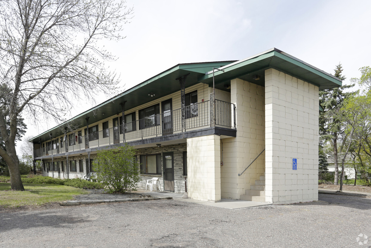
1075 County Highway 10 in Blaine, MN is ready to be your home. This community is located on County Highway 10 in Blaine. Come for a visit to see the current floorplan options. The community staff is ready and waiting for you to come for a visit. Get a head start on your move right now. Contact or stop by 1075 County Highway 10 to check the current floorplan availability today!
1075 County Highway 10 is an apartment community located in Anoka County and the 55432 ZIP Code. This area is served by the Spring Lake Park Public Schools attendance zone.
Sitting on the north side of Minneapolis along I-35W, Blaine makes a nice, quiet hometown setting for folks who work in the Twin Cities but prefer an apartment in the suburbs. One of the city’s key landmarks is the National Sports Center, an enormous 650-acre complex that houses 50 full-sized soccer fields, a golf course, and the largest ice arena complex in the world.
Less-structured recreation is very popular here as well, with the large Rice Creek North Regional Trail Corridor and Carlos Avery State Wildlife Area just outside the city limits and several smaller public parks scattered around town.
Learn more about living in Blaine| Colleges & Universities | Distance | ||
|---|---|---|---|
| Colleges & Universities | Distance | ||
| Drive: | 12 min | 6.6 mi | |
| Drive: | 12 min | 7.4 mi | |
| Drive: | 13 min | 9.1 mi | |
| Drive: | 14 min | 9.7 mi |


Transportation options available in Blaine include Target Field Station Platform 2, located 13.0 miles from 1075 County Highway 10. 1075 County Highway 10 is near Minneapolis-St Paul International/Wold-Chamberlain, located 22.9 miles or 37 minutes away.
| Transit / Subway | Distance | ||
|---|---|---|---|
| Transit / Subway | Distance | ||
| Drive: | 20 min | 13.0 mi | |
|
|
Drive: | 20 min | 13.2 mi |
| Commuter Rail | Distance | ||
|---|---|---|---|
| Commuter Rail | Distance | ||
|
|
Drive: | 9 min | 5.6 mi |
|
|
Drive: | 12 min | 8.3 mi |
|
|
Drive: | 14 min | 10.0 mi |
|
|
Drive: | 21 min | 13.0 mi |
| Drive: | 19 min | 14.3 mi |
| Airports | Distance | ||
|---|---|---|---|
| Airports | Distance | ||
|
Minneapolis-St Paul International/Wold-Chamberlain
|
Drive: | 37 min | 22.9 mi |
Time and distance from 1075 County Highway 10.
| Shopping Centers | Distance | ||
|---|---|---|---|
| Shopping Centers | Distance | ||
| Walk: | 10 min | 0.5 mi | |
| Walk: | 17 min | 0.9 mi | |
| Walk: | 17 min | 0.9 mi |
| Parks and Recreation | Distance | ||
|---|---|---|---|
| Parks and Recreation | Distance | ||
|
Springbrook Nature Center
|
Drive: | 4 min | 1.7 mi |
|
Creekview Park
|
Drive: | 6 min | 3.7 mi |
|
B. F. Nelson Park
|
Drive: | 8 min | 4.3 mi |
|
Locke County Park
|
Drive: | 9 min | 4.6 mi |
|
West Coon Rapids Dam Visitor Center
|
Drive: | 15 min | 8.1 mi |
| Hospitals | Distance | ||
|---|---|---|---|
| Hospitals | Distance | ||
| Drive: | 14 min | 7.8 mi | |
| Drive: | 12 min | 9.7 mi | |
| Drive: | 18 min | 12.2 mi |
| Military Bases | Distance | ||
|---|---|---|---|
| Military Bases | Distance | ||
| Drive: | 33 min | 21.2 mi |
$1,375 - $1,695
Plus Fees1-2 Beds
Pets Allowed Fitness Center Pool Dishwasher Refrigerator Kitchen
$1,019 - $1,199
Plus Fees1 Bed
Pets Allowed Fitness Center Pool Dishwasher Refrigerator Kitchen
$2,034 - $6,246
Total Monthly Price1-2 Beds
Pets Allowed Fitness Center Pool Dishwasher Refrigerator Clubhouse Maintenance on site
$1,741 - $2,791
Total Monthly Price1-3 Beds
Pets Allowed Fitness Center In Unit Washer & Dryer Maintenance on site Stainless Steel Appliances Granite Countertops Gated
$1,581 - $5,156
Total Monthly Price1-2 Beds
Pets Allowed Fitness Center Pool In Unit Washer & Dryer Walk-In Closets High-Speed Internet Controlled Access
$1,545 - $2,740
Total Monthly Price1-3 Beds
Pets Allowed Fitness Center In Unit Washer & Dryer Maintenance on site Controlled Access
$1,861 - $3,361
Total Monthly Price1-2 Beds
Pets Allowed Fitness Center Pool In Unit Washer & Dryer Maintenance on site Stainless Steel Appliances Granite Countertops
What Are Walk Score®, Transit Score®, and Bike Score® Ratings?
Walk Score® measures the walkability of any address. Transit Score® measures access to public transit. Bike Score® measures the bikeability of any address.
What is a Sound Score Rating?
A Sound Score Rating aggregates noise caused by vehicle traffic, airplane traffic and local sources


