
$4,850 / Month
1063 Kansas St Unit 1063 Kanas St
San Francisco, CA 94107
Today
Favorites
-
Bedrooms
3
-
Bathrooms
2
-
Square Feet
1,300 sq ft
-
Available
Available Now
Highlights
- Yard
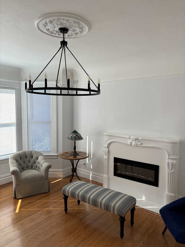
- Fireplace
- Smoke Free
1063 Kansas St Unit 1063 Kanas St

Favorites
About This Home
12 Month Lease,
$4,850 deposit,
Available Now
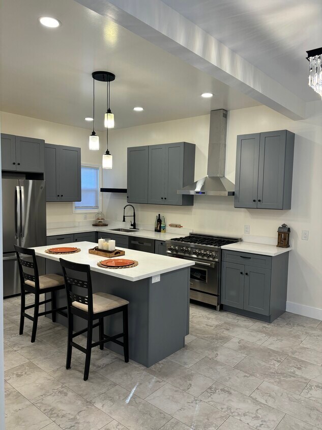
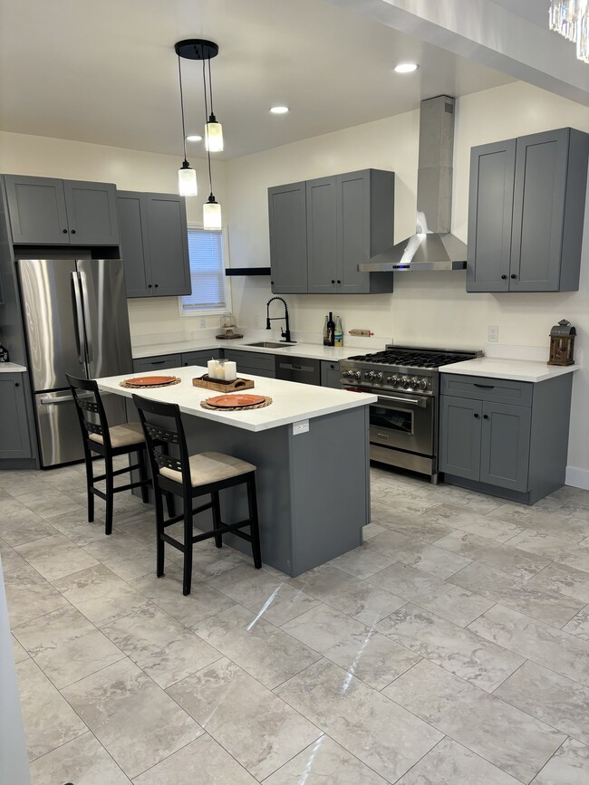
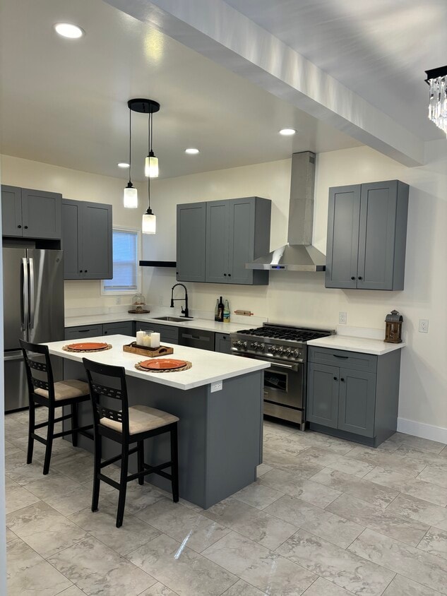
Beautifully and freshly renovated property walking distance from General Hospital, restaurant and public transportation. A three-bedroom apartment with a new modern kitchen and a share back yard.
1063 Kansas St is an apartment community located in San Francisco County and the 94107 ZIP Code. This area is served by the San Francisco Unified attendance zone.
* Price shown is base rent and may not include non-optional fees and utilities.
Price, availability, fees, and any applicable rent special are subject to change without notice.
* Square footage definitions vary. Displayed square footage is approximate.
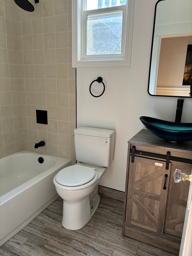
Apartment Features
Dishwasher
Fireplace
Smoke Free
Kitchen
- Smoke Free
- Fireplace
- Dishwasher
- Kitchen
- Laundry Facilities
- Yard
Fees and Policies
The fees below are based on community-supplied data and may exclude additional fees and utilities.
- Parking
-
Garage--
Details
Utilities Included
-
Water
-
Sewer
Property Information
-
2 units
Contact
- Contact
Location
Get Directions
Nestled between the Mission District and Dogpatch, Potrero is a diverse, family-friendly neighborhood. Known for its rolling hills and stellar city views, Potrero is an upscale urban local with Victorian houses and high-rise apartments available for rent. A feeling of closeness prevails in Potrero, and those who choose to reside in the cozy homes on these steep hills often say it feels as if they live in a small village. Great for families looking to raise children in a close-knit environment, Potrero has several community gardens and community centers, parks, grocers, offices, bookstores, and restaurants. Along 18th Street you’ll find everything from quaint eateries to edgy live music spots. Once you move in, be sure to go on a tour at the historic Anchor Brewing Company! If you want even more options for shopping, dining, and entertainment, there are plenty of spots nearby in Dog Patch and the Mission District.
Learn more about living in Potrero
Education
| Colleges & Universities | Distance | ||
|---|---|---|---|
| Colleges & Universities | Distance | ||
| Walk: | 19 min | 1.0 mi | |
| Drive: | 4 min | 1.4 mi | |
| Drive: | 8 min | 3.9 mi | |
| Drive: | 9 min | 4.3 mi |
1063 Kansas St Unit 1063 Kanas St is within 19 minutes or 1.0 miles from California College of the Arts. It is also near UC San Francisco, Mission Bay and Academy of Art University.
Schools


Public Elementary School
Grades K-5
Nearby
Public Elementary School
Grades K-5
322 Students
Attendance Zone
Public Middle & High School
Grades 8-12
401 Students
Attendance Zone
Public Middle School
Grades 6-8
848 Students
Attendance Zone
Public High School
Grades 9-12
506 Students
Attendance Zone
Private Elementary & Middle School
Grades PK-8
21 Students
Nearby
Private Elementary School
Grades 1-6
21 Students
Nearby
Private Elementary, Middle & High School
Grades 5-12
19 Students
Nearby
School data provided by
 The GreatSchools Rating helps parents compare schools within a state based on a variety of school quality indicators and provides a helpful picture of how effectively each school serves all of its students. Ratings are on a scale of 1 (below average) to 10 (above average) and can include test scores, college readiness, academic progress, advanced courses, equity, discipline and attendance data. We also advise parents to visit schools, consider other information on school performance and programs, and consider family needs as part of the school selection process.
View GreatSchools Rating Methodology
View GreatSchools Rating Methodology
Transportation options available in San Francisco include 20Th Street Station, located 1.0 miles from 1063 Kansas St Unit 1063 Kanas St. 1063 Kansas St Unit 1063 Kanas St is near San Francisco International, located 11.5 miles or 19 minutes away, and Metro Oakland International, located 21.6 miles or 33 minutes away.
| Transit / Subway | Distance | ||
|---|---|---|---|
| Transit / Subway | Distance | ||
|
|
Walk: | 19 min | 1.0 mi |
|
|
Walk: | 21 min | 1.1 mi |
|
|
Drive: | 4 min | 1.3 mi |
|
|
Drive: | 4 min | 1.3 mi |
|
|
Drive: | 4 min | 1.4 mi |
| Commuter Rail | Distance | ||
|---|---|---|---|
| Commuter Rail | Distance | ||
| Drive: | 4 min | 1.6 mi | |
| Drive: | 6 min | 3.2 mi | |
| Drive: | 7 min | 3.6 mi | |
| Drive: | 13 min | 8.1 mi | |
|
|
Drive: | 22 min | 13.2 mi |
| Airports | Distance | ||
|---|---|---|---|
| Airports | Distance | ||
|
San Francisco International
|
Drive: | 19 min | 11.5 mi |
|
Metro Oakland International
|
Drive: | 33 min | 21.6 mi |
Time and distance from 1063 Kansas St Unit 1063 Kanas St.
| Shopping Centers | Distance | ||
|---|---|---|---|
| Shopping Centers | Distance | ||
| Drive: | 4 min | 1.2 mi | |
| Drive: | 5 min | 1.6 mi | |
| Drive: | 4 min | 2.3 mi |
1063 Kansas St Unit 1063 Kanas St has 3 shopping centers within 2.3 miles, which is about a 4-minute drive. The miles and minutes will be for the farthest away property.
| Parks and Recreation | Distance | ||
|---|---|---|---|
| Parks and Recreation | Distance | ||
|
Heron's Head Park
|
Drive: | 6 min | 2.3 mi |
|
Children's Creativity Museum
|
Drive: | 7 min | 3.4 mi |
|
Buena Vista Park
|
Drive: | 9 min | 4.0 mi |
|
Randall Museum
|
Drive: | 10 min | 4.2 mi |
|
Candlestick Point State Recreation Area
|
Drive: | 11 min | 4.4 mi |
1063 Kansas St Unit 1063 Kanas St has 5 parks within 4.4 miles, including Heron's Head Park, Children's Creativity Museum, and Randall Museum.
| Hospitals | Distance | ||
|---|---|---|---|
| Hospitals | Distance | ||
| Walk: | 6 min | 0.3 mi | |
| Drive: | 6 min | 1.7 mi | |
| Drive: | 8 min | 2.9 mi |
1063 Kansas St Unit 1063 Kanas St has 3 hospitals within 2.9 miles, the nearest is Zuckerberg San Francisco General Hospital & Trauma Center which is 0.3 mile away and a 6 minute walk.
| Military Bases | Distance | ||
|---|---|---|---|
| Military Bases | Distance | ||
| Drive: | 15 min | 7.7 mi | |
| Drive: | 29 min | 16.1 mi |
1063 Kansas St Unit 1063 Kanas St is 7.7 miles from Treasure Island Naval Station, and is convenient to other military bases, including Alameda/US Naval Air Station San Francisco.
Amenities
- Smoke Free
- Fireplace
- Dishwasher
- Kitchen
- Laundry Facilities
- Yard
1063 Kansas St Unit 1063 Kanas St Photos
What Are Walk Score®, Transit Score®, and Bike Score® Ratings?
Walk Score® measures the walkability of any address. Transit Score® measures access to public transit. Bike Score® measures the bikeability of any address.
What is a Sound Score Rating?
A Sound Score Rating aggregates noise caused by vehicle traffic, airplane traffic and local sources
1063 Kansas St
San Francisco, CA 94107