
Venue Residences
3688 Overland Ave,
Los Angeles, CA 90034
$3,150 - $4,795
Studio - 2 Beds

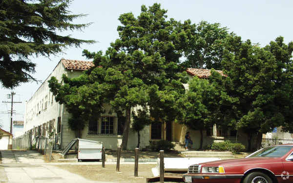
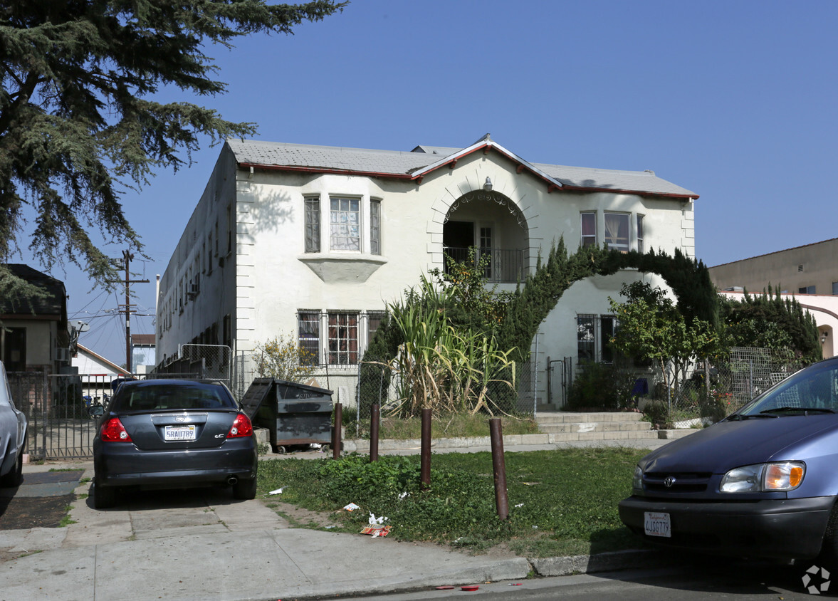

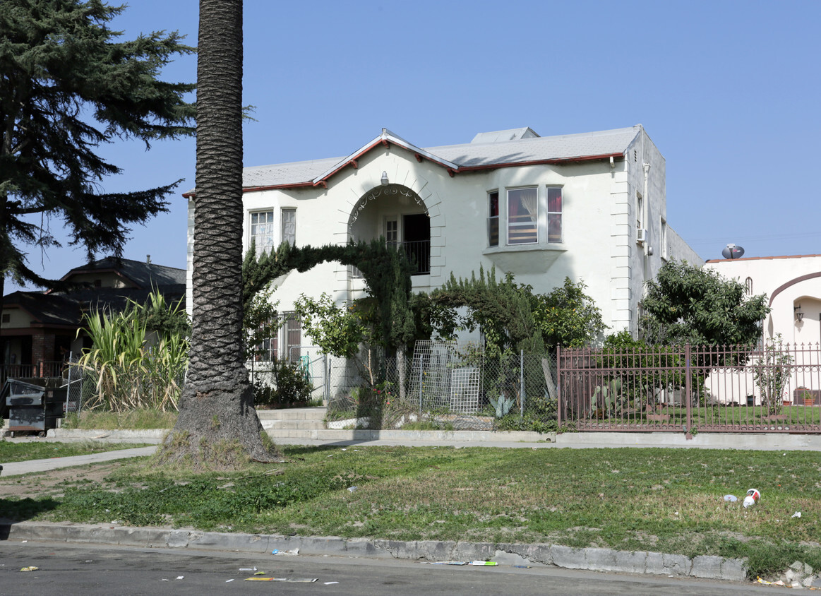
1051 Browning Blvd is ready for you to visit. The address for this community is on Browning Blvd in the 90037 area of Los Angeles. Schedule a time to view the available floorplans. The leasing staff will be ready to help you find your new place. Contact us or drop by the leasing office to check the availability and schedule a tour today and find your new home at 1051 Browning Blvd.
1051 Browning Blvd is an apartment community located in Los Angeles County and the 90037 ZIP Code. This area is served by the Los Angeles Unified Rocp School District attendance zone.
Dishwasher
High Speed Internet Access
Refrigerator
Disposal
Historic South-Central Los Angeles is a storied neighborhood in the South Los Angeles region. South LA is home to the University of Southern California, a top-ranking university founded in 1880, a close-knit community, and a rich past.
Renting an apartment in South Central LA places you in an active neighborhood near many LA hotspots. This neighborhood had one of America's first jazz scenes (often nicknamed the West Coast Harlem) and was home to Kid Ory, a famous trombonist, and bandleader. Today, South Central LA offers residents terrific proximity to downtown, USC, and a variety of historic sites in addition to numerous freeways.
Learn more about living in South Central LACompare neighborhood and city base rent averages by bedroom.
| South Central LA | Los Angeles, CA | |
|---|---|---|
| Studio | $1,032 | $1,709 |
| 1 Bedroom | $1,188 | $2,184 |
| 2 Bedrooms | $1,802 | $3,025 |
| 3 Bedrooms | $3,022 | $4,282 |
| Colleges & Universities | Distance | ||
|---|---|---|---|
| Colleges & Universities | Distance | ||
| Drive: | 3 min | 1.5 mi | |
| Drive: | 5 min | 2.3 mi | |
| Drive: | 5 min | 2.3 mi | |
| Drive: | 7 min | 4.3 mi |


Transportation options available in Los Angeles include Expo/Vermont, located 0.5 mile from 1051 Browning Blvd. 1051 Browning Blvd is near Los Angeles International, located 10.1 miles or 19 minutes away, and Bob Hope, located 16.0 miles or 28 minutes away.
| Transit / Subway | Distance | ||
|---|---|---|---|
| Transit / Subway | Distance | ||
|
|
Walk: | 10 min | 0.5 mi |
|
|
Walk: | 15 min | 0.8 mi |
|
|
Drive: | 3 min | 1.5 mi |
|
|
Drive: | 3 min | 1.8 mi |
|
|
Drive: | 4 min | 2.2 mi |
| Commuter Rail | Distance | ||
|---|---|---|---|
| Commuter Rail | Distance | ||
|
|
Drive: | 10 min | 5.0 mi |
|
|
Drive: | 12 min | 5.3 mi |
| Drive: | 13 min | 9.1 mi | |
|
|
Drive: | 16 min | 10.7 mi |
|
|
Drive: | 19 min | 12.0 mi |
| Airports | Distance | ||
|---|---|---|---|
| Airports | Distance | ||
|
Los Angeles International
|
Drive: | 19 min | 10.1 mi |
|
Bob Hope
|
Drive: | 28 min | 16.0 mi |
Scores provided by
Traffic
-Airport
-Businesses
-Scores provided by
HowLoud What is a Sound Score Rating? A Sound Score Rating aggregates noise caused by vehicle traffic, airplane traffic and local sources. How It WorksTime and distance from 1051 Browning Blvd.
| Shopping Centers | Distance | ||
|---|---|---|---|
| Shopping Centers | Distance | ||
| Walk: | 3 min | 0.2 mi | |
| Walk: | 11 min | 0.6 mi | |
| Walk: | 15 min | 0.8 mi |
| Parks and Recreation | Distance | ||
|---|---|---|---|
| Parks and Recreation | Distance | ||
|
Natural History Museum of LA County
|
Walk: | 13 min | 0.7 mi |
|
Exposition Park Rose Garden
|
Walk: | 16 min | 0.9 mi |
|
California Science Center
|
Drive: | 3 min | 1.1 mi |
|
MacArthur Park Lake
|
Drive: | 8 min | 3.9 mi |
|
Augustus Hawkins Natural Park
|
Drive: | 7 min | 4.5 mi |
| Hospitals | Distance | ||
|---|---|---|---|
| Hospitals | Distance | ||
| Drive: | 6 min | 2.9 mi | |
| Drive: | 8 min | 4.2 mi | |
| Drive: | 8 min | 4.6 mi |
| Military Bases | Distance | ||
|---|---|---|---|
| Military Bases | Distance | ||
| Drive: | 18 min | 13.4 mi |
What Are Walk Score®, Transit Score®, and Bike Score® Ratings?
Walk Score® measures the walkability of any address. Transit Score® measures access to public transit. Bike Score® measures the bikeability of any address.
What is a Sound Score Rating?
A Sound Score Rating aggregates noise caused by vehicle traffic, airplane traffic and local sources.
1051 Browning Blvd
Los Angeles, CA 90037


