

$2,895 / Month
1040 1st St
Benicia, CA 94510
Today
Favorites
707-386-1046
-
Bedrooms
3
-
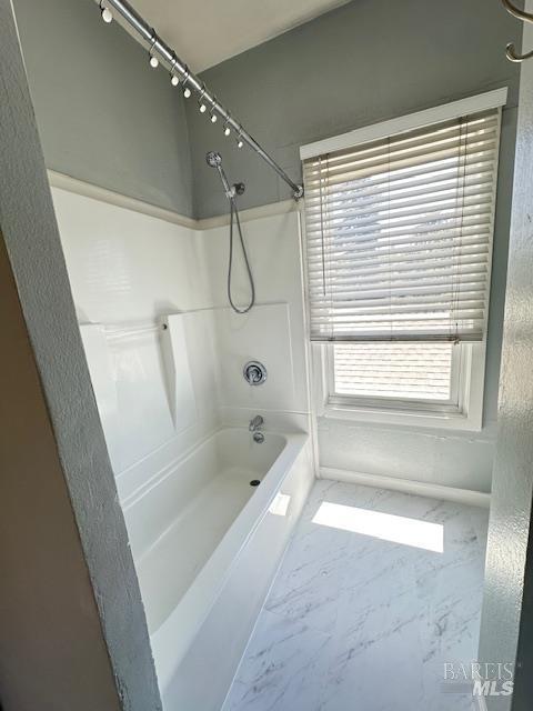
Bathrooms
1
-
Square Feet
1,000 sq ft
-
Available
Available Now
Highlights
- Downtown View
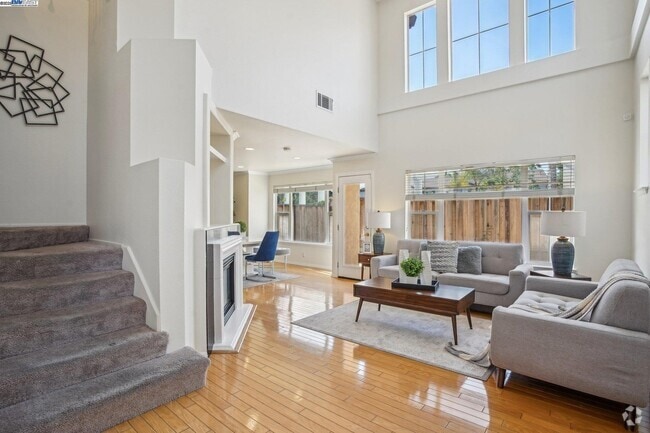
- Cathedral Ceiling
- Wood Flooring
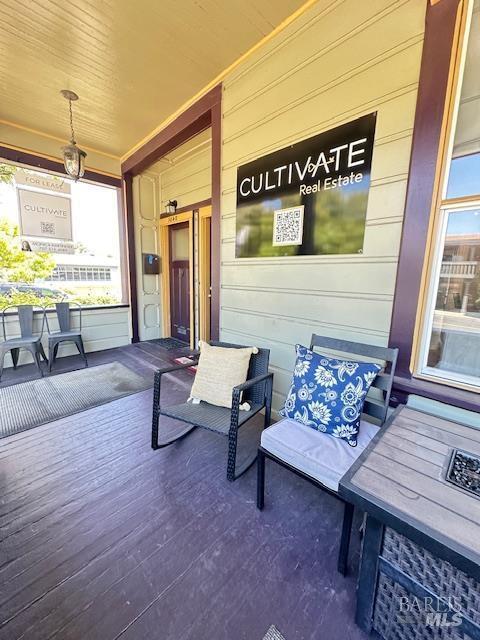
- Rear Porch
- Storage
- Central Heating
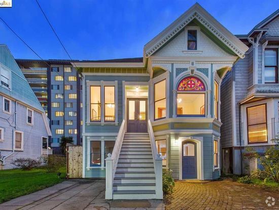
1040 1st St

Favorites
About This Home
Available Now
Now Available: Charming 3-Bedroom Victorian on Benicia's Iconic First Street 📍 1040 First Street, Benicia, CA 94510 💰 Rent: $2,895/month. Don't miss this rare opportunity to live in a beautifully maintained 1906 Victorian nestled in the heart of historic downtown Benicia. This charming 3-bedroom, 1-bath upstairs home is perched right on the corner of First Street across from the popular First Street Green Park with front-row views of holiday parades and community events right from your windows! Walkable Downtown Living: Just 1 block to the public library, grocery store, banks, restaurants, coffee shops, bocce ball courts, and the public swimming pool. You're truly in the center of it all. Live where history meets community! MLS#325047320
1040 1st St is a townhome located in Solano County and the 94510 ZIP Code. This area is served by the Benicia Unified attendance zone.
* Price shown is base rent and may not include non-optional fees and utilities.
Price, availability, fees, and any applicable rent special are subject to change without notice.
* Square footage definitions vary. Displayed square footage is approximate.
Home Details
Home Type
Townhome
Year Built
Built in 1906 | Remodeled
Bedrooms and Bathrooms
Primary Bedroom Upstairs
1 Full Bathroom
3 Bedrooms
Home Security
Carbon Monoxide Detectors
Fire and Smoke Detector
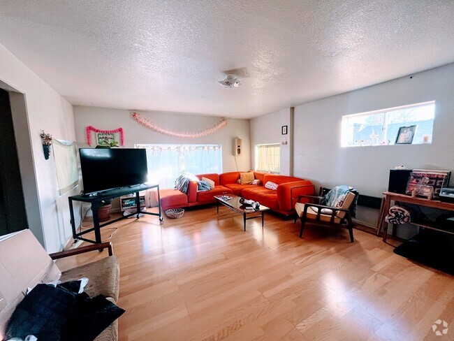
Interior Spaces
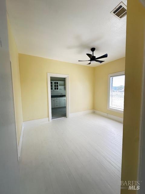
Cathedral Ceiling
Wood Flooring
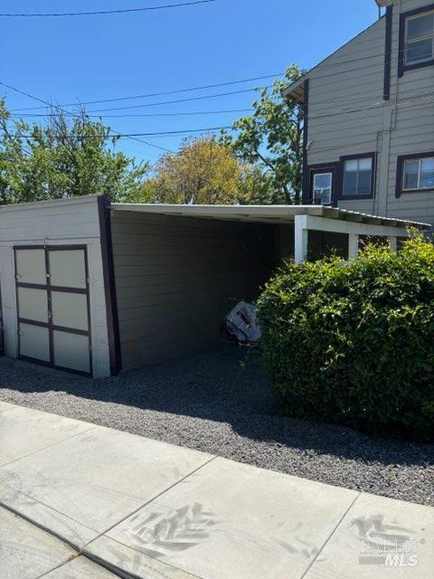
Storage
Combination Dining and Living Room
Ceiling Fan
1,000 Sq Ft Home
2-Story Property
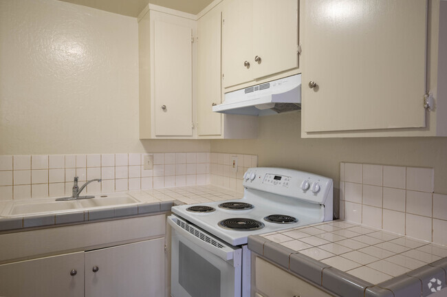
Kitchen
Free-Standing Electric Range
Microwave
Laminate Countertops
Laundry
Dryer
Laundry on upper level
Washer
Listing and Financial Details
Security Deposit $2,895
Assessor Parcel Number 0088-142-110
Lot Details
7,501 Sq Ft Lot
Fenced
Outdoor Features
Rear Porch
Parking
1 Carport Space
No Garage
Assigned Parking
1 Open Parking Space
2 Parking Spaces
Utilities
Central Heating
Internet Available
Views
Downtown Views
Community Details
Fees and Policies
The fees below are based on community-supplied data and may exclude additional fees and utilities.
- Parking
-
Covered--Assigned Parking
-
Other--Assigned Parking
Contact
- Listed by Cindy Sherman | Cultivate Real Estate
- Phone Number
- Contact
-
Source
 BAREIS MLS ®
Copyright 2025, Bay Area Real Estate Information Services, Inc. All Rights Reserved.
Location
Get Directions
Amenities
- High Speed Internet Access
- Hardwood Floors
Situated along the Carquinez Strait in the San Francisco Bay Area, Benicia is a scenic waterfront city rich in history, cultural amenities, and sweeping vistas. Benicia boasts an irresistible historic charm, especially in its quaint downtown area, which is brimming with one-of-a-kind shops, delectable eateries, and vibrant artists’ studios.
Founded in 1847, Benicia once served as California’s state capital for 13 months, and now touts the only state capitol building outside of Sacramento. Residents and visitors alike can uncover much of Benicia’s past at the Benicia Historical Museum.
Nearly 500 acres of parkland provides ample green space and tranquil trails for all kinds of outdoor recreation. Benicia’s thriving arts community creates a broad range of art, from glass art and sculptures to theatrical plays and music. Benicia’s friendly community comes together for a variety of events, like the Downtown Farmers Market, Opening Day on the Strait, and artist studio open houses.
Learn more about living in Benicia
Education
| Colleges & Universities | Distance | ||
|---|---|---|---|
| Colleges & Universities | Distance | ||
| Drive: | 15 min | 9.6 mi | |
| Drive: | 20 min | 10.7 mi | |
| Drive: | 23 min | 16.3 mi | |
| Drive: | 24 min | 17.0 mi |
1040 1st St is within 20 minutes or 10.7 miles from Touro University California. It is also near Diablo Valley, Pleasant Hill and Solano Community College.
Schools


Public Elementary School
Grades K-5
440 Students
Nearby
Public Elementary School
Grades K-5
420 Students
Attendance Zone
Public Middle School
Grades 6-8
986 Students
Attendance Zone
Public High School
Grades 9-12
1,432 Students
Attendance Zone
Private Elementary & Middle School
Grades PK-8
389 Students
Nearby
Private Elementary & Middle School
Grades PK-8
330 Students
Nearby
Private Elementary School
Grades K-5
Nearby
Private Middle & High School
Grades 7-12
Nearby
School data provided by
 The GreatSchools Rating helps parents compare schools within a state based on a variety of school quality indicators and provides a helpful picture of how effectively each school serves all of its students. Ratings are on a scale of 1 (below average) to 10 (above average) and can include test scores, college readiness, academic progress, advanced courses, equity, discipline and attendance data. We also advise parents to visit schools, consider other information on school performance and programs, and consider family needs as part of the school selection process.
View GreatSchools Rating Methodology
View GreatSchools Rating Methodology
Transportation options available in Benicia include North Concord Martinez Station, located 10.7 miles from 1040 1st St. 1040 1st St is near Metro Oakland International, located 37.1 miles or 48 minutes away, and San Francisco International, located 46.8 miles or 64 minutes away.
| Transit / Subway | Distance | ||
|---|---|---|---|
| Transit / Subway | Distance | ||
|
|
Drive: | 15 min | 10.7 mi |
|
|
Drive: | 15 min | 10.7 mi |
|
|
Drive: | 16 min | 11.2 mi |
| Commuter Rail | Distance | ||
|---|---|---|---|
| Commuter Rail | Distance | ||
|
|
Drive: | 8 min | 5.7 mi |
|
|
Drive: | 26 min | 20.4 mi |
| Drive: | 28 min | 20.6 mi | |
|
|
Drive: | 32 min | 24.8 mi |
|
|
Drive: | 34 min | 26.6 mi |
| Airports | Distance | ||
|---|---|---|---|
| Airports | Distance | ||
|
Metro Oakland International
|
Drive: | 48 min | 37.1 mi |
|
San Francisco International
|
Drive: | 64 min | 46.8 mi |
Time and distance from 1040 1st St.
| Shopping Centers | Distance | ||
|---|---|---|---|
| Shopping Centers | Distance | ||
| Walk: | 2 min | 0.2 mi | |
| Walk: | 4 min | 0.2 mi | |
| Walk: | 9 min | 0.5 mi |
1040 1st St has 3 shopping centers within 0.5 mile, which is about a 9-minute walk. The miles and minutes will be for the farthest away property.
| Parks and Recreation | Distance | ||
|---|---|---|---|
| Parks and Recreation | Distance | ||
|
Benicia Capitol State Historic Park
|
Walk: | 4 min | 0.2 mi |
|
Benicia State Recreation Area
|
Drive: | 9 min | 4.0 mi |
|
Martinez Regional Shoreline
|
Drive: | 10 min | 5.1 mi |
|
Alhambra Creek Watershed
|
Drive: | 8 min | 5.7 mi |
|
Carquinez Strait Regional Shoreline
|
Drive: | 18 min | 11.1 mi |
1040 1st St has 5 parks within 11.1 miles, including Benicia Capitol State Historic Park, Benicia State Recreation Area, and Martinez Regional Shoreline.
| Hospitals | Distance | ||
|---|---|---|---|
| Hospitals | Distance | ||
| Drive: | 10 min | 6.3 mi | |
| Drive: | 12 min | 7.7 mi | |
| Drive: | 13 min | 8.8 mi |
1040 1st St has 3 hospitals within 8.8 miles, the nearest is Contra Costa Regional Medical Center which is 6.3 miles away and a 10 minute drive.
| Military Bases | Distance | ||
|---|---|---|---|
| Military Bases | Distance | ||
| Drive: | 4 min | 1.9 mi | |
| Drive: | 18 min | 10.1 mi |
1040 1st St is 1.9 miles from Armory Vallejo, and is convenient to other military bases, including Mare Island Naval Reserve.
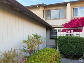
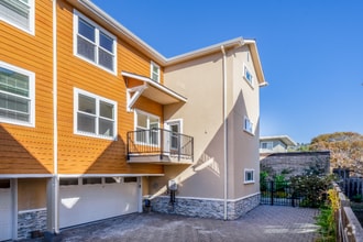
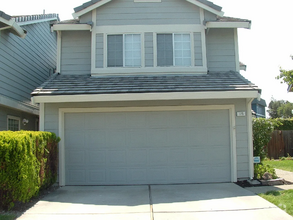
You May Also Like
Similar Rentals Nearby

What Are Walk Score®, Transit Score®, and Bike Score® Ratings?
Walk Score® measures the walkability of any address. Transit Score® measures access to public transit. Bike Score® measures the bikeability of any address.
What is a Sound Score Rating?
A Sound Score Rating aggregates noise caused by vehicle traffic, airplane traffic and local sources
1040 1st St
Benicia, CA 94510