
$3,150
/ Month
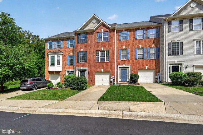
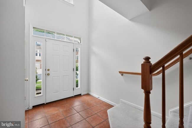
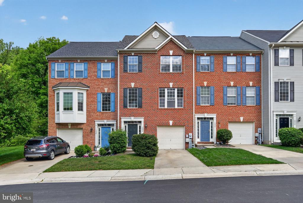
1034 Meandering Way
Odenton, MD 21113
Favorites
443-995-0159
-
Bedrooms
3
-
Bathrooms
3.5
-
Square Feet
2,496 sq ft
-
Available
Available Apr 29
Highlight
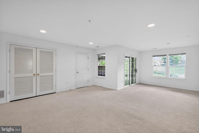
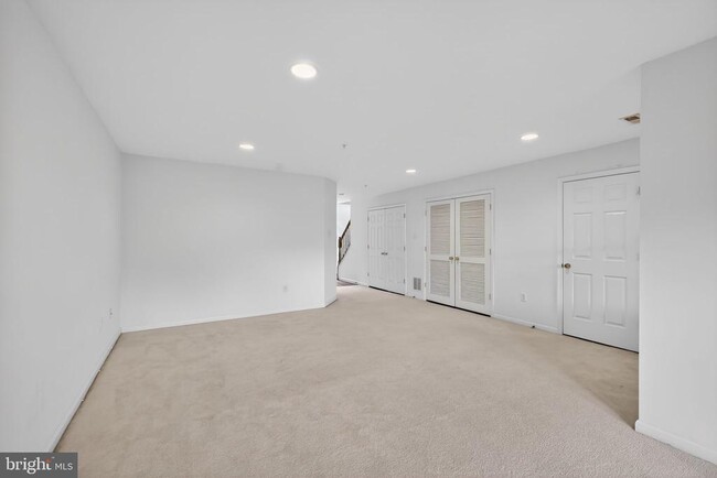
- Basement
1034 Meandering Way

Favorites
1034 Meandering Way is a townhome located in Anne Arundel County and the 21113 ZIP Code. This area is served by the Anne Arundel County Public Schools attendance zone.
* Price shown is base rent. Excludes user-selected optional fees and variable or usage-based fees and required charges due at or prior to move-in or at move-out. Price, availability, fees, and any applicable rent special are subject to change without notice.
* Square footage definitions vary. Displayed square footage is approximate.
Townhome Features
- Dishwasher
- Basement
Contact
- Listed by F. Aidan Surlis Jr. | LISSADELL PROPERTIES
- Phone Number
- Contact
-
Source
 Bright MLS, Inc.
Copyright © 2026 Bright MLS, Inc.
Location
Get Directions
Odenton sits at a geographic crossroads in Anne Arundel County, positioned roughly equidistant between Baltimore, Washington, D.C., and Annapolis. That location is not a coincidence — it has shaped the community's identity as one of Maryland's fastest-growing areas, driven largely by the presence of Fort George G. Meade, which hosts the NSA headquarters and U.S. Cyber Command. The result is a community with steady demand, a broad range of employers, and a population that leans toward government, defense, and technology sectors.
Neighborhoods like Piney Orchard and Seven Oaks each carry a distinct character. Piney Orchard offers wooded trails, a village center, and preserved green space along the Little Patuxent River, while Seven Oaks sits closer to Fort Meade with easy base access. The Odenton Town Center continues to develop around the MARC Penn Line station, making transit-oriented living a genuine option for those commuting to D.C. or Baltimore.
Learn more about living in Odenton
Amenities
- Dishwasher
- Basement
Education
| Colleges & Universities | Distance | ||
|---|---|---|---|
| Colleges & Universities | Distance | ||
| Drive: | 25 min | 12.2 mi | |
| Drive: | 28 min | 15.4 mi | |
| Drive: | 31 min | 18.4 mi | |
| Drive: | 33 min | 20.7 mi |
1034 Meandering Way is within 25 minutes or 12.2 miles from Bowie State University. It is also near Anne Arundel Community College and United States Naval Academy.
Schools


Public Middle School
Grades 6-8
1,286 Students
Nearby
Public High School
Grades 9-12
1,617 Students
Nearby
School data provided by
 The GreatSchools Rating helps parents compare schools within a state based on a variety of school quality indicators and provides a helpful picture of how effectively each school serves all of its students. Ratings are on a scale of 1 (below average) to 10 (above average) and can include test scores, college readiness, academic progress, advanced courses, equity, discipline and attendance data. We also advise parents to visit schools, consider other information on school performance and programs, and consider family needs as part of the school selection process.
View GreatSchools Rating Methodology
Data provided by GreatSchools.org © 2026. All rights reserved.
View GreatSchools Rating Methodology
Data provided by GreatSchools.org © 2026. All rights reserved.
Transportation options available in Odenton include Bwi Business District, located 11.4 miles from 1034 Meandering Way. 1034 Meandering Way is near Baltimore/Washington International Thurgood Marshall, located 11.5 miles or 22 minutes away, and Ronald Reagan Washington Ntl, located 32.7 miles or 50 minutes away.
| Transit / Subway | Distance | ||
|---|---|---|---|
| Transit / Subway | Distance | ||
|
|
Drive: | 22 min | 11.4 mi |
|
|
Drive: | 23 min | 11.8 mi |
|
|
Drive: | 22 min | 11.9 mi |
|
|
Drive: | 21 min | 12.1 mi |
|
|
Drive: | 22 min | 12.4 mi |
| Commuter Rail | Distance | ||
|---|---|---|---|
| Commuter Rail | Distance | ||
|
|
Drive: | 7 min | 3.3 mi |
|
|
Drive: | 20 min | 9.7 mi |
|
|
Drive: | 20 min | 11.1 mi |
| Drive: | 23 min | 11.9 mi | |
|
Bowie State Marc Sb
|
Drive: | 24 min | 13.6 mi |
| Airports | Distance | ||
|---|---|---|---|
| Airports | Distance | ||
|
Baltimore/Washington International Thurgood Marshall
|
Drive: | 22 min | 11.5 mi |
|
Ronald Reagan Washington Ntl
|
Drive: | 50 min | 32.7 mi |
Getting Around
 What do Walkability, Transit, Drivability, and Bikeability mean?
Walkability measures the walking distance to day-to-day needs.
Transit measures access to public transportation.
Drivability measures congestion, parking availability, and access to major roads.
Bikeability measures the suitability for cycling.
How It Works
What do Walkability, Transit, Drivability, and Bikeability mean?
Walkability measures the walking distance to day-to-day needs.
Transit measures access to public transportation.
Drivability measures congestion, parking availability, and access to major roads.
Bikeability measures the suitability for cycling.
How It Works
Somewhat Walkable
Walkability
30
/ 100
Minimal Public Transit
Transit
0
/ 100
Very Drivable
Drivability
80
/ 100
Moderately Bikeable
Bikeability
60
/ 100
Scores provided by
Calm
Soundscore™
84
/ 100
Traffic
CalmAirport
CalmBusinesses
CalmScores provided by
HowLoud What is a Sound Score Rating? A Sound Score Rating aggregates noise caused by vehicle traffic, airplane traffic and local sources. How It WorksTime and distance from 1034 Meandering Way.
| Shopping Centers | Distance | ||
|---|---|---|---|
| Shopping Centers | Distance | ||
| Drive: | 6 min | 2.1 mi | |
| Drive: | 7 min | 3.2 mi | |
| Drive: | 8 min | 3.8 mi |
1034 Meandering Way has 3 shopping centers within 3.8 miles, which is about a 8-minute drive. The miles and minutes will be for the farthest away property.
| Parks and Recreation | Distance | ||
|---|---|---|---|
| Parks and Recreation | Distance | ||
|
Patuxent Research Refuge - North Tract
|
Drive: | 18 min | 8.9 mi |
|
Kinder Farm Park
|
Drive: | 23 min | 11.7 mi |
|
Howard Owens Science Center
|
Drive: | 29 min | 16.1 mi |
|
NASA Goddard Space Flight Center
|
Drive: | 31 min | 17.0 mi |
|
Patuxent Research Refuge - South Tract
|
Drive: | 32 min | 17.0 mi |
1034 Meandering Way has 5 parks within 17.0 miles, including Patuxent Research Refuge - North Tract, Kinder Farm Park, and Howard Owens Science Center.
| Hospitals | Distance | ||
|---|---|---|---|
| Hospitals | Distance | ||
| Drive: | 21 min | 12.1 mi | |
| Drive: | 28 min | 14.8 mi | |
| Drive: | 31 min | 17.6 mi |
1034 Meandering Way has 3 hospitals within 17.6 miles, the nearest is University of Maryland Baltimore Washington Medical Center which is 12.1 miles away and a 21 minute drive.
| Military Bases | Distance | ||
|---|---|---|---|
| Military Bases | Distance | ||
| Drive: | 14 min | 6.5 mi | |
| Drive: | 39 min | 25.0 mi | |
| Drive: | 38 min | 25.4 mi |
1034 Meandering Way has 3 military bases within 25.4 miles, the nearest is Fort George Meade which is 6.5 miles away and a 14 minute drive.
You May Also Like
Similar Rentals Nearby


What Are Walk Score®, Transit Score®, and Bike Score® Ratings?
Walk Score® measures the walkability of any address. Transit Score® measures access to public transit. Bike Score® measures the bikeability of any address.
What is a Sound Score Rating?
A Sound Score Rating aggregates noise caused by vehicle traffic, airplane traffic and local sources.
1034 Meandering Way
Odenton, MD 21113