

$1,825
/ Month
1024 Kearsley Rd
Gloucester Township, NJ 08081
2 Weeks Ago
|
Edit
Favorites
1024 Kearsley Rd

Favorites
Check Back Soon for Upcoming Availability
| Beds | Baths | Average SF |
|---|---|---|
| 3 Bedrooms 3 Bedrooms 3 Br | 1 Bath 1 Bath 1 Ba | — |
About This Property
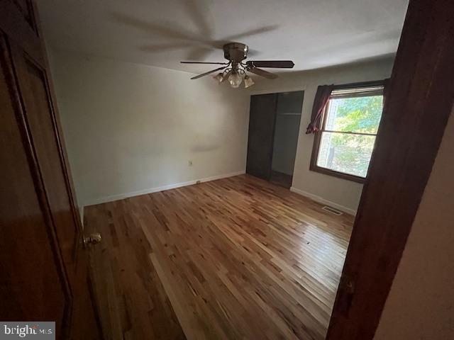
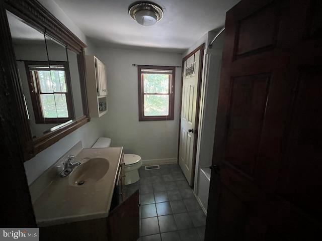
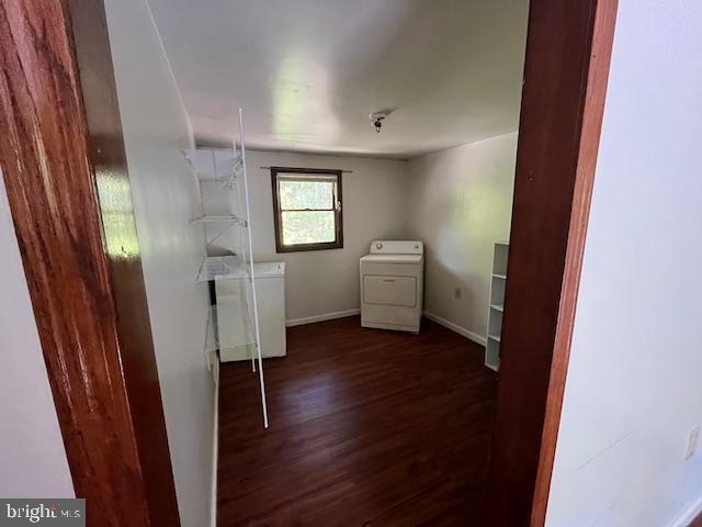
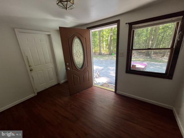
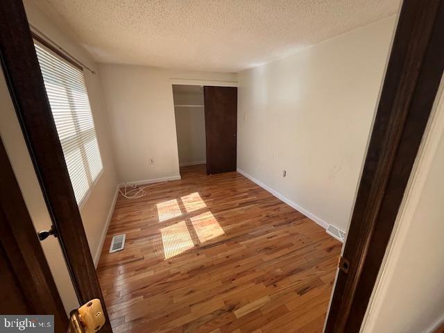
This lovely rancher 3 bedrooms and 1 Full bathroom house is available for rent . One mile away from major shopping center on Cross Keys Road . The house offer a spacious Living room, large kitchen where you can fit a breakfast area , 3 nice size bedrooms , attached one garage door that offer a door to a fenced yard . Landlord is asking for good credit, no eviction . Pets are allowed based on case by case and with deposit. Call me to schedule your private showing .
1024 Kearsley Rd is a house located in Camden County and the 08081 ZIP Code. This area is served by the Gloucester Township Public attendance zone.
House Features
- Basement
Location
Get Directions
Amenities
- Basement
Education
| Colleges & Universities | Distance | ||
|---|---|---|---|
| Colleges & Universities | Distance | ||
| Drive: | 11 min | 5.1 mi | |
| Drive: | 17 min | 9.6 mi | |
| Drive: | 21 min | 11.3 mi | |
| Drive: | 27 min | 17.4 mi |
1024 Kearsley Rd is within 11 minutes or 5.1 miles from Camden Co. Coll., Blackwood. It is also near Gloucester County College and Rowan University.
Schools


Public Middle School
Grades PK & 6-8
933 Students
Attendance Zone
Public Elementary School
Grades PK-5
500 Students
Attendance Zone
Public High School
Grades 9-12
1,166 Students
Attendance Zone
Private Elementary, Middle & High School
Grades K-12
112 Students
Nearby
Private Elementary & Middle School
Grades PK-8
127 Students
Nearby
School data provided by
 The GreatSchools Rating helps parents compare schools within a state based on a variety of school quality indicators and provides a helpful picture of how effectively each school serves all of its students. Ratings are on a scale of 1 (below average) to 10 (above average) and can include test scores, college readiness, academic progress, advanced courses, equity, discipline and attendance data. We also advise parents to visit schools, consider other information on school performance and programs, and consider family needs as part of the school selection process.
View GreatSchools Rating Methodology
Data provided by GreatSchools.org © 2026. All rights reserved.
View GreatSchools Rating Methodology
Data provided by GreatSchools.org © 2026. All rights reserved.
Transportation options available in Gloucester Township include Lindenwold (Patco), located 5.5 miles from 1024 Kearsley Rd. 1024 Kearsley Rd is near Philadelphia International, located 23.6 miles or 41 minutes away, and Atlantic City International, located 37.5 miles or 66 minutes away.
| Transit / Subway | Distance | ||
|---|---|---|---|
| Transit / Subway | Distance | ||
|
|
Drive: | 13 min | 5.5 mi |
|
|
Drive: | 18 min | 8.0 mi |
|
|
Drive: | 21 min | 9.9 mi |
|
|
Drive: | 21 min | 11.0 mi |
| Commuter Rail | Distance | ||
|---|---|---|---|
| Commuter Rail | Distance | ||
|
|
Drive: | 13 min | 5.5 mi |
|
|
Drive: | 11 min | 6.9 mi |
|
|
Drive: | 26 min | 14.1 mi |
|
|
Drive: | 24 min | 18.0 mi |
| Drive: | 32 min | 20.2 mi |
| Airports | Distance | ||
|---|---|---|---|
| Airports | Distance | ||
|
Philadelphia International
|
Drive: | 41 min | 23.6 mi |
|
Atlantic City International
|
Drive: | 66 min | 37.5 mi |
Time and distance from 1024 Kearsley Rd.
| Shopping Centers | Distance | ||
|---|---|---|---|
| Shopping Centers | Distance | ||
| Drive: | 3 min | 1.4 mi | |
| Drive: | 4 min | 1.6 mi | |
| Drive: | 4 min | 1.7 mi |
1024 Kearsley Rd has 3 shopping centers within 1.7 miles, which is about a 4-minute drive. The miles and minutes will be for the farthest away property.
| Parks and Recreation | Distance | ||
|---|---|---|---|
| Parks and Recreation | Distance | ||
|
Downs Farms Trails
|
Drive: | 18 min | 8.6 mi |
|
Woodford Cedar Run Wildlife Refuge
|
Drive: | 25 min | 11.3 mi |
|
Kresson Nature Trails
|
Drive: | 20 min | 11.8 mi |
|
Croft Farm Nature Trail
|
Drive: | 21 min | 13.0 mi |
|
Barclay Farmstead Nature Trail
|
Drive: | 25 min | 15.7 mi |
1024 Kearsley Rd has 5 parks within 15.7 miles, including Downs Farms Trails, Kresson Nature Trails, and Woodford Cedar Run Wildlife Refuge.
| Hospitals | Distance | ||
|---|---|---|---|
| Hospitals | Distance | ||
| Drive: | 13 min | 6.0 mi | |
| Drive: | 13 min | 7.4 mi | |
| Drive: | 15 min | 8.5 mi |
1024 Kearsley Rd has 3 hospitals within 8.5 miles, the nearest is Jefferson Stratford Hospital which is 6.0 miles away and a 13 minute drive.
| Military Bases | Distance | ||
|---|---|---|---|
| Military Bases | Distance | ||
| Drive: | 31 min | 18.7 mi |
1024 Kearsley Rd is 18.7 miles and a 31 minute drive from Philadelphia Naval Busi Center.
You May Also Like
How do I access Social Services in New Jersey?
Statewide service is free, confidential, multilingual and always open. Three easy ways to reach Social Services in NJ: Dial 2-1-1; text your zip code to 898-211; or chat at https://www.nj211.org
Similar Rentals Nearby


What Are Walk Score®, Transit Score®, and Bike Score® Ratings?
Walk Score® measures the walkability of any address. Transit Score® measures access to public transit. Bike Score® measures the bikeability of any address.
What is a Sound Score Rating?
A Sound Score Rating aggregates noise caused by vehicle traffic, airplane traffic and local sources
1024 Kearsley Rd
Gloucester Township, NJ 08081