

$2,350 / Month
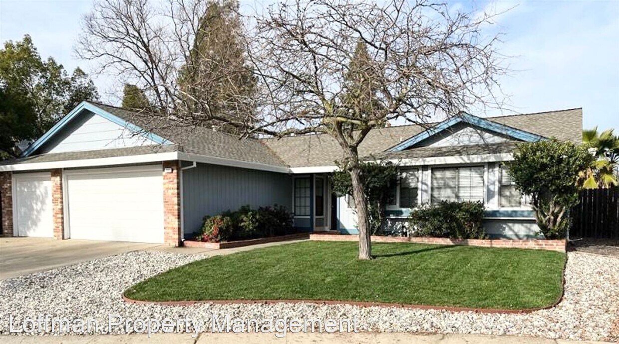
1009 Mayflower Ct
Roseville, CA 95747
2 Weeks Ago
Favorites
1009 Mayflower Ct

Favorites
Check Back Soon for Upcoming Availability
| Beds | Baths | Average SF |
|---|---|---|
| 3 Bedrooms 3 Bedrooms 3 Br | 2 Baths 2 Baths 2 Ba | 1,279 SF |
Fees and Policies
The fees below are based on community-supplied data and may exclude additional fees and utilities.
About This Property
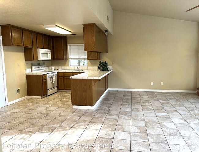
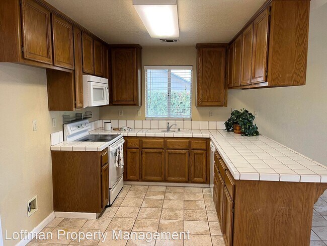
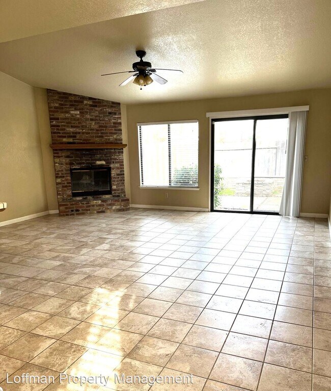
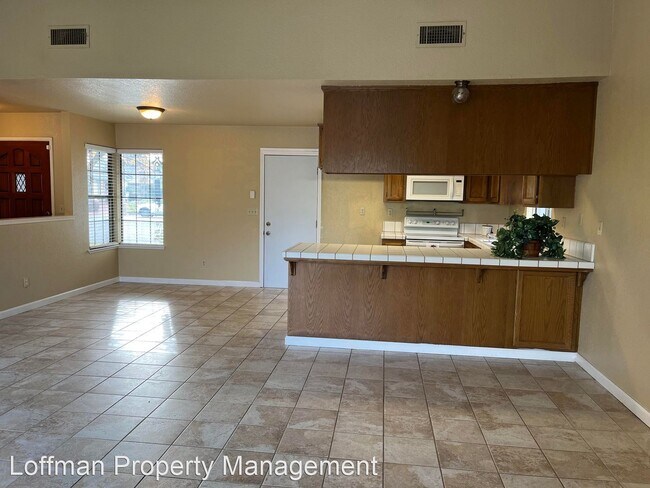
- Cute 3 Bedroom 2 Bathroom Home for Rent in Good Roseville Location - 3 bedrooms, 2 bathrooms BRAND NEW carpeting in the bedrooms 1279 square feet New front yard landscaping, new water heater Qualifications are: Credit score of 640 or above Income three times the rent Good landlord report - no evictions Pet upon approval with extra $500 deposit No smoking in home If you think you can qualify, please email Leasing Agent Ali for an appointment to see the house: or TEXT (No calls, please) No Pets Allowed (RLNE8381102) Pet policies: No Dogs Allowed, No Cats Allowed.
1009 Mayflower Ct is a house located in Placer County and the 95747 ZIP Code.
Unique Features
- No Dogs Allowed, No Cats Allowed
Location
Get Directions
Located about 20 miles away from Sacramento, Foothills Junction provides residents with a slice of suburbia. Moderately priced to upscale apartments and Mediterranean-style houses are available for rent in Foothills Junction. This family-friendly neighborhood has excellent schools and access to plenty of amenities and kid-friendly activities. Foothills Junction is near several restaurants and commercial hubs like Westfield Galleria at Roseville. Along with several parks, Foothills Junction is about a mile away from Roseville Aquatics Complex, Martha Riley Community Library, Placer County Fairgrounds, and Roseville Utility Exploration Center, a small science museum. Although families enjoy living in Foothills Junction, the neighborhood is also a great option for commuters with Highway 80 nearby, making travel throughout Northern California easy.
Learn more about living in Foothills JunctionBelow are rent ranges for similar nearby apartments
Amenities
- No Dogs Allowed, No Cats Allowed
Education
| Colleges & Universities | Distance | ||
|---|---|---|---|
| Colleges & Universities | Distance | ||
| Drive: | 15 min | 8.4 mi | |
| Drive: | 20 min | 10.2 mi | |
| Drive: | 34 min | 16.9 mi | |
| Drive: | 30 min | 18.6 mi |
1009 Mayflower Ct is within 15 minutes or 8.4 miles from Sierra College, Rocklin Campus. It is also near American River College and Folsom Lake College, Folsom.
Transportation options available in Roseville include Watt/I-80, located 11.0 miles from 1009 Mayflower Ct. 1009 Mayflower Ct is near Sacramento International, located 22.6 miles or 34 minutes away.
| Transit / Subway | Distance | ||
|---|---|---|---|
| Transit / Subway | Distance | ||
|
|
Drive: | 17 min | 11.0 mi |
|
|
Drive: | 19 min | 12.2 mi |
|
|
Drive: | 18 min | 12.2 mi |
| Drive: | 19 min | 12.8 mi | |
|
|
Drive: | 25 min | 14.0 mi |
| Commuter Rail | Distance | ||
|---|---|---|---|
| Commuter Rail | Distance | ||
|
|
Drive: | 6 min | 2.4 mi |
|
|
Drive: | 14 min | 7.4 mi |
| Drive: | 27 min | 19.5 mi | |
| Drive: | 27 min | 19.8 mi | |
|
|
Drive: | 27 min | 19.8 mi |
| Airports | Distance | ||
|---|---|---|---|
| Airports | Distance | ||
|
Sacramento International
|
Drive: | 34 min | 22.6 mi |
Time and distance from 1009 Mayflower Ct.
| Shopping Centers | Distance | ||
|---|---|---|---|
| Shopping Centers | Distance | ||
| Walk: | 8 min | 0.4 mi | |
| Walk: | 11 min | 0.6 mi | |
| Walk: | 12 min | 0.6 mi |
1009 Mayflower Ct has 3 shopping centers within 0.6 mile, which is about a 12-minute walk. The miles and minutes will be for the farthest away property.
| Parks and Recreation | Distance | ||
|---|---|---|---|
| Parks and Recreation | Distance | ||
|
Mahany Park
|
Drive: | 6 min | 2.1 mi |
|
Mahan Park
|
Drive: | 9 min | 4.6 mi |
|
Luken Park
|
Drive: | 9 min | 4.7 mi |
|
Roccucci Park
|
Drive: | 11 min | 5.8 mi |
|
Astill Family Park
|
Drive: | 12 min | 6.2 mi |
1009 Mayflower Ct has 5 parks within 6.2 miles, including Mahany Park, Luken Park, and Mahan Park.
| Hospitals | Distance | ||
|---|---|---|---|
| Hospitals | Distance | ||
| Drive: | 11 min | 5.0 mi | |
| Drive: | 12 min | 5.7 mi | |
| Drive: | 16 min | 8.4 mi |
1009 Mayflower Ct has 3 hospitals within 8.4 miles, the nearest is Kaiser Foundation Hospital - Roseville which is 5.0 miles away and a 11 minute drive.
| Military Bases | Distance | ||
|---|---|---|---|
| Military Bases | Distance | ||
| Drive: | 26 min | 11.0 mi |
1009 Mayflower Ct is 11.0 miles and a 26 minute drive from McClellan Air Force Base.
You May Also Like
Similar Rentals Nearby


What Are Walk Score®, Transit Score®, and Bike Score® Ratings?
Walk Score® measures the walkability of any address. Transit Score® measures access to public transit. Bike Score® measures the bikeability of any address.
What is a Sound Score Rating?
A Sound Score Rating aggregates noise caused by vehicle traffic, airplane traffic and local sources
1009 Mayflower Ct
Roseville, CA 95747