10046 Manistee Way
Cincinnati, OH 45251
-
Bedrooms
3
-
Bathrooms
1.5
-
Square Feet
1,226 sq ft
-
Available
Available Jun 15
Highlight
- Pets Allowed

About This Home
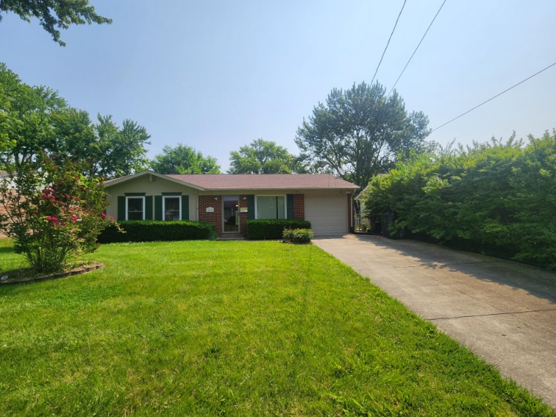
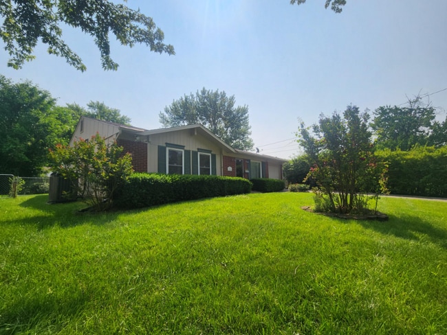
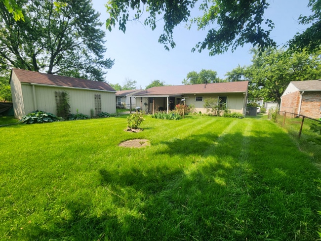
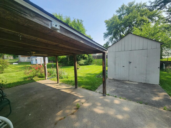
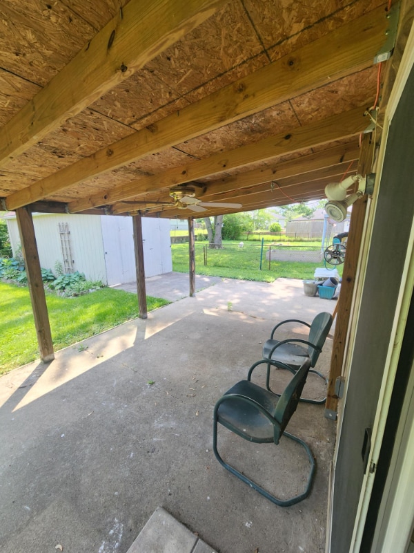
Property Id: 1944638 Now available in Colerain Township! This charming 3 bed, 1.5 bath ranch offers one-level living with an attached 1-car garage. Enjoy a spacious eat-in kitchen, fenced backyard, and a large storage shed. Conveniently located near shops, schools, and highways. Rental criteria: Income must be 3x the rent, good credit/criminal background, and strong rental history required. Pets welcome—no aggressive breeds. No Section 8. Immediate occupancy available.
10046 Manistee Way is a house located in Hamilton County and the 45251 ZIP Code. This area is served by the Mt Healthy City attendance zone.
House Features
Dishwasher
Microwave
Refrigerator
Tile Floors
- Dishwasher
- Microwave
- Oven
- Refrigerator
- Tile Floors
Fees and Policies
The fees below are based on community-supplied data and may exclude additional fees and utilities.
- Dogs Allowed
-
Fees not specified
- Cats Allowed
-
Fees not specified
Contact
- Phone Number
- Contact
-
Source

- Dishwasher
- Microwave
- Oven
- Refrigerator
- Tile Floors
Set in the suburbs of Cincinnati, Northbrook is a great mix of modern convenience and Midwestern charm. Traveling to downtown Cincinnati attractions is easy thanks to its locale near Interstate 275 – where you’ll be close to it all like the zoo, the botanical gardens, and the University of Cincinnati!
Taylor Elementary School is located in Northbrook and down the road from Clippard Park. The neighborhood is surrounded by golf courses, plus the Northgate Mall and Stone Creek Towne Center. Both shopping destinations have a great selection of stores and restaurants.
Learn more about living in Northbrook| Colleges & Universities | Distance | ||
|---|---|---|---|
| Colleges & Universities | Distance | ||
| Drive: | 24 min | 9.3 mi | |
| Drive: | 19 min | 10.0 mi | |
| Drive: | 23 min | 12.7 mi | |
| Drive: | 26 min | 14.9 mi |


View GreatSchools Rating Methodology
Data provided by GreatSchools.org © 2025. All rights reserved.
Transportation options available in Cincinnati include Brewery District Station, Elm & Henry, located 11.8 miles from 10046 Manistee Way. 10046 Manistee Way is near Cincinnati/Northern Kentucky International, located 25.8 miles or 49 minutes away.
| Transit / Subway | Distance | ||
|---|---|---|---|
| Transit / Subway | Distance | ||
| Drive: | 25 min | 11.8 mi |
| Commuter Rail | Distance | ||
|---|---|---|---|
| Commuter Rail | Distance | ||
|
|
Drive: | 25 min | 11.8 mi |
| Airports | Distance | ||
|---|---|---|---|
| Airports | Distance | ||
|
Cincinnati/Northern Kentucky International
|
Drive: | 49 min | 25.8 mi |
Time and distance from 10046 Manistee Way.
| Shopping Centers | Distance | ||
|---|---|---|---|
| Shopping Centers | Distance | ||
| Walk: | 10 min | 0.5 mi | |
| Walk: | 18 min | 0.9 mi | |
| Drive: | 5 min | 1.6 mi |
| Parks and Recreation | Distance | ||
|---|---|---|---|
| Parks and Recreation | Distance | ||
|
Triple Creek Park
|
Drive: | 5 min | 2.0 mi |
|
Farbach-Werner Nature Preserve
|
Drive: | 7 min | 2.5 mi |
|
Winton Woods Park
|
Drive: | 11 min | 4.2 mi |
|
LaBoiteaux Woods
|
Drive: | 14 min | 5.7 mi |
|
Richardson Forest Preserve
|
Drive: | 15 min | 6.4 mi |
| Hospitals | Distance | ||
|---|---|---|---|
| Hospitals | Distance | ||
| Drive: | 13 min | 6.5 mi | |
| Drive: | 18 min | 7.1 mi | |
| Drive: | 16 min | 9.6 mi |
| Military Bases | Distance | ||
|---|---|---|---|
| Military Bases | Distance | ||
| Drive: | 65 min | 49.2 mi | |
| Drive: | 71 min | 54.2 mi | |
| Drive: | 73 min | 57.5 mi |
10046 Manistee Way Photos
Nearby Apartments
Within 50 Miles of 10046 Manistee Way Cincinnati, OH 45251
-
8756 Daly Rd
Cincinnati, OH 45231
3 Br $1,600 3.1 mi
-
501 Delta Ave
Cincinnati, OH 45226
4 Br $2,500 11.9 mi
-
126 Thompson St
Trenton, OH 45067
3 Br $1,895 16.1 mi
-
10 W Arlington Dr
Trenton, OH 45067
3 Br $2,265 17.6 mi
-
545 Foxglove Ct
Maineville, OH 45039
3 Br $2,405 18.9 mi
-
7432 Big Horn Ct
Burlington, KY 41005
3 Br $2,500 19.4 mi
What Are Walk Score®, Transit Score®, and Bike Score® Ratings?
Walk Score® measures the walkability of any address. Transit Score® measures access to public transit. Bike Score® measures the bikeability of any address.
What is a Sound Score Rating?
A Sound Score Rating aggregates noise caused by vehicle traffic, airplane traffic and local sources

10046 Manistee Way
Cincinnati, OH 45251