

$1,995
/ Month
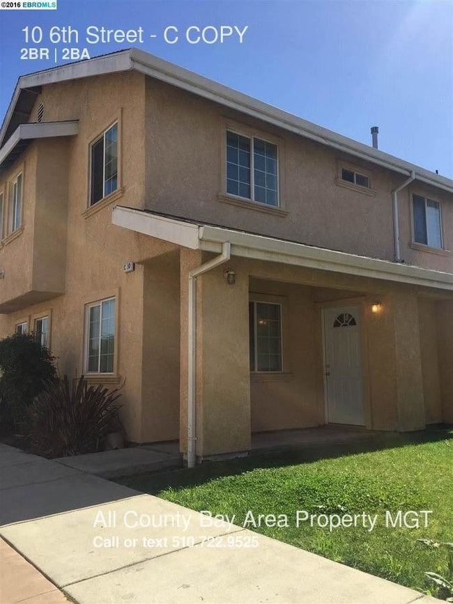
10 6th St Unit C
Richmond, CA 94801
Favorites
10 6th St Unit C

Favorites
Check Back Soon for Upcoming Availability
| Beds | Baths | Average SF |
|---|---|---|
| 2 Bedrooms 2 Bedrooms 2 Br | 1 Bath 1 Bath 1 Ba | 903 SF |
About This Property
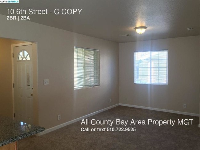
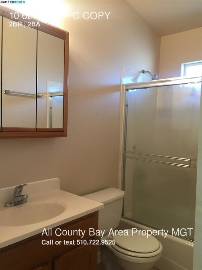
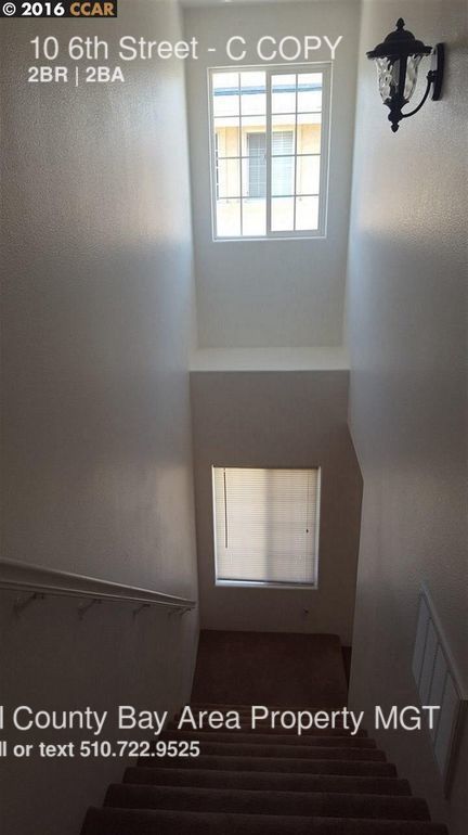
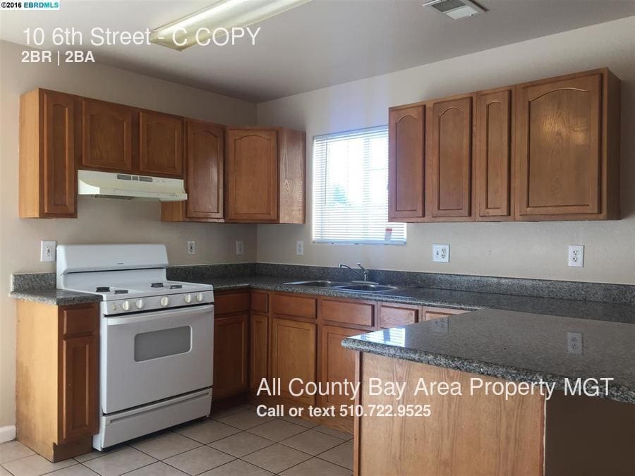
---- SCHEDULE A SHOWING ONLINE AT: http://showmojo.com/lac/4b1e78404e ---- This condo provides a lot of natural lighting and was built with high ceilings in 2005. It contains 2 bedrooms and 1.5 bathrooms and a private rear patio.Located close to El Cerrito in Richmond, very close to Bart, AC transit, UC Berkeley and very easy freeway access to 80 and 580, shopping center and restaurants. The location is just a half hour from downtown San Francisco, with close proximity to excellent neighborhood shopping and dining destinations. - Light with lots of windows and window coverings - New paint -- Convenient Amenities: - Requirements: - Verifiable income and employment with credit report - No Evictions -Sorry no section 8 (non- negotiable) Parks: www.ebparks.org/parks/pt_isabel and www.pido.org
10 6th St is a condo located in Contra Costa County and the 94801 ZIP Code. This area is served by the West Contra Costa Unified School District attendance zone.
Condo Features
- Refrigerator
10 6th St,
Richmond,
CA
94801
The Iron Triangle neighborhood sits in the heart of Central Richmond, California. With the area being largely residential, most rentals reside in the upper part of the triangle and an easy three-mile commute north to Point Richmond, a major shipping and industrial area. To the south, Berkeley and Oakland lie roughly 10 miles away via Interstate 580.
Locals often head for the Miller/Knox Regional Shoreline for a bit of jogging or cycling, or to cast a line off the fishing pier. Wade into the waters of San Francisco Bay at Keller Beach on the northern end of the park, or enjoy a show at the Masquers Playhouse, also just outside the Iron Triangle's southern border. Most eateries sit along Interstate 580, including several fast food chains. The MacDonald 80 Shopping Center lies roughly three miles east of the neighborhood. Drive another three miles and find Wildcat Canyon Regional Park and the Tilden Nature Area.
Learn more about living in Iron TriangleBelow are rent ranges for similar nearby apartments
Amenities
- Refrigerator
Education
| Colleges & Universities | Distance | ||
|---|---|---|---|
| Colleges & Universities | Distance | ||
| Drive: | 8 min | 3.7 mi | |
| Drive: | 15 min | 8.8 mi | |
| Drive: | 19 min | 9.9 mi | |
| Drive: | 19 min | 11.5 mi |
10 6th St Unit C is within 8 minutes or 3.7 miles from Contra Costa College. It is also near Berkeley City College and UC Berkeley.
Schools


Public Elementary School
Grades K-5
339 Students
Attendance Zone
Public Middle School
Grades 6-8
381 Students
Attendance Zone
Public High School
Grades 9-12
740 Students
Attendance Zone
Private Elementary, Middle & High School
Grades PK-12
Nearby
Private Elementary, Middle & High School
Grades K-12
Nearby
School data provided by
 The GreatSchools Rating helps parents compare schools within a state based on a variety of school quality indicators and provides a helpful picture of how effectively each school serves all of its students. Ratings are on a scale of 1 (below average) to 10 (above average) and can include test scores, college readiness, academic progress, advanced courses, equity, discipline and attendance data. We also advise parents to visit schools, consider other information on school performance and programs, and consider family needs as part of the school selection process.
View GreatSchools Rating Methodology
Data provided by GreatSchools.org © 2026. All rights reserved.
View GreatSchools Rating Methodology
Data provided by GreatSchools.org © 2026. All rights reserved.
Transportation options available in Richmond include Richmond Station, located 1.3 miles from 10 6th St Unit C. 10 6th St Unit C is near Metro Oakland International, located 21.9 miles or 30 minutes away, and San Francisco International, located 29.5 miles or 43 minutes away.
| Transit / Subway | Distance | ||
|---|---|---|---|
| Transit / Subway | Distance | ||
|
|
Drive: | 3 min | 1.3 mi |
|
|
Drive: | 7 min | 3.5 mi |
|
|
Drive: | 10 min | 5.6 mi |
|
|
Drive: | 14 min | 8.2 mi |
|
|
Drive: | 16 min | 9.0 mi |
| Commuter Rail | Distance | ||
|---|---|---|---|
| Commuter Rail | Distance | ||
| Walk: | 17 min | 0.9 mi | |
|
|
Drive: | 9 min | 7.0 mi |
| Drive: | 13 min | 9.3 mi | |
| Drive: | 16 min | 9.7 mi | |
| Drive: | 16 min | 10.7 mi |
| Airports | Distance | ||
|---|---|---|---|
| Airports | Distance | ||
|
Metro Oakland International
|
Drive: | 30 min | 21.9 mi |
|
San Francisco International
|
Drive: | 43 min | 29.5 mi |
Walkability Near 10 6th St Richmond, CA 94801
Getting Around
 What do Walkability, Transit, Drivability, and Bikeability mean?
Walkability measures the walking distance to day-to-day needs.
Transit measures access to public transportation.
Drivability measures congestion, parking availability, and access to major roads.
Bikeability measures the suitability for cycling.
How It Works
What do Walkability, Transit, Drivability, and Bikeability mean?
Walkability measures the walking distance to day-to-day needs.
Transit measures access to public transportation.
Drivability measures congestion, parking availability, and access to major roads.
Bikeability measures the suitability for cycling.
How It Works
Fairly Walkable
Walkability
50
/ 100
Some Public Transit
Transit
50
/ 100
Exceptionally Drivable
Drivability
90
/ 100
Moderately Bikeable
Bikeability
60
/ 100
Scores provided by
-
Soundscore™
-
/ 100
Traffic
-Airport
-Businesses
-Scores provided by
HowLoud What is a Sound Score Rating? A Sound Score Rating aggregates noise caused by vehicle traffic, airplane traffic and local sources. How It WorksTime and distance from 10 6th St Unit C.
| Shopping Centers | Distance | ||
|---|---|---|---|
| Shopping Centers | Distance | ||
| Walk: | 11 min | 0.6 mi | |
| Drive: | 3 min | 1.6 mi |
10 6th St Unit C has 2 shopping centers within 1.6 miles, which is about a 3-minute drive. The miles and minutes will be for the farthest away property.
| Parks and Recreation | Distance | ||
|---|---|---|---|
| Parks and Recreation | Distance | ||
|
Rosie the Riveter WWII Home Front National Historical Park
|
Drive: | 4 min | 1.8 mi |
|
Marina Park & Green
|
Drive: | 5 min | 2.0 mi |
|
Miller/Knox Regional Shoreline
|
Drive: | 5 min | 2.2 mi |
|
Shimada Friendship Park
|
Drive: | 6 min | 2.7 mi |
|
Brooks Island Regional Preserve
|
Drive: | 9 min | 3.9 mi |
10 6th St Unit C has 5 parks within 3.9 miles, including Rosie the Riveter WWII Home Front National Historical Park, Marina Park & Green, and Miller/Knox Regional Shoreline.
| Hospitals | Distance | ||
|---|---|---|---|
| Hospitals | Distance | ||
| Drive: | 18 min | 10.5 mi | |
| Drive: | 16 min | 11.4 mi | |
| Drive: | 15 min | 11.4 mi |
10 6th St Unit C has 3 hospitals within 11.4 miles, the nearest is Alta Bates Summit Medical Center - Alta Bates Campus which is 10.5 miles away and a 18 minute drive.
| Military Bases | Distance | ||
|---|---|---|---|
| Military Bases | Distance | ||
| Drive: | 8 min | 3.8 mi | |
| Drive: | 13 min | 5.8 mi | |
| Drive: | 24 min | 15.5 mi |
10 6th St Unit C has 3 military bases within 15.5 miles, the nearest is Armory West Contra Costa which is 3.8 miles away and a 8 minute drive.
You May Also Like
Similar Rentals Nearby


What Are Walk Score®, Transit Score®, and Bike Score® Ratings?
Walk Score® measures the walkability of any address. Transit Score® measures access to public transit. Bike Score® measures the bikeability of any address.
What is a Sound Score Rating?
A Sound Score Rating aggregates noise caused by vehicle traffic, airplane traffic and local sources.
10 6th St
Richmond, CA 94801