Warwick Terrace Apartment Homes
413 N Warwick Rd,
Somerdale, NJ 08083
$1,535 - $2,675
Studio - 2 Beds
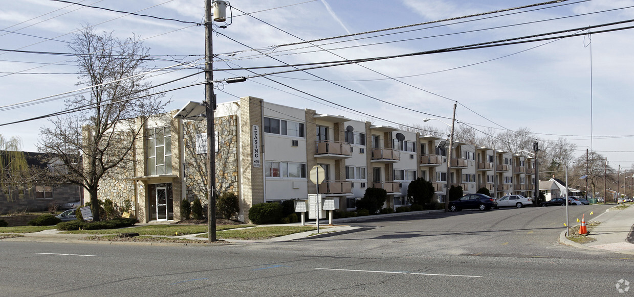

309 Apartments offers a combination of style, comfort, and livability. The 309 N White Horse Pike location in the 8083 neighborhood of Somerdale is convenient to everything. Let the leasing team show you everything this community has to offer. It's time to love where you live. Stop by for a visit today.
309 Apartments is an apartment community located in Camden County and the 08083 ZIP Code. This area is served by the Somerdale Public School District attendance zone.
Air Conditioning
Walk-In Closets
Refrigerator
Ceiling Fans

Warwick Terrace Apartment Homes
413 N Warwick Rd,
Somerdale, NJ 08083
$1,535 - $2,675
Studio - 2 Beds
Somerdale sits at the crossroads of South Jersey, a compact borough in Camden County that keeps Philadelphia within easy reach while holding onto its own quieter identity. Incorporated in 1929, this close-knit community spans just under 1.4 square miles, yet packs in tree-lined streets, a well-established residential character, and solid access to the wider region. Philadelphia International Airport is only a short drive away, making the borough a practical base for frequent travelers and commuters alike.
Life here revolves around walkable stretches along White Horse Pike, where local shops and eateries fill everyday needs without a long drive. Nearby Voorhees Town Center and Eagle Plaza expand those options considerably. Rowan University and Cooper Medical School of Rowan University anchor the broader Camden County education scene, giving the surrounding area a steady economic and cultural pulse.
Learn more about living in Somerdale| Colleges & Universities | Distance | ||
|---|---|---|---|
| Colleges & Universities | Distance | ||
| Drive: | 11 min | 5.9 mi | |
| Drive: | 17 min | 10.0 mi | |
| Drive: | 15 min | 11.1 mi | |
| Drive: | 16 min | 11.4 mi |

Transportation options available in Somerdale include Ashland, located 1.8 miles from 309 Apartments. 309 Apartments is near Philadelphia International, located 17.3 miles or 28 minutes away, and Trenton Mercer, located 41.1 miles or 56 minutes away.
| Transit / Subway | Distance | ||
|---|---|---|---|
| Transit / Subway | Distance | ||
|
|
Drive: | 3 min | 1.8 mi |
|
|
Drive: | 3 min | 2.0 mi |
|
|
Drive: | 7 min | 3.0 mi |
|
|
Drive: | 6 min | 4.1 mi |
|
|
Drive: | 8 min | 5.4 mi |
| Commuter Rail | Distance | ||
|---|---|---|---|
| Commuter Rail | Distance | ||
|
|
Drive: | 3 min | 1.9 mi |
|
|
Drive: | 12 min | 7.3 mi |
|
|
Drive: | 12 min | 8.9 mi |
| Drive: | 19 min | 10.9 mi | |
|
|
Drive: | 20 min | 13.4 mi |
| Airports | Distance | ||
|---|---|---|---|
| Airports | Distance | ||
|
Philadelphia International
|
Drive: | 28 min | 17.3 mi |
|
Trenton Mercer
|
Drive: | 56 min | 41.1 mi |
Scores provided by
Traffic
ActiveAirport
CalmBusinesses
ActiveScores provided by
HowLoud What is a Sound Score Rating? A Sound Score Rating aggregates noise caused by vehicle traffic, airplane traffic and local sources. How It WorksTime and distance from 309 Apartments.
| Shopping Centers | Distance | ||
|---|---|---|---|
| Shopping Centers | Distance | ||
| Walk: | 5 min | 0.3 mi | |
| Walk: | 6 min | 0.3 mi | |
| Walk: | 11 min | 0.6 mi |
| Parks and Recreation | Distance | ||
|---|---|---|---|
| Parks and Recreation | Distance | ||
|
Downs Farms Trails
|
Drive: | 4 min | 2.5 mi |
|
Kresson Nature Trails
|
Drive: | 9 min | 4.8 mi |
|
Croft Farm Nature Trail
|
Drive: | 8 min | 5.1 mi |
|
Erlton North Trails
|
Drive: | 11 min | 6.7 mi |
|
Barclay Farmstead Nature Trail
|
Drive: | 12 min | 7.2 mi |
| Hospitals | Distance | ||
|---|---|---|---|
| Hospitals | Distance | ||
| Drive: | 3 min | 1.9 mi | |
| Drive: | 12 min | 6.6 mi | |
| Drive: | 13 min | 7.5 mi |
| Military Bases | Distance | ||
|---|---|---|---|
| Military Bases | Distance | ||
| Drive: | 19 min | 12.4 mi | |
| Drive: | 55 min | 31.2 mi | |
| Drive: | 54 min | 31.8 mi |

309 N White Horse Pike
Somerdale, NJ 08083


