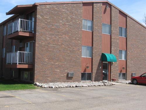
Westwood

1201 3rd Ave N, Wahpeton, ND 58075

Share Listing
Favorites
Westwood
Share Listing
Favorites

About Westwood

Experience a new place to live at Westwood in Wahpeton, ND. The 58075 location in Wahpeton is an ideal place for residents. Schedule a time to check out the apartment floorplan options. The professional leasing team is ready and waiting to help you find the perfect fit. Come see Westwood today.

Westwood is an apartment community located in Richland County and the 58075 ZIP Code. This area is served by the Wahpeton 37 School District attendance zone.

Community Amenities

  • Laundry Facilities
  • Controlled Access

Apartment Features

Air Conditioning

Dishwasher

Refrigerator

Tub/Shower

  • Air Conditioning
  • Heating
  • Tub/Shower
  • Dishwasher
  • Kitchen
  • Oven
  • Refrigerator
  • Carpet
Location
1201 3rd Ave N, Wahpeton,
ND 58075
Get Directions
City - Wahpeton

Wahpeton is a small city on the Minnesota state line, about fifty miles south of Fargo. The community has a rich history, and many of the buildings downtown (including the iconic Richland County Courthouse) date back well over a century. The small Downtown district along Dakota Avenue serves as a popular hangout for residents, hosting a popular collective of locally-owned specialty shops, cafes, and neighborhood bars.

Manufacturing has long been the main industry in the area, and several plants operate in town and nearby. The Red River flows along the eastern border of the city, and on its banks you’ll find lush green parks and the Bois de Sioux Golf Course, offering terrific opportunities to spend time outdoors.

Learn more about living in Wahpeton 
Education
Schools
Public Elementary School
Grades K-5
Attendance Zone
Public Elementary School
Grades PK-5
Attendance Zone
Public Middle School
Grades 6-8
Attendance Zone
Public High School
Grades 9-12
Attendance Zone
Private Elementary & Middle School
Grades PK-8
Nearby
Private Elementary School
Grades PK-5
Nearby
Private High School
Grades 9-12
Nearby
Transportation

Walkability Near Westwood

Getting Around
Fairly Walkable
Walkability
50 / 100
Exceptionally Drivable
Drivability
100 / 100
Fairly Bikeable
Bikeability
40 / 100

Scores provided by

What do Walkability, Transit, Drivability, and Bikeability mean? Walkability measures the walking distance to day-to-day needs. Transit measures access to public transportation. Drivability measures congestion, parking availability, and access to major roads. Bikeability measures the suitability for cycling. How It Works
-
Soundscore
- / 100

Traffic

-

Airport

-

Businesses

-

Scores provided by

HowLoud What is a Sound Score Rating? A Sound Score Rating aggregates noise caused by vehicle traffic, airplane traffic and local sources. How It Works
Points of Interest

Time and distance from Westwood.

Parks and Recreation Distance
Chahinkapa Zoo
Drive: 5 min 1.6 mi
Westwood has a nearby park, Chahinkapa Zoo , located 1.6 miles or 5 minutes away.
Hospitals Distance
Hospitals Distance
Drive: 6 min 3.8 mi
Westwood is 3.8 miles and a 6 minute drive from St. Francis Medical Center.
Military Bases Distance
Drive: 62 min 56.2 mi
Westwood is 56.2 miles and a 62 minute drive from Hector Field Airport Air Guard Station.

Explore Similar Rentals Nearby