$2,700
/ Month
435 W 57th St
New York, NY 10019
Favorites
WEST 57 STREET

Favorites
Check Back Soon for Upcoming Availability
| Beds | Baths | Average SF |
|---|---|---|
| Studio Studio 0 Br | 1 Bath 1 Bath 1 Ba | — |
About This Property
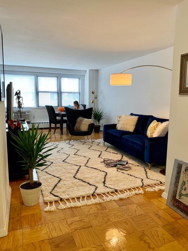
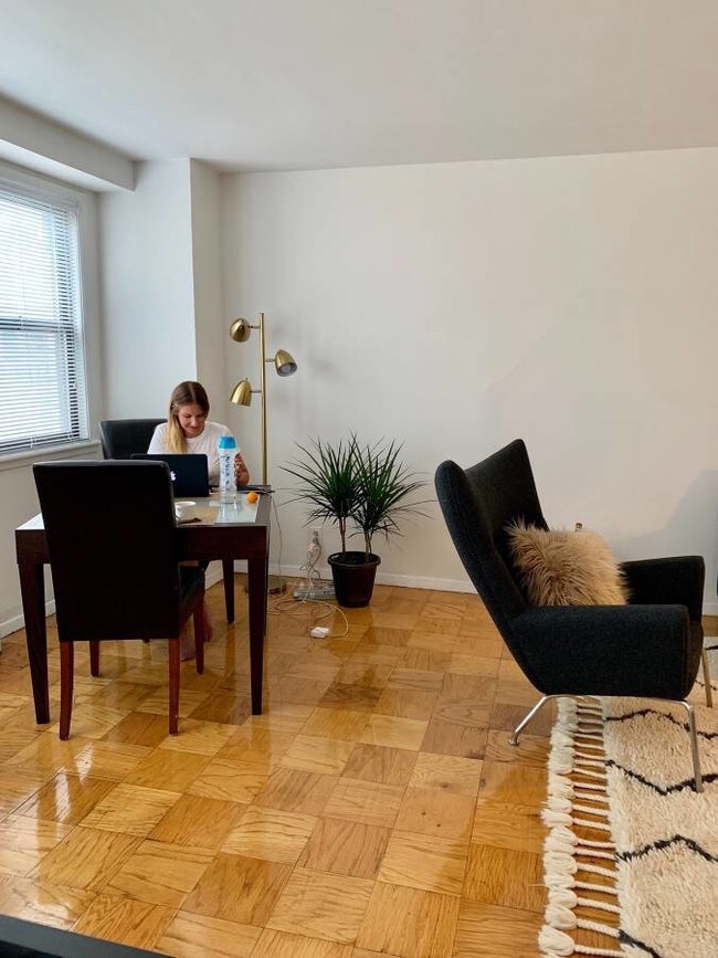
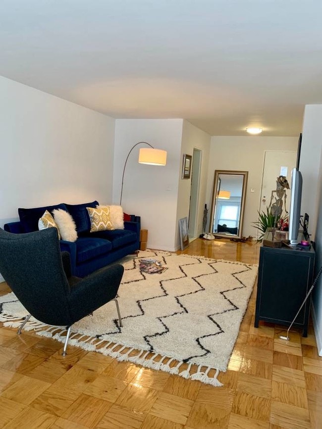
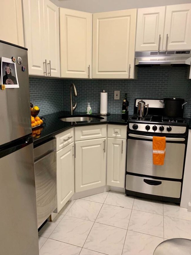
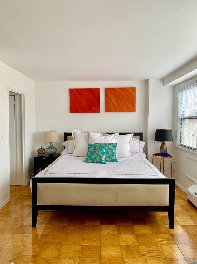
SOUTH FACING3 LARGE CLOSETSNEW KITCHEN APPLIANCES W/ DISHWASHERDOORMANCENTRAL LAUNDRY ROOM1 BLOCK FROM A/C/B/D/1 SUBWAY LINES + 2 CROSSTOWN BUSES===Ref:570062===
WEST 57 STREET is an apartment community located in New York County and the 10019 ZIP Code.
435 W 57th St,
New York,
NY
10019
Lincoln Square is a lively, historic neighborhood bordering Central Park overlooking the Hudson River. Its unbeatable proximity to Manhattan’s most iconic green space, along with its beautiful riverfront views, make this neighborhood a one-of-a-kind urban destination for renters. The public transit on Broadway will get you around New York City, though this neighborhood is very walkable.
Both Julliard and Fordham University reside in Lincoln Square, making this an education hub for Manhattan. The arts are celebrated in Lincoln Square with various theaters, performing arts centers, museums, and music halls, most notable being the Metropolitan Opera House! Local restaurants are divine in Lincoln Square, so after you find your trendy urban apartment, check out the Smith, Rosa Mexicano, or grab a cupcake from Magnolia Bakery.
Learn more about living in Lincoln SquareBelow are rent ranges for similar nearby apartments
Education
| Colleges & Universities | Distance | ||
|---|---|---|---|
| Colleges & Universities | Distance | ||
| Walk: | 3 min | 0.2 mi | |
| Walk: | 6 min | 0.3 mi | |
| Drive: | 3 min | 1.3 mi | |
| Drive: | 4 min | 1.6 mi |
WEST 57 STREET is within 3 minutes or 0.2 mile from John Jay College, CUNY. It is also near Fordham Univ., Lincoln Center and LIM College.
Transportation options available in New York include 59 Street-Columbus Circle, located 0.4 mile from WEST 57 STREET. WEST 57 STREET is near LaGuardia, located 7.8 miles or 17 minutes away, and Newark Liberty International, located 14.5 miles or 20 minutes away.
| Transit / Subway | Distance | ||
|---|---|---|---|
| Transit / Subway | Distance | ||
|
|
Walk: | 6 min | 0.4 mi |
|
|
Walk: | 9 min | 0.5 mi |
| Walk: | 9 min | 0.5 mi | |
|
|
Walk: | 11 min | 0.6 mi |
|
|
Walk: | 12 min | 0.6 mi |
| Commuter Rail | Distance | ||
|---|---|---|---|
| Commuter Rail | Distance | ||
|
|
Drive: | 3 min | 1.5 mi |
|
|
Drive: | 4 min | 1.7 mi |
|
|
Drive: | 4 min | 1.7 mi |
|
|
Drive: | 5 min | 1.9 mi |
|
|
Drive: | 5 min | 1.9 mi |
| Airports | Distance | ||
|---|---|---|---|
| Airports | Distance | ||
|
LaGuardia
|
Drive: | 17 min | 7.8 mi |
|
Newark Liberty International
|
Drive: | 20 min | 14.5 mi |
Walkability Near WEST 57 STREET
Getting Around
 What do Walkability, Transit, Drivability, and Bikeability mean?
Walkability measures the walking distance to day-to-day needs.
Transit measures access to public transportation.
Drivability measures congestion, parking availability, and access to major roads.
Bikeability measures the suitability for cycling.
How It Works
What do Walkability, Transit, Drivability, and Bikeability mean?
Walkability measures the walking distance to day-to-day needs.
Transit measures access to public transportation.
Drivability measures congestion, parking availability, and access to major roads.
Bikeability measures the suitability for cycling.
How It Works
Exceptionally Walkable
Walkability
100
/ 100
Exceptional Public Transit
Transit
100
/ 100
Moderately Drivable
Drivability
60
/ 100
Very Bikeable
Bikeability
80
/ 100
Scores provided by
-
Soundscore™
-
/ 100
Traffic
-Airport
-Businesses
-Scores provided by
HowLoud What is a Sound Score Rating? A Sound Score Rating aggregates noise caused by vehicle traffic, airplane traffic and local sources. How It WorksTime and distance from WEST 57 STREET.
| Shopping Centers | Distance | ||
|---|---|---|---|
| Shopping Centers | Distance | ||
| Walk: | 20 min | 1.1 mi | |
| Drive: | 3 min | 1.2 mi | |
| Drive: | 4 min | 1.7 mi |
WEST 57 STREET has 3 shopping centers within 1.7 miles, which is about a 4-minute drive. The miles and minutes will be for the farthest away property.
| Parks and Recreation | Distance | ||
|---|---|---|---|
| Parks and Recreation | Distance | ||
|
Damrosch Park
|
Walk: | 8 min | 0.4 mi |
|
De Witt Clinton Park
|
Walk: | 10 min | 0.5 mi |
|
Sony Wonder Technology Lab
|
Walk: | 17 min | 0.9 mi |
|
Central Park
|
Walk: | 18 min | 1.0 mi |
|
Central Park Zoo
|
Drive: | 4 min | 1.5 mi |
WEST 57 STREET has 5 parks within 1.5 miles, including Damrosch Park, De Witt Clinton Park, and Sony Wonder Technology Lab.
| Hospitals | Distance | ||
|---|---|---|---|
| Hospitals | Distance | ||
| Walk: | 2 min | 0.1 mi | |
| Drive: | 5 min | 2.3 mi | |
| Drive: | 6 min | 2.3 mi |
WEST 57 STREET has 3 hospitals within 2.3 miles, the nearest is Mount Sinai St. Luke's Roosevelt Hospital which is 0.1 mile away and a 2 minute walk.
| Military Bases | Distance | ||
|---|---|---|---|
| Military Bases | Distance | ||
| Drive: | 16 min | 6.0 mi | |
| Drive: | 24 min | 12.5 mi | |
| Drive: | 36 min | 17.2 mi |
WEST 57 STREET has 3 military bases within 17.2 miles, the nearest is Governors Island Support Center which is 6.0 miles away and a 16 minute drive.
You May Also Like
Similar Rentals Nearby


What Are Walk Score®, Transit Score®, and Bike Score® Ratings?
Walk Score® measures the walkability of any address. Transit Score® measures access to public transit. Bike Score® measures the bikeability of any address.
What is a Sound Score Rating?
A Sound Score Rating aggregates noise caused by vehicle traffic, airplane traffic and local sources.

435 W 57th St
New York, NY 10019