Washington Street

23-47 S Turner Cir, Coats, NC 27521

Share Listing
Favorites
Washington Street
Share Listing
Favorites

About Washington Street

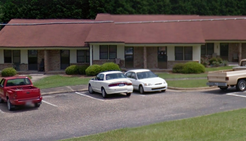
Washington Street in Coats is ready for you to visit. These apartments are located in Coats at 23-47 S. Turner Cir. in the 27521 area. The community staff is ready to help you find the perfect place to live. Come by to see the current floorplan options. Welcome to your new home at Washington Street. Stop by the leasing office to check the availability and schedule a tour today.

Washington Street is an apartment community located in Harnett County and the 27521 ZIP Code. This area is served by the Harnett County School District attendance zone.

Apartment Features

Air Conditioning

Refrigerator

Tub/Shower

Heating

  • Air Conditioning
  • Heating
  • Tub/Shower
  • Wheelchair Accessible (Rooms)
  • Kitchen
  • Range
  • Refrigerator
Location
23-47 S Turner Cir, Coats,
NC 27521
Get Directions
City - Coats

A secluded small town between Fayetteville and Raleigh, Coats is known for its welcoming community and family-friendly atmosphere. Affordable rentals line the residential streets of this rural town. Farmland surrounds the city of Coats, and a few local businesses sit within the city limits like Cornerstone Café & Coffee, a cozy local hangout. Residents of Coats — families in particular — appreciate the safe streets and great public schools offered in town like Coats Elementary. Although Coats is relatively secluded from any major cities, residents can still easily travel north into Raleigh or south into Fayetteville for work or play. Interstates 95 and 40 sit just a few miles east of town, offering the quickest commutes into either major North Carolina metro area.

Learn more about living in Coats 
Education
Colleges & Universities Distance
Drive: 7 min 4.3 mi
Drive: 30 min 20.3 mi
Drive: 40 min 25.7 mi
Drive: 41 min 26.1 mi
Washington Street is within 7 minutes or 4.3 miles from Campbell University. It is also near Wake Technical and Wake Technical, Western Wake.
Schools
Public Elementary School
Grades PK-5
671 Students
Attendance Zone
Public Middle School
Grades 6-8
606 Students
Attendance Zone
Public High School
Grades 9-12
1,287 Students
Attendance Zone
Private Elementary, Middle & High School
Grades PK-12
251 Students
Nearby
Transportation

Washington Street is near Fayetteville Regional/Grannis Field, located 38.6 miles or 54 minutes away, and Raleigh-Durham International, located 40.0 miles or 61 minutes away.

Commuter Rail Distance
Drive: 44 min 27.5 mi
Drive: 39 min 28.6 mi
Drive: 53 min 32.5 mi
Drive: 47 min 34.5 mi
Airports Distance
Airports Distance
Fayetteville Regional/Grannis Field
Drive: 54 min 38.6 mi
Raleigh-Durham International
Drive: 61 min 40.0 mi

Walkability Near Washington Street

Getting Around
Somewhat Walkable
Walkability
30 / 100
Exceptionally Drivable
Drivability
90 / 100
Somewhat Bikeable
Bikeability
20 / 100

Scores provided by

What do Walkability, Transit, Drivability, and Bikeability mean? Walkability measures the walking distance to day-to-day needs. Transit measures access to public transportation. Drivability measures congestion, parking availability, and access to major roads. Bikeability measures the suitability for cycling. How It Works
-
Soundscore
- / 100

Traffic

-

Airport

-

Businesses

-

Scores provided by

HowLoud What is a Sound Score Rating? A Sound Score Rating aggregates noise caused by vehicle traffic, airplane traffic and local sources. How It Works
Points of Interest

Time and distance from Washington Street.

Shopping Centers Distance
Drive: 13 min 7.3 mi
Drive: 13 min 7.6 mi
Drive: 13 min 8.0 mi
Washington Street has 3 shopping centers within 8.0 miles, which is about a 13-minute drive. The miles and minutes will be for the farthest away property.
Parks and Recreation Distance
Cape Fear River Trail Park
Drive: 8 min 5.5 mi
Washington Street has a nearby park, Cape Fear River Trail Park , located 5.5 miles or 8 minutes away.
Hospitals Distance
Hospitals Distance
Drive: 10 min 6.4 mi
Drive: 15 min 8.8 mi
Washington Street is 6.4 miles from Good Hope Hospital, and is convenient to other hospitals, including Betsy Johnson Regional Hospital.
Military Bases Distance
Drive: 48 min 30.7 mi
Drive: 52 min 32.7 mi
Drive: 60 min 35.0 mi
Washington Street has 3 military bases within 35.0 miles, the nearest is Pope Army Airfield which is 30.7 miles away and a 48 minute drive.

Explore Similar Rentals Nearby