
Viewpoint
651 Addison St,
Berkeley,
CA
94710
-
Monthly Rent
$3,450 - $3,560
-
Bedrooms
2 bd
-
Bathrooms
2 ba
-
Square Feet
1,159 - 1,229 sq ft
Highlights
- Walker's Paradise
- Bike-Friendly Area
- Furnished Units Available
- Floor to Ceiling Windows
- Bay Window
- Pet Washing Station
- High Ceilings
- Walk-In Closets
- Walking/Biking Trails
Pricing & Floor Plans
Check Back Soon for Upcoming Availability
| Beds | Baths | Average SF | Availability |
|---|---|---|---|
| 2 Bedrooms 2 Bedrooms 2 Br | 2 Baths 2 Baths 2 Ba | 1,180 SF | Call for Availability |
-
Unit 424price $3,450square feet 1,229availibility Call for Availability
-
Unit 423price $3,490square feet 1,161availibility Call for Availability
-
Unit 223price $3,490square feet 1,161availibility Call for Availability
Fees and Policies
The fees listed below are community-provided and may exclude utilities or add-ons. All payments are made directly to the property and are non-refundable unless otherwise specified.
-
One-Time Basics
-
Application Fee Per Applicant$30
-
-
Dogs
-
Allowed
-
-
Cats
-
Allowed
-
-
CoveredCovered parking garage with lifts. Street Parking is also available for Guests and Future Residents.
Property Fee Disclaimer: Based on community-supplied data and independent market research. Subject to change without notice. May exclude fees for mandatory or optional services and usage-based utilities.
Details
Lease Options
-
12 mo
Property Information
-
Built in 2014
-
94 units/5 stories
-
Furnished Units Available
Matterport 3D Tours
About Viewpoint
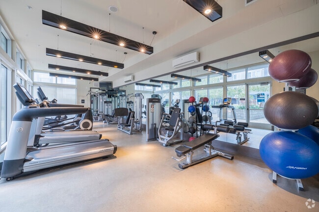
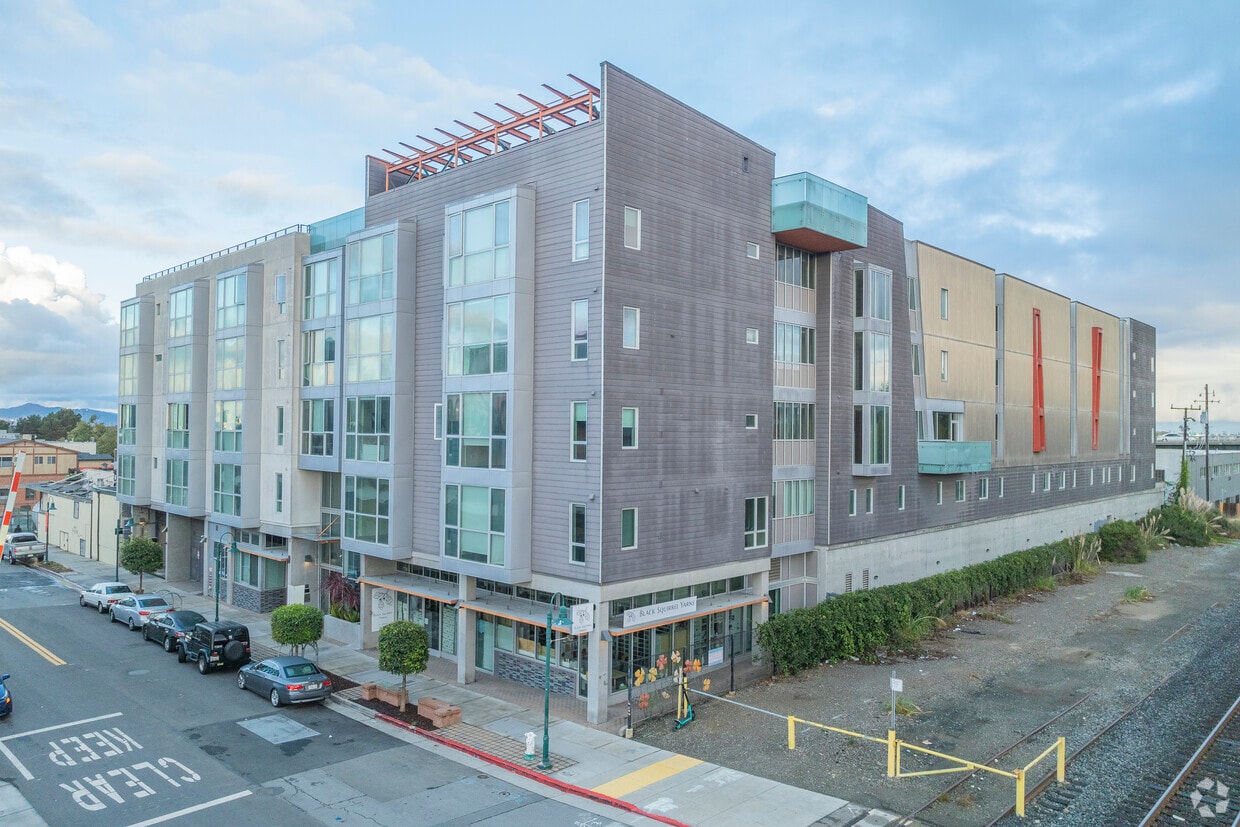
Viewpoint is a five-story community in Southwest Berkeley offering 94 modern apartment homes. Our community of studios, one-, and two-bedroom apartments makes high-quality living more attainable. A select number of units are set aside for individuals and families earning 50-80% of the Area Median Income (AMI). To qualify for these programs, your household must meet specified income criteria. Community amenities include a state of the art fitness center, rooftop lounge with views of the Golden Gate, Bay and Richmond-San Rafael Bridges, and a self-serve pet wash station.
Viewpoint is an apartment community located in Alameda County and the 94710 ZIP Code. This area is served by the Berkeley Unified School District attendance zone.
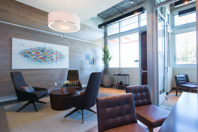
Community Amenities
Fitness Center
Furnished Units Available
Elevator
Key Fob Entry
- Wi-Fi
- Furnished Units Available
- Pet Washing Station
- EV Charging
- Public Transportation
- Key Fob Entry
- Wheelchair Accessible
- Elevator
- Lounge
- Fitness Center
- Bicycle Storage
- Walking/Biking Trails
Apartment Features
Washer/Dryer
Air Conditioning
Dishwasher
High Speed Internet Access
Walk-In Closets
Island Kitchen
Granite Countertops
Microwave
Indoor Features
- High Speed Internet Access
- Washer/Dryer
- Air Conditioning
- Smoke Free
- Tub/Shower
Kitchen Features & Appliances
- Dishwasher
- Disposal
- Granite Countertops
- Stainless Steel Appliances
- Island Kitchen
- Kitchen
- Microwave
- Oven
- Refrigerator
- Freezer
- Gas Range
Model Details
- Carpet
- Vinyl Flooring
- High Ceilings
- Family Room
- Bay Window
- Views
- Walk-In Closets
- Double Pane Windows
- Large Bedrooms
- Floor to Ceiling Windows
Situated on the bright, bustling west side of Berkeley is the compact, coastal neighborhood of Aquatic Park. Two miles from Downtown Berkeley and 12 miles from Downtown San Francisco, this community is enjoying a renaissance as developers and residents renovate the historic buildings for modern tastes. This renovation has resulted in a number of upgraded lofts in vintage buildings as well as an array of luxury apartments in new developments, many of which are available for rent.
The neighborhood is centered on its namesake park, which offers 70 acres of green space just south of the Berkeley Marina. Several other outdoor destinations sit near Aquatic Park as well, including McLaughlin Eastshore State Seashore, Cesar E. Chavez Park, and Golden Gate Fields. Commuting and traveling from the neighborhood is a breeze with access to Interstate 580 and the Berkeley Amtrak Station.
Learn more about living in Aquatic ParkCompare neighborhood and city base rent averages by bedroom.
| Aquatic Park | Berkeley, CA | |
|---|---|---|
| Studio | $2,145 | $2,085 |
| 1 Bedroom | $2,494 | $2,257 |
| 2 Bedrooms | $3,341 | $3,310 |
| 3 Bedrooms | - | $4,382 |
- Wi-Fi
- Furnished Units Available
- Pet Washing Station
- EV Charging
- Public Transportation
- Key Fob Entry
- Wheelchair Accessible
- Elevator
- Lounge
- Fitness Center
- Bicycle Storage
- Walking/Biking Trails
- High Speed Internet Access
- Washer/Dryer
- Air Conditioning
- Smoke Free
- Tub/Shower
- Dishwasher
- Disposal
- Granite Countertops
- Stainless Steel Appliances
- Island Kitchen
- Kitchen
- Microwave
- Oven
- Refrigerator
- Freezer
- Gas Range
- Carpet
- Vinyl Flooring
- High Ceilings
- Family Room
- Bay Window
- Views
- Walk-In Closets
- Double Pane Windows
- Large Bedrooms
- Floor to Ceiling Windows
| Monday | 9am - 6pm |
|---|---|
| Tuesday | 9am - 6pm |
| Wednesday | 9am - 6pm |
| Thursday | 9am - 6pm |
| Friday | 9am - 6pm |
| Saturday | 9am - 6pm |
| Sunday | Closed |
| Colleges & Universities | Distance | ||
|---|---|---|---|
| Colleges & Universities | Distance | ||
| Drive: | 7 min | 2.0 mi | |
| Drive: | 10 min | 3.1 mi | |
| Drive: | 10 min | 5.9 mi | |
| Drive: | 12 min | 6.5 mi |


View GreatSchools Rating Methodology
Data provided by GreatSchools.org © 2026. All rights reserved.
Transportation options available in Berkeley include North Berkeley, located 1.4 miles from Viewpoint. Viewpoint is near Metro Oakland International, located 16.3 miles or 24 minutes away, and San Francisco International, located 23.9 miles or 37 minutes away.
| Transit / Subway | Distance | ||
|---|---|---|---|
| Transit / Subway | Distance | ||
|
|
Drive: | 4 min | 1.4 mi |
|
|
Drive: | 7 min | 2.2 mi |
|
|
Drive: | 8 min | 2.8 mi |
|
|
Drive: | 7 min | 3.4 mi |
|
|
Drive: | 14 min | 7.3 mi |
| Commuter Rail | Distance | ||
|---|---|---|---|
| Commuter Rail | Distance | ||
|
|
Drive: | 3 min | 1.2 mi |
| Drive: | 7 min | 2.3 mi | |
| Drive: | 11 min | 6.5 mi | |
|
|
Drive: | 13 min | 7.8 mi |
| Drive: | 19 min | 11.5 mi |
| Airports | Distance | ||
|---|---|---|---|
| Airports | Distance | ||
|
Metro Oakland International
|
Drive: | 24 min | 16.3 mi |
|
San Francisco International
|
Drive: | 37 min | 23.9 mi |
Time and distance from Viewpoint.
| Shopping Centers | Distance | ||
|---|---|---|---|
| Shopping Centers | Distance | ||
| Drive: | 3 min | 1.1 mi | |
| Drive: | 4 min | 1.5 mi | |
| Drive: | 5 min | 1.8 mi |
| Parks and Recreation | Distance | ||
|---|---|---|---|
| Parks and Recreation | Distance | ||
|
McLaughlin Eastshore State Park
|
Walk: | 14 min | 0.8 mi |
|
Strawberry Creek Park
|
Walk: | 17 min | 0.9 mi |
|
Cedar-Rose Park
|
Drive: | 4 min | 1.4 mi |
|
Shorebird Nature Center
|
Drive: | 4 min | 1.5 mi |
|
Shorebird Park
|
Drive: | 4 min | 1.7 mi |
| Hospitals | Distance | ||
|---|---|---|---|
| Hospitals | Distance | ||
| Drive: | 10 min | 3.4 mi | |
| Drive: | 10 min | 3.6 mi | |
| Drive: | 10 min | 5.8 mi |
| Military Bases | Distance | ||
|---|---|---|---|
| Military Bases | Distance | ||
| Drive: | 12 min | 5.4 mi | |
| Drive: | 16 min | 6.9 mi |
Viewpoint Photos
-
Viewpoint
-
Studio 1 Bath - 610SF
-
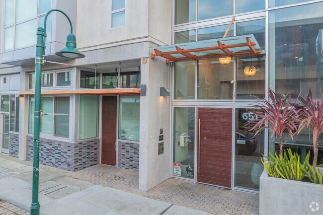
Entrance
-
Lounge
-
Fitness Center
-
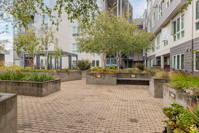
Courtyard
-
2BR, 2BA - 1,168 SF - Living Room
-
2BR, 2BA - 1,168 SF - Living Room
-
Elevator
Models
-
2 Bedrooms
Nearby Apartments
Within 50 Miles of Viewpoint
Viewpoint has units with in‑unit washers and dryers, making laundry day simple for residents.
Utilities are not included in rent. Residents should plan to set up and pay for all services separately.
Parking is available at Viewpoint. Contact this property for details.
Yes, Viewpoint welcomes pets. Breed restrictions, weight limits, and additional fees may apply. View this property's pet policy.
A good rule of thumb is to spend no more than 30% of your gross income on rent. Based on the lowest available rent of $3,450 for a two-bedrooms, you would need to earn about $138,000 per year to qualify. Want to double-check your budget? Calculate how much rent you can afford with our Rent Affordability Calculator.
Viewpoint is not currently offering any rent specials. Check back soon, as promotions change frequently.
Yes! Viewpoint offers 3 Matterport 3D Tours. Explore different floor plans and see unit level details, all without leaving home.
What Are Walk Score®, Transit Score®, and Bike Score® Ratings?
Walk Score® measures the walkability of any address. Transit Score® measures access to public transit. Bike Score® measures the bikeability of any address.
What is a Sound Score Rating?
A Sound Score Rating aggregates noise caused by vehicle traffic, airplane traffic and local sources.
651 Addison St
Berkeley, CA 94710
Property Manager Responded