
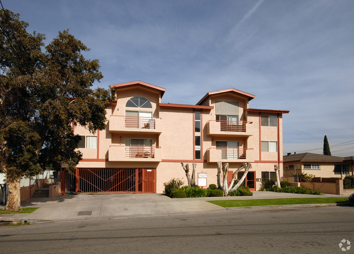
Toland Way Apartments
4403 Toland Way,
Eagle Rock,
CA
90041
-
Monthly Rent
$2,000 - $2,400
-
Bedrooms
1 - 2 bd
-
Bathrooms
1 - 2 ba
-
Square Feet
650 - 850 sq ft

This community is located in the Eagle Rock area of Los Angeles.
Highlights
- Controlled Access
- Fenced Lot
- Gated
- Property Manager on Site
Pricing & Floor Plans
-
Unit 16price $2,000square feet 650availibility May 1
-
Unit 6price $2,400square feet 850availibility May 1
-
Unit 16price $2,000square feet 650availibility May 1
-
Unit 6price $2,400square feet 850availibility May 1
Fees and Policies
The fees listed below are community-provided and may exclude utilities or add-ons. All payments are made directly to the property and are non-refundable unless otherwise specified.
-
Garage Lot
-
Parking FeeMax of 2. Charged per vehicle.$1 / mo
CommentsMax of 2, Assigned Parking SpaceRead More Read Less -
Property Fee Disclaimer: Based on community-supplied data and independent market research. Subject to change without notice. May exclude fees for mandatory or optional services and usage-based utilities.
Details
Utilities Included
-
Water
-
Trash Removal
-
Sewer
Property Information
-
Built in 1990
-
17 units/2 stories
About Toland Way Apartments
This community is located in the Eagle Rock area of Los Angeles.
Toland Way Apartments is an apartment community located in Los Angeles County and the 90041 ZIP Code. This area is served by the Los Angeles Unified Rocp School District attendance zone.
Contact
Community Amenities
Laundry Facilities
Controlled Access
Recycling
Gated
- Laundry Facilities
- Controlled Access
- Property Manager on Site
- Recycling
- Gated
- Fenced Lot
Apartment Features
Air Conditioning
Dishwasher
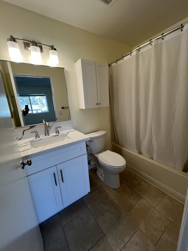
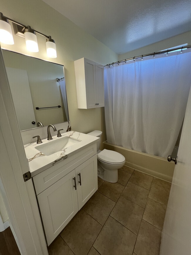
Tub/Shower
Disposal
- Air Conditioning
- Heating
- Smoke Free
- Cable Ready
- Tub/Shower
- Intercom
- Dishwasher
- Disposal
- Pantry
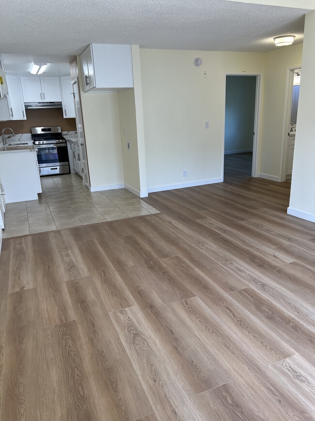
- Kitchen
- Oven
- Quartz Countertops
- Gas Range
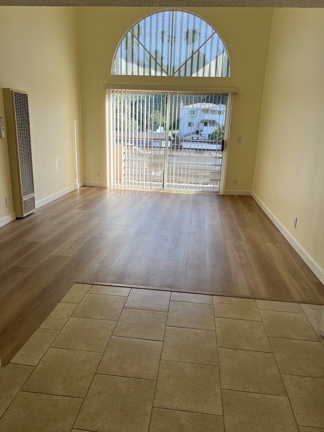
- Tile Floors
- Vinyl Flooring
- Family Room
Located about nine miles northeast of Downtown Los Angeles, Eagle Rock is an eclectic neighborhood with a small-town feel, vintage look, and fiercely independent spirit. The main thoroughfares, Colorado and Eagle Rock Boulevards, contain plenty of unique boutiques, specialty markets, antique craft shops, cafes, restaurants, and bars that contribute to the neighborhood’s charm. Eagle Rock is also home to Occidental College, which boasts notable former attendees such as Barack Obama, Ben Affleck, and Luke Wilson. Eagle Rock is no stranger to the entertainment industry, serving as the backdrop for a host of films, television shows, and music videos.
The tight-knit community in Eagle Rock often gathers at local mainstays such as the Eagle Rock Recreation Center and the Center for the Arts Eagle Rock.
Learn more about living in Eagle Rock- Laundry Facilities
- Controlled Access
- Property Manager on Site
- Recycling
- Gated
- Fenced Lot
- Air Conditioning
- Heating
- Smoke Free
- Cable Ready
- Tub/Shower
- Intercom
- Dishwasher
- Disposal
- Pantry
- Kitchen
- Oven
- Quartz Countertops
- Gas Range
- Tile Floors
- Vinyl Flooring
- Family Room
| Monday | 9am - 5pm |
|---|---|
| Tuesday | 9am - 5pm |
| Wednesday | 9am - 5pm |
| Thursday | 9am - 5pm |
| Friday | 9am - 5pm |
| Saturday | By Appointment |
| Sunday | By Appointment |
| Colleges & Universities | Distance | ||
|---|---|---|---|
| Colleges & Universities | Distance | ||
| Drive: | 4 min | 1.2 mi | |
| Drive: | 8 min | 4.1 mi | |
| Drive: | 12 min | 5.4 mi | |
| Drive: | 14 min | 6.8 mi |


View GreatSchools Rating Methodology
Data provided by GreatSchools.org © 2026. All rights reserved.
Transportation options available in Eagle Rock include Southwest Museum Station, located 2.3 miles from Toland Way Apartments. Toland Way Apartments is near Bob Hope, located 14.7 miles or 21 minutes away, and Los Angeles International, located 21.1 miles or 35 minutes away.
| Transit / Subway | Distance | ||
|---|---|---|---|
| Transit / Subway | Distance | ||
|
|
Drive: | 5 min | 2.3 mi |
|
|
Drive: | 6 min | 2.5 mi |
|
|
Drive: | 8 min | 3.3 mi |
|
|
Drive: | 7 min | 3.9 mi |
|
|
Drive: | 9 min | 4.0 mi |
| Commuter Rail | Distance | ||
|---|---|---|---|
| Commuter Rail | Distance | ||
|
|
Drive: | 6 min | 2.9 mi |
|
|
Drive: | 12 min | 6.0 mi |
|
|
Drive: | 14 min | 6.1 mi |
|
|
Drive: | 13 min | 9.3 mi |
| Drive: | 16 min | 10.2 mi |
| Airports | Distance | ||
|---|---|---|---|
| Airports | Distance | ||
|
Bob Hope
|
Drive: | 21 min | 14.7 mi |
|
Los Angeles International
|
Drive: | 35 min | 21.1 mi |
Scores provided by
Traffic
-Airport
-Businesses
-Scores provided by
HowLoud What is a Sound Score Rating? A Sound Score Rating aggregates noise caused by vehicle traffic, airplane traffic and local sources. How It WorksTime and distance from Toland Way Apartments.
| Shopping Centers | Distance | ||
|---|---|---|---|
| Shopping Centers | Distance | ||
| Walk: | 4 min | 0.2 mi | |
| Walk: | 7 min | 0.4 mi | |
| Walk: | 17 min | 0.9 mi |
| Parks and Recreation | Distance | ||
|---|---|---|---|
| Parks and Recreation | Distance | ||
|
Elyria Canyon Park
|
Drive: | 6 min | 2.5 mi |
|
Audubon Center at Debs Park
|
Drive: | 7 min | 2.9 mi |
|
Marsh Park
|
Drive: | 7 min | 3.3 mi |
|
Chavez Ravine Arboretum
|
Drive: | 7 min | 4.4 mi |
|
Elysian Park
|
Drive: | 11 min | 5.2 mi |
| Hospitals | Distance | ||
|---|---|---|---|
| Hospitals | Distance | ||
| Drive: | 5 min | 2.9 mi | |
| Drive: | 7 min | 3.0 mi | |
| Drive: | 8 min | 4.8 mi |
| Military Bases | Distance | ||
|---|---|---|---|
| Military Bases | Distance | ||
| Drive: | 32 min | 22.7 mi |
Toland Way Apartments Photos
-
Toland Way Apartments
-
-
-
-
-
-
-
-
While Toland Way Apartments does not provide in‑unit laundry, on‑site laundry facilities are available for shared resident use.
Select utilities are included in rent at Toland Way Apartments, including water, trash removal, and sewer. Residents are responsible for any other utilities not listed.
Parking is available at Toland Way Apartments for $1 / mo. Contact this property for details.
Toland Way Apartments has one to two-bedrooms with rent ranges from $2,000/mo. to $2,400/mo.
Toland Way Apartments does not allow pets, though service animals are always welcome in accordance with applicable laws.
A good rule of thumb is to spend no more than 30% of your gross income on rent. Based on the lowest available rent of $2,000 for a one-bedroom, you would need to earn about $80,000 per year to qualify. Want to double-check your budget? Calculate how much rent you can afford with our Rent Affordability Calculator.
Toland Way Apartments is not currently offering any rent specials. Check back soon, as promotions change frequently.
While Toland Way Apartments does not offer Matterport 3D tours, renters can request a tour directly through our online platform.
What Are Walk Score®, Transit Score®, and Bike Score® Ratings?
Walk Score® measures the walkability of any address. Transit Score® measures access to public transit. Bike Score® measures the bikeability of any address.
What is a Sound Score Rating?
A Sound Score Rating aggregates noise caused by vehicle traffic, airplane traffic and local sources.
4403 Toland Way
Eagle Rock, CA 90041