
Hillsdale Garden
3500 Edison St,
San Mateo, CA 94403
$2,323 - $4,950
Studio - 3 Beds
This is a senior community for independent living. 55 and older only. We offer one and two bedroom homes that offer a great use of space and a fully-equipped kitchen. Our homes feature oversized windows, with heating and air-conditioning units in each room. In select apartments there are walk-in closets and private balconies. Our community boasts wonderful amenities such as free community Wi-Fi in our main lobby, resource center/library, seasonally heated outdoor pool, barbeque area, coffee lounge, movie lounge, a fitness center, game room and regularly scheduled resident activities such as resident happy hour, ice cream socials and fitness classes. The Elder Care Alliance of San Mateo DBA The Villa at San Mateo
The Villa at San Mateo is an apartment community located in San Mateo County and the 94403 ZIP Code. This area is served by the San Mateo-Foster City attendance zone.
Pool
Fitness Center
Lounge
Gameroom
Air Conditioning
Dishwasher
High Speed Internet Access
Walk-In Closets
Located about halfway between San Francisco and San Jose, Sugarloaf is a peaceful, suburban neighborhood in San Mateo. Sugarloaf is predominantly residential, touting an array of single-family houses and apartment buildings atop scenic hillsides. However, Sugarloaf also provides plenty of shopping opportunities, from the extensive retail offerings of the Hillsdale Shopping Center to the unique finds in local shops along 37th Avenue.
Sugarloaf residents enjoy ample outdoor activities at the sprawling Laurelwood Park in addition to quick commutes for those working at the San Mateo Medical Center and the College of San Mateo. Convenience to El Camino Real, J. Arthur Younger Freeway, the Hillsdale CalTrain Station, and San Francisco International Airport makes getting around from Sugarloaf a breeze.
Learn more about living in Sugarloaf| Colleges & Universities | Distance | ||
|---|---|---|---|
| Colleges & Universities | Distance | ||
| Drive: | 7 min | 3.4 mi | |
| Drive: | 18 min | 9.9 mi | |
| Drive: | 20 min | 12.1 mi | |
| Drive: | 26 min | 15.5 mi |


Transportation options available in San Mateo include Millbrae Bart Station, located 9.1 miles from The Villa at San Mateo. The Villa at San Mateo is near San Francisco International, located 10.1 miles or 15 minutes away, and Metro Oakland International, located 25.8 miles or 34 minutes away.
| Transit / Subway | Distance | ||
|---|---|---|---|
| Transit / Subway | Distance | ||
|
|
Drive: | 14 min | 9.1 mi |
|
|
Drive: | 14 min | 9.1 mi |
| Drive: | 15 min | 9.8 mi | |
|
|
Drive: | 15 min | 10.0 mi |
|
|
Drive: | 15 min | 10.1 mi |
| Commuter Rail | Distance | ||
|---|---|---|---|
| Commuter Rail | Distance | ||
| Drive: | 3 min | 1.1 mi | |
| Drive: | 3 min | 1.3 mi | |
| Drive: | 3 min | 1.3 mi | |
| Drive: | 5 min | 2.0 mi | |
| Drive: | 5 min | 2.0 mi |
| Airports | Distance | ||
|---|---|---|---|
| Airports | Distance | ||
|
San Francisco International
|
Drive: | 15 min | 10.1 mi |
|
Metro Oakland International
|
Drive: | 34 min | 25.8 mi |
Time and distance from The Villa at San Mateo.
| Shopping Centers | Distance | ||
|---|---|---|---|
| Shopping Centers | Distance | ||
| Walk: | 2 min | 0.1 mi | |
| Walk: | 4 min | 0.2 mi | |
| Walk: | 11 min | 0.6 mi |
| Parks and Recreation | Distance | ||
|---|---|---|---|
| Parks and Recreation | Distance | ||
|
San Mateo Arboretum
|
Drive: | 6 min | 2.7 mi |
|
Japanese Tea Garden (San Mateo)
|
Drive: | 7 min | 3.0 mi |
|
Shoreline Parks
|
Drive: | 8 min | 4.7 mi |
|
Crystal Springs Trail
|
Drive: | 12 min | 7.0 mi |
|
Pulgas Ridge Open Space Preserve
|
Drive: | 16 min | 7.6 mi |
| Hospitals | Distance | ||
|---|---|---|---|
| Hospitals | Distance | ||
| Walk: | 10 min | 0.6 mi | |
| Drive: | 11 min | 5.0 mi | |
| Drive: | 9 min | 5.2 mi |
| Military Bases | Distance | ||
|---|---|---|---|
| Military Bases | Distance | ||
| Drive: | 26 min | 17.4 mi |
What Are Walk Score®, Transit Score®, and Bike Score® Ratings?
Walk Score® measures the walkability of any address. Transit Score® measures access to public transit. Bike Score® measures the bikeability of any address.
What is a Sound Score Rating?
A Sound Score Rating aggregates noise caused by vehicle traffic, airplane traffic and local sources

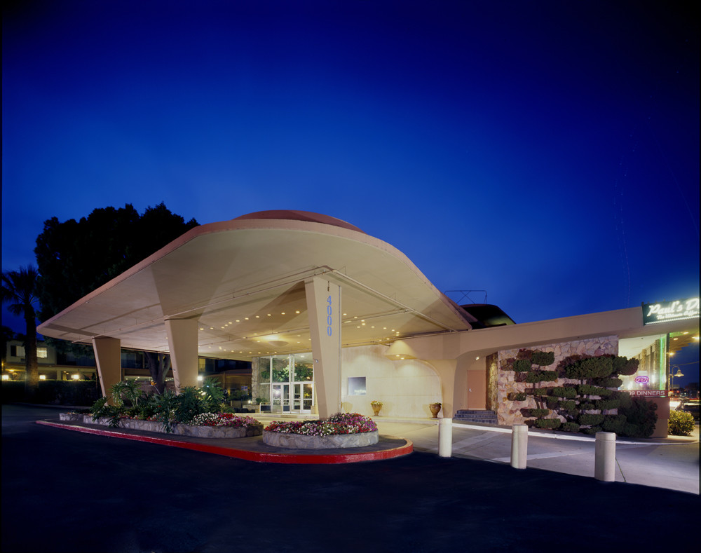
4000 S El Camino Real
San Mateo, CA 94403


