The Mark

1330-1338 Hawthorne Pl, Richmond Heights, MO 63117

2 Weeks Ago
Share Listing
Favorites
The Mark
Share Listing
Favorites

Highlights

  • Walk-In Closets
  • Controlled Access
  • Gated
  • Property Manager on Site
  • Views
  • Patio

About The Mark

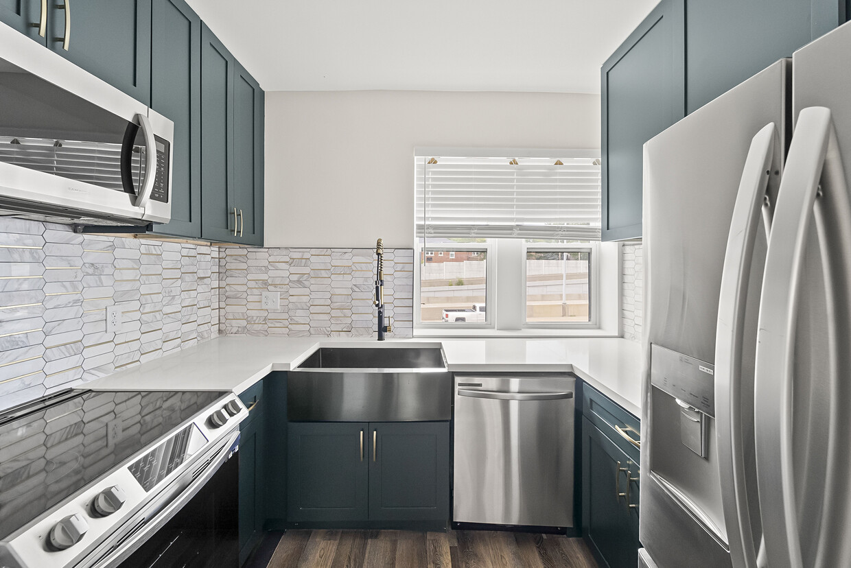
Welcome to the Mark! You are looking at a full-gutted renovation in Richmond Heights where a luxury touch was implemented into this 36-unit apartment building. The Mark is located in a very quiet and charming neighborhood surrounded by residential housing, which gives it a very welcoming feel with lots of walkability. Along with this relaxing feel, you are also extremely close to the lively Brentwood and Clayton area. The Mark is also a 5 minute drive from the Wash U campus and a 10 minute drive from the SLU campus. The immediate access to Interstate-64 allows an easy communte to anywhere in St. Louis. Gated parking is offered in the rear of the building, there is 24/7 security, coded access to each tower, in-unit washer/dryer, and built in Wi-Fi.

The Mark is an apartment community located in St. Louis County and the 63117 ZIP Code. This area is served by the Maplewood-Richmond Heights School District attendance zone.

Community Amenities

Laundry Facilities

Controlled Access

Gated

Property Manager on Site

  • Laundry Facilities
  • Controlled Access
  • Maintenance on site
  • Property Manager on Site
  • Renters Insurance Program
  • Gated

Apartment Features

Washer/Dryer

Dishwasher

High Speed Internet Access

Walk-In Closets

  • High Speed Internet Access
  • Wi-Fi
  • Washer/Dryer
  • Heating
  • Smoke Free
  • Cable Ready
  • Dishwasher
  • Disposal
  • Ice Maker
  • Granite Countertops
  • Stainless Steel Appliances
  • Kitchen
  • Microwave
  • Oven
  • Tile Floors
  • Views
  • Walk-In Closets
  • Patio
Location
1330-1338 Hawthorne Pl, Richmond Heights,
MO 63117
Get Directions
City - Richmond Heights

Richmond Heights is a bustling suburb known for its unbeatable location, well-kept neighborhoods, and fantastic amenities. Richmond Heights features grocery stores, shopping malls, banks, hospitals, community parks, and historic landmarks. You name it, and Richmond Heights most likely has it. But the convenience factor doesn’t end there – Richmond Heights is only seven miles west of Saint Louis along Interstate 64, so locals have easy access to job opportunities and big-city adventures.

The Saint Louis Galleria is an upscale shopping mall in Richmond Heights, offering the best of department stores, retailers, and restaurants. Both the Brentwood and Richmond Heights Metrolink stations are easily accessible in this town, and there are numerous public bus stops throughout the area.

Learn more about living in Richmond Heights 
Education
Colleges & Universities Distance
Drive: 3 min 1.4 mi
Drive: 5 min 2.3 mi
Drive: 6 min 2.4 mi
Drive: 8 min 3.9 mi
The Mark is within 3 minutes or 1.4 miles from Fontbonne University. It is also near Wash. Univ. in St. Louis and Saint Louis C.C., Forest Park.
Schools
Public Elementary School
Grades K-5
417 Students
Attendance Zone
Public Elementary School
Grades PK-5
460 Students
Attendance Zone
Public Middle School
Grades 6-8
220 Students
Attendance Zone
Grades 9-12
413 Students
Attendance Zone
Private Elementary & Middle School
Grades PK-8
Nearby
Private Middle & High School
Grades 6-12
122 Students
Nearby
Transportation

The Mark is near St Louis Lambert International, located 11.8 miles or 18 minutes away, and Scott AFB/Midamerica St Louis, located 32.4 miles or 48 minutes away.

Commuter Rail Distance
Drive: 3 min 1.5 mi
Drive: 4 min 1.9 mi
Drive: 5 min 2.4 mi
Drive: 5 min 2.7 mi
Drive: 6 min 2.7 mi
Airports Distance
Airports Distance
St Louis Lambert International
Drive: 18 min 11.8 mi
Scott AFB/Midamerica St Louis
Drive: 48 min 32.4 mi

Walkability Near The Mark

Getting Around
Moderately Walkable
Walkability
60 / 100
Limited Public Transit
Transit
30 / 100
Exceptionally Drivable
Drivability
100 / 100
Fairly Bikeable
Bikeability
50 / 100

Scores provided by

What do Walkability, Transit, Drivability, and Bikeability mean? Walkability measures the walking distance to day-to-day needs. Transit measures access to public transportation. Drivability measures congestion, parking availability, and access to major roads. Bikeability measures the suitability for cycling. How It Works
-
Soundscore
- / 100

Traffic

-

Airport

-

Businesses

-

Scores provided by

HowLoud What is a Sound Score Rating? A Sound Score Rating aggregates noise caused by vehicle traffic, airplane traffic and local sources. How It Works
Points of Interest

Time and distance from The Mark.

Shopping Centers Distance
Walk: 11 min 0.6 mi
Walk: 15 min 0.8 mi
Drive: 4 min 1.4 mi
The Mark has 3 shopping centers within 1.4 miles, which is about a 4-minute drive. The miles and minutes will be for the farthest away property.
Parks and Recreation Distance
Saint Louis Zoo
Drive: 5 min 1.9 mi
St. Louis Science Center
Drive: 6 min 2.9 mi
Tilles Park
Drive: 7 min 3.7 mi
The Green Center
Drive: 9 min 4.3 mi
Missouri Botanical Garden
Drive: 10 min 4.6 mi
The Mark has 5 parks within 4.6 miles, including Saint Louis Zoo, St. Louis Science Center, and Tilles Park.
Hospitals Distance
Hospitals Distance
Walk: 14 min 0.7 mi
Drive: 7 min 3.3 mi
Drive: 6 min 4.0 mi
The Mark has 3 hospitals within 4.0 miles, the nearest is SSM Health St. Mary's Hospital - St Louis which is 0.7 mile away and a 14 minute walk.
Military Bases Distance
Drive: 21 min 12.3 mi
Drive: 48 min 32.4 mi
The Mark is 12.3 miles from Price Support Center, and is convenient to other military bases, including Scott Air Force Base.

Explore Similar Rentals Nearby