The Lynwood

5701 Lynwood Blvd, Mound, MN 55364

Share Listing
Favorites
The Lynwood
Share Listing
Favorites

About The Lynwood

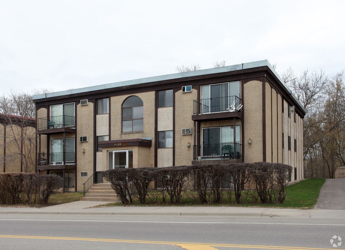
Find your new home at The Lynwood. The 5701 Lynwood Blvd location in the Outlying Hennepin Far Western Suburbs neighborhood of Mound is a terrific place to live. From amenities to availability, the leasing staff is ready to help you find the perfect apartment. Drop by the leasing office to see available floor plans and find your new home at The Lynwood.

The Lynwood is an apartment community located in Hennepin County and the 55364 ZIP Code. This area is served by the Westonka Public School District attendance zone.

Location
5701 Lynwood Blvd, Mound,
MN 55364
Get Directions
Average Prices by Area

Compare neighborhood and city base rent averages by bedroom.

Hennepin Far Western Suburbs Mound, MN
Studio $2,356 $527
1 Bedroom $2,772 $1,165
2 Bedrooms $3,794 $1,572
3 Bedrooms $4,159 -
Education
Colleges & Universities Distance
Drive: 35 min 23.9 mi
Drive: 40 min 24.0 mi
Drive: 35 min 24.4 mi
Drive: 41 min 28.7 mi
The Lynwood is within 35 minutes or 23.9 miles from Minneapolis College. It is also near University of St. Thomas and Normandale Community College.
Schools
Public Elementary School
Grades K-5
439 Students
Nearby
Public Elementary School
Grades K-5
466 Students
Attendance Zone
Public Elementary & Middle School
Grades K-8
527 Students
Attendance Zone
Public Middle & High School
Grades 6-12
947 Students
Attendance Zone
Private Elementary & Middle School
Grades PK-8
190 Students
Nearby
Private High School
Grades 9-12
519 Students
Nearby
Transportation

The Lynwood is near Minneapolis-St Paul International/Wold-Chamberlain, located 29.0 miles or 45 minutes away.

Commuter Rail Distance
Drive: 36 min 24.8 mi
Drive: 45 min 30.3 mi
Drive: 52 min 35.3 mi
Drive: 54 min 37.0 mi
Drive: 56 min 38.8 mi
Airports Distance
Airports Distance
Minneapolis-St Paul International/Wold-Chamberlain
Drive: 45 min 29.0 mi

Walkability Near The Lynwood

Getting Around
Fairly Walkable
Walkability
40 / 100
Limited Public Transit
Transit
30 / 100
Exceptionally Drivable
Drivability
100 / 100
Fairly Bikeable
Bikeability
50 / 100

Scores provided by

What do Walkability, Transit, Drivability, and Bikeability mean? Walkability measures the walking distance to day-to-day needs. Transit measures access to public transportation. Drivability measures congestion, parking availability, and access to major roads. Bikeability measures the suitability for cycling. How It Works
Active
Soundscore
75 / 100

Traffic

Active

Airport

Calm

Businesses

Active

Scores provided by

HowLoud What is a Sound Score Rating? A Sound Score Rating aggregates noise caused by vehicle traffic, airplane traffic and local sources. How It Works
Points of Interest

Time and distance from The Lynwood.

Shopping Centers Distance
Walk: 1 min 0.1 mi
Walk: 4 min 0.2 mi
Walk: 8 min 0.4 mi
The Lynwood has 3 shopping centers within 0.4 mile, which is about a 8-minute walk. The miles and minutes will be for the farthest away property.
Parks and Recreation Distance
Gale Woods Farm
Drive: 5 min 2.8 mi
Lake Minnetonka Regional Park
Drive: 8 min 3.8 mi
Noerenberg Memorial Gardens
Drive: 12 min 4.7 mi
Lowry Nature Center
Drive: 11 min 5.5 mi
Carver Park Reserve
Drive: 17 min 7.5 mi
The Lynwood has 5 parks within 7.5 miles, including Gale Woods Farm, Lake Minnetonka Regional Park, and Noerenberg Memorial Gardens.
Hospitals Distance
Hospitals Distance
Drive: 19 min 11.3 mi
The Lynwood is 11.3 miles and a 19 minute drive from Ridgeview Medical Center.
Military Bases Distance
Drive: 47 min 30.6 mi
The Lynwood is 30.6 miles and a 47 minute drive from Fort Snelling Military Reservation.

Explore Similar Rentals Nearby