
Kinect at Southport
2301 Jefferson Blvd,
Sacramento, CA 95691
$1,780 - $3,059
Studio - 3 Beds

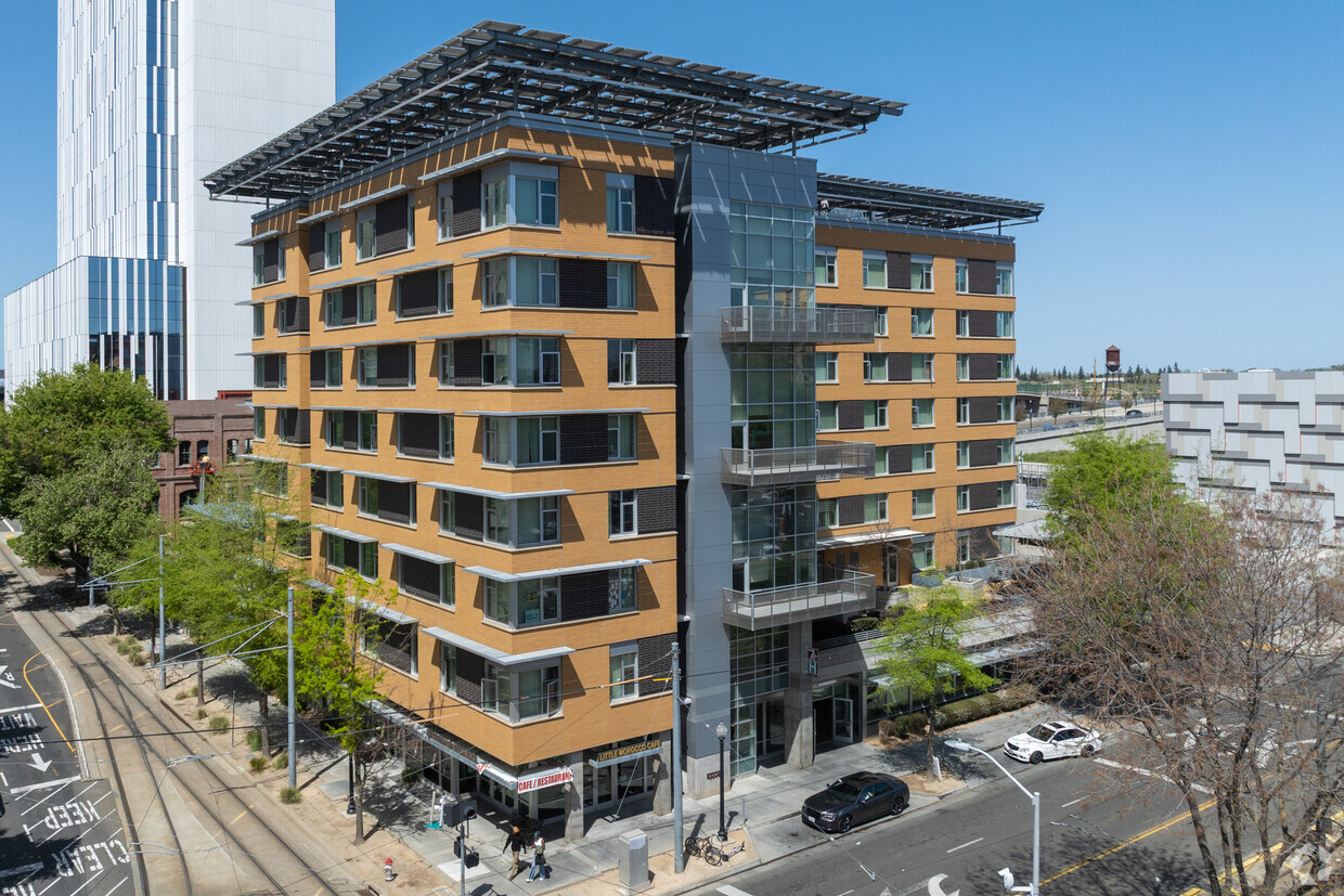
Discover your next place at The 7th & H Housing Community in Sacramento. This community can be found in Sacramento on 7th St.. Be sure to see the available floorplan options. From availability to location, the leasing team is ready to help you find the perfect new home. It's time to love where you live. Stop by for a visit today.
The 7th & H Housing Community is an apartment community located in Sacramento County and the 95814 ZIP Code. This area is served by the Sacramento City Unified attendance zone.
Air Conditioning
Refrigerator
Heating
Range
This beautiful namesake neighborhood is dedicated to one of California’s most profound civil rights activists. The green space that anchors the area brings a breath of fresh air within the urban jungle of downtown. The park has palm trees, flowers, a fountain, and a café. Stop by La Cosecha by Mayahuel, a funky Mexican eatery with live entertainment and fire pits. The park also hosts farmers markets, summer concerts, and food trucks. Cesar Chavez Park is located right in the heart of downtown, across from Sacramento City Hall and several other government offices.
The neighborhood’s central location allows residents to be close to tons of diverse restaurants, trendy nightlife spots, and warm coffee shops. Indulge at a lively food hall with international cuisines in a refurnished financial building at The Bank or go shopping at the Downtown Commons. Cesar Chavez Park in convenient to several premier entertainment venues, including the Golden Center and Broadway Sacramento.
Learn more about living in Cesar Chavez Park| Colleges & Universities | Distance | ||
|---|---|---|---|
| Colleges & Universities | Distance | ||
| Drive: | 8 min | 4.0 mi | |
| Drive: | 11 min | 4.8 mi | |
| Drive: | 17 min | 10.9 mi | |
| Drive: | 19 min | 11.8 mi |


Transportation options available in Sacramento include 7Th & I/County Center, located 0.2 mile from The 7th & H Housing Community. The 7th & H Housing Community is near Sacramento International, located 11.0 miles or 16 minutes away.
| Transit / Subway | Distance | ||
|---|---|---|---|
| Transit / Subway | Distance | ||
|
|
Walk: | 3 min | 0.2 mi |
|
|
Walk: | 5 min | 0.3 mi |
|
|
Walk: | 7 min | 0.4 mi |
|
|
Walk: | 8 min | 0.4 mi |
|
|
Walk: | 8 min | 0.4 mi |
| Commuter Rail | Distance | ||
|---|---|---|---|
| Commuter Rail | Distance | ||
| Walk: | 5 min | 0.3 mi | |
|
|
Drive: | 19 min | 14.3 mi |
|
|
Drive: | 26 min | 19.5 mi |
|
|
Drive: | 27 min | 21.6 mi |
|
|
Drive: | 41 min | 33.9 mi |
| Airports | Distance | ||
|---|---|---|---|
| Airports | Distance | ||
|
Sacramento International
|
Drive: | 16 min | 11.0 mi |
Time and distance from The 7th & H Housing Community.
| Shopping Centers | Distance | ||
|---|---|---|---|
| Shopping Centers | Distance | ||
| Walk: | 6 min | 0.3 mi | |
| Walk: | 8 min | 0.5 mi | |
| Drive: | 8 min | 1.8 mi |
| Parks and Recreation | Distance | ||
|---|---|---|---|
| Parks and Recreation | Distance | ||
|
Old Sacramento Historic District
|
Walk: | 10 min | 0.6 mi |
|
California State Railroad Museum
|
Walk: | 10 min | 0.6 mi |
|
Governor's Mansion State Historic Park
|
Walk: | 15 min | 0.8 mi |
|
California State Capitol Museum
|
Walk: | 17 min | 0.9 mi |
|
Leland Stanford Mansion State Historic Park
|
Walk: | 17 min | 0.9 mi |
| Hospitals | Distance | ||
|---|---|---|---|
| Hospitals | Distance | ||
| Drive: | 5 min | 2.1 mi | |
| Drive: | 6 min | 2.8 mi | |
| Drive: | 7 min | 3.7 mi |
| Military Bases | Distance | ||
|---|---|---|---|
| Military Bases | Distance | ||
| Drive: | 23 min | 10.1 mi |
What Are Walk Score®, Transit Score®, and Bike Score® Ratings?
Walk Score® measures the walkability of any address. Transit Score® measures access to public transit. Bike Score® measures the bikeability of any address.
What is a Sound Score Rating?
A Sound Score Rating aggregates noise caused by vehicle traffic, airplane traffic and local sources
720 7th
Sacramento, CA 95814


