
The Village at Haddonfield
126 Kent Rd,
Haddonfield, NJ 08033
$1,595 - $1,795
1-2 Beds
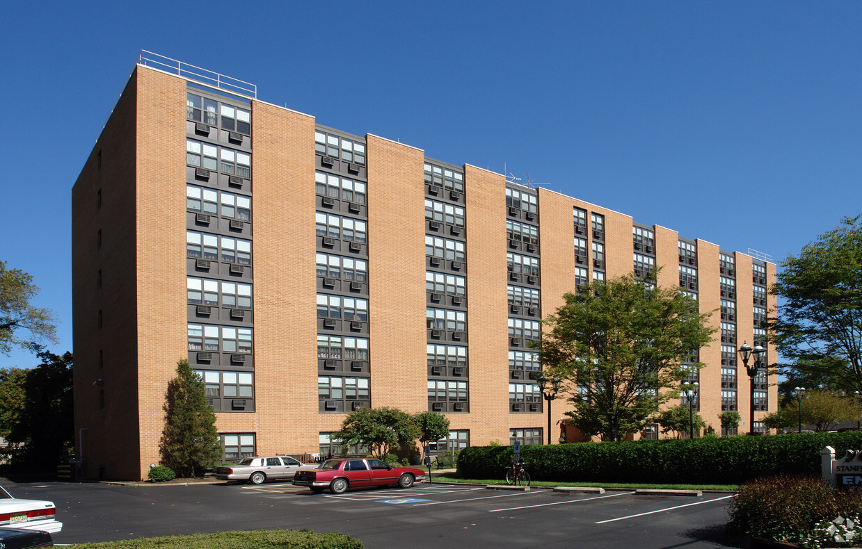
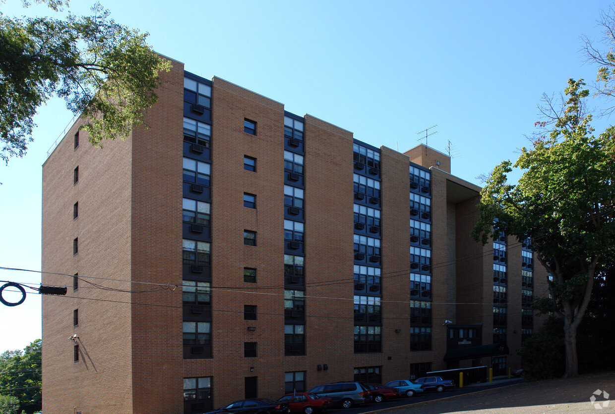
Stanfill Towers offers a blend of quality and design. The location in Haddon Heights's 08035 area is an ideal place to live. Come by to check out the apartment floorplan options. Here at this community, the professional leasing staff is ready and waiting to help you find the perfect new place. Drop by the leasing office to check the current floorplan availability.
Stanfill Towers is an apartment community located in Camden County and the 08035 ZIP Code. This area is served by the Haddon Heights attendance zone.
Cherry Hill is a close-knit community located 8 miles southeast of Philadelphia. Haddonfield, its neighbor immediately south, creates the border between the two towns. With a preserved historic district teeming with Victorian, colonial and federal-period houses, it's no wonder that Philadelphia Magazine chose Haddonfield as one of the best places to live in the Delaware Valley.
The close proximity to the city combined with safe neighborhoods, excellent school systems, and all the charm living in a historic town brings, checking out the area is a no-brainer to those contemplating a move in the area.
Learn more about living in Cherry Hill/Haddonfield| Colleges & Universities | Distance | ||
|---|---|---|---|
| Colleges & Universities | Distance | ||
| Drive: | 12 min | 6.3 mi | |
| Drive: | 13 min | 6.7 mi | |
| Drive: | 18 min | 9.1 mi | |
| Drive: | 16 min | 9.1 mi |

Transportation options available in Haddon Heights include Haddonfield, located 1.9 miles from Stanfill Towers. Stanfill Towers is near Philadelphia International, located 13.6 miles or 26 minutes away, and Trenton Mercer, located 40.9 miles or 56 minutes away.
| Transit / Subway | Distance | ||
|---|---|---|---|
| Transit / Subway | Distance | ||
|
|
Drive: | 4 min | 1.9 mi |
|
|
Drive: | 6 min | 2.3 mi |
|
|
Drive: | 7 min | 3.3 mi |
|
|
Drive: | 7 min | 3.4 mi |
|
|
Drive: | 6 min | 3.8 mi |
| Commuter Rail | Distance | ||
|---|---|---|---|
| Commuter Rail | Distance | ||
|
|
Drive: | 9 min | 5.1 mi |
|
|
Drive: | 8 min | 5.2 mi |
|
|
Drive: | 17 min | 9.0 mi |
| Drive: | 16 min | 9.2 mi | |
|
|
Drive: | 18 min | 9.5 mi |
| Airports | Distance | ||
|---|---|---|---|
| Airports | Distance | ||
|
Philadelphia International
|
Drive: | 26 min | 13.6 mi |
|
Trenton Mercer
|
Drive: | 56 min | 40.9 mi |
Time and distance from Stanfill Towers.
| Shopping Centers | Distance | ||
|---|---|---|---|
| Shopping Centers | Distance | ||
| Walk: | 14 min | 0.8 mi | |
| Drive: | 3 min | 1.6 mi | |
| Drive: | 4 min | 1.6 mi |
| Parks and Recreation | Distance | ||
|---|---|---|---|
| Parks and Recreation | Distance | ||
|
Croft Farm Nature Trail
|
Drive: | 6 min | 3.4 mi |
|
Downs Farms Trails
|
Drive: | 7 min | 3.8 mi |
|
Erlton North Trails
|
Drive: | 8 min | 4.5 mi |
|
Barclay Farmstead Nature Trail
|
Drive: | 10 min | 4.9 mi |
|
Kresson Nature Trails
|
Drive: | 12 min | 5.5 mi |
| Hospitals | Distance | ||
|---|---|---|---|
| Hospitals | Distance | ||
| Drive: | 9 min | 3.8 mi | |
| Drive: | 7 min | 5.0 mi | |
| Drive: | 11 min | 5.8 mi |
| Military Bases | Distance | ||
|---|---|---|---|
| Military Bases | Distance | ||
| Drive: | 16 min | 8.7 mi |
What Are Walk Score®, Transit Score®, and Bike Score® Ratings?
Walk Score® measures the walkability of any address. Transit Score® measures access to public transit. Bike Score® measures the bikeability of any address.
What is a Sound Score Rating?
A Sound Score Rating aggregates noise caused by vehicle traffic, airplane traffic and local sources

117 E Atlantic Ave
Haddon Heights, NJ 08035


