Sherwood Forest

710 Cambridge Ln, Lugoff, SC 29078

Share Listing
Favorites
Sherwood Forest
Share Listing
Favorites

About Sherwood Forest

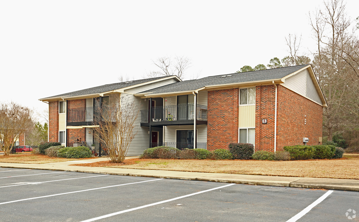
Consider making a move to Sherwood Forest in Lugoff. This community can be found at 710 Cambridge Ln. in the 29078 area of Lugoff. Schedule a time to view the available floorplans. At this community, you'll experience a wide variety in options of amenities and features. These include: tile floors, granite countertops, and smoke free options. At Sherwood Forest you'll feel right at home.

Sherwood Forest is an apartment community located in Kershaw County and the 29078 ZIP Code. This area is served by the Kershaw 01 School District attendance zone.

Community Amenities

  • Laundry Facilities
  • Playground

Apartment Features

High Speed Internet Access

Granite Countertops

Tile Floors

Smoke Free

  • High Speed Internet Access
  • Smoke Free
  • Granite Countertops
  • Carpet
  • Tile Floors
Location
710 Cambridge Ln, Lugoff,
SC 29078
Get Directions
Education
Colleges & Universities Distance
Drive: 39 min 28.4 mi
Drive: 40 min 28.7 mi
Drive: 42 min 30.2 mi
Drive: 43 min 31.1 mi
Sherwood Forest is within 39 minutes or 28.4 miles from Allen University. It is also near Benedict College and University of South Carolina.
Schools
Public Elementary School
Grades PK-5
Nearby
Public Elementary School
Grades PK-5
Attendance Zone
Public Middle School
Grades 6-8
Attendance Zone
Public High School
Grades 9-12
Attendance Zone
Private Elementary School
Grades PK-5
Nearby
Private Elementary & Middle School
Grades K-8
Nearby
Private Middle & High School
Grades 6-12
Nearby
Transportation

Sherwood Forest is near Columbia Metro, located 40.8 miles or 62 minutes away.

Commuter Rail Distance
Drive: 8 min 3.5 mi
Drive: 43 min 31.3 mi
Airports Distance
Airports Distance
Columbia Metro
Drive: 62 min 40.8 mi

Walkability Near Sherwood Forest

Getting Around
Somewhat Walkable
Walkability
30 / 100
Exceptionally Drivable
Drivability
90 / 100
Somewhat Bikeable
Bikeability
20 / 100

Scores provided by

What do Walkability, Transit, Drivability, and Bikeability mean? Walkability measures the walking distance to day-to-day needs. Transit measures access to public transportation. Drivability measures congestion, parking availability, and access to major roads. Bikeability measures the suitability for cycling. How It Works
Calm
Soundscore
82 / 100

Traffic

Calm

Airport

Calm

Businesses

Calm

Scores provided by

HowLoud What is a Sound Score Rating? A Sound Score Rating aggregates noise caused by vehicle traffic, airplane traffic and local sources. How It Works
Points of Interest

Time and distance from Sherwood Forest.

Shopping Centers Distance
Walk: 18 min 0.9 mi
Walk: 18 min 1.0 mi
Drive: 4 min 1.1 mi
Sherwood Forest has 3 shopping centers within 1.1 miles, which is about a 4-minute drive. The miles and minutes will be for the farthest away property.
Parks and Recreation Distance
Goodale State Park
Drive: 27 min 11.0 mi
Sherwood Forest has a nearby park, Goodale State Park , located 11.0 miles or 27 minutes away.
Hospitals Distance
Hospitals Distance
Drive: 13 min 5.8 mi
Sherwood Forest is 5.8 miles and a 13 minute drive from Kershaw Health.
Military Bases Distance
Drive: 55 min 27.4 mi
Drive: 51 min 29.9 mi
Drive: 49 min 30.2 mi
Sherwood Forest has 3 military bases within 30.2 miles, the nearest is Fort Jackson which is 27.4 miles away and a 55 minute drive.

Explore Similar Rentals Nearby