
3415 Linden Ave.
3415 Linden Ave,
Long Beach, CA 90807
$2,095 - $2,100
1 Bed
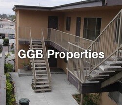

OPEN HOUSE TUES / THURS 11:30-1:00/ Spacious bright freshly painted 2BR 2BA unit, includes newer carpet and a gas stove. Private balcony with view, enjoy the convenience of garage parking with remote. This property is prewired for Verizon FIOS service. Contact Verizon for FIOS internet/TV/phone packages. See FIOS link on the home web page. Also property is prewired for DirecTV service and uses a centralized dish for service to all units - DirecTV service is available without installing your own dish.
Sea View is an apartment community located in Los Angeles County and the 90755 ZIP Code. This area is served by the Long Beach Unified Rop School District attendance zone.
High Speed Internet Access
Disposal
Smoke Free
Range
Signal Hill is a small, incorporated city completely surrounded by Long Beach, sitting atop a hill that once served as a signal point for the U.S. Coast and Geodetic Survey and later became one of Southern California's most productive oil fields. That history still marks the landscape, and the elevated terrain gives the city a distinct identity within Los Angeles County. Despite covering just three square miles and a population of roughly 11,000, Signal Hill functions as its own municipality with an independent city government and a well-regarded public school district. The local economy draws on proximity to Long Beach's port, healthcare, and commercial sectors, all reachable within minutes. Renters here find a mix of apartment communities and townhomes, with options ranging from modest studios to multi-bedroom layouts, generally at a lower price point than neighboring Long Beach. Hilltop Park and Signal Hill Park offer open space with sweeping views of the basin and coastline.
Learn more about living in Signal Hill| Colleges & Universities | Distance | ||
|---|---|---|---|
| Colleges & Universities | Distance | ||
| Drive: | 3 min | 1.2 mi | |
| Drive: | 7 min | 3.1 mi | |
| Drive: | 10 min | 4.4 mi | |
| Drive: | 17 min | 9.1 mi |


Transportation options available in Signal Hill include Pacific Coast Highway Station, located 1.7 miles from Sea View. Sea View is near Long Beach (Daugherty Field), located 3.0 miles or 6 minutes away, and Los Angeles International, located 22.0 miles or 31 minutes away.
| Transit / Subway | Distance | ||
|---|---|---|---|
| Transit / Subway | Distance | ||
|
|
Drive: | 4 min | 1.7 mi |
|
|
Drive: | 5 min | 2.2 mi |
|
|
Drive: | 7 min | 2.6 mi |
|
|
Drive: | 8 min | 2.9 mi |
|
|
Drive: | 7 min | 3.0 mi |
| Commuter Rail | Distance | ||
|---|---|---|---|
| Commuter Rail | Distance | ||
|
|
Drive: | 27 min | 15.0 mi |
|
|
Drive: | 25 min | 15.1 mi |
|
|
Drive: | 28 min | 18.0 mi |
|
|
Drive: | 31 min | 18.4 mi |
|
|
Drive: | 30 min | 19.5 mi |
| Airports | Distance | ||
|---|---|---|---|
| Airports | Distance | ||
|
Long Beach (Daugherty Field)
|
Drive: | 6 min | 3.0 mi |
|
Los Angeles International
|
Drive: | 31 min | 22.0 mi |
Scores provided by
Traffic
-Airport
-Businesses
-Scores provided by
HowLoud What is a Sound Score Rating? A Sound Score Rating aggregates noise caused by vehicle traffic, airplane traffic and local sources. How It WorksTime and distance from Sea View.
| Shopping Centers | Distance | ||
|---|---|---|---|
| Shopping Centers | Distance | ||
| Walk: | 6 min | 0.3 mi | |
| Walk: | 9 min | 0.5 mi | |
| Walk: | 15 min | 0.8 mi |
| Parks and Recreation | Distance | ||
|---|---|---|---|
| Parks and Recreation | Distance | ||
|
Earl Burns Miller Japanese Garden
|
Drive: | 6 min | 2.9 mi |
|
Colorado Lagoon
|
Drive: | 6 min | 2.9 mi |
|
Aquarium of the Pacific
|
Drive: | 9 min | 3.5 mi |
|
El Dorado Nature Center
|
Drive: | 9 min | 4.4 mi |
|
El Dorado East Regional Park
|
Drive: | 10 min | 4.6 mi |
| Hospitals | Distance | ||
|---|---|---|---|
| Hospitals | Distance | ||
| Drive: | 4 min | 1.7 mi | |
| Drive: | 5 min | 2.1 mi | |
| Drive: | 6 min | 2.6 mi |
| Military Bases | Distance | ||
|---|---|---|---|
| Military Bases | Distance | ||
| Drive: | 17 min | 9.7 mi | |
| Drive: | 21 min | 9.7 mi |
Pets Allowed Fitness Center Pool In Unit Washer & Dryer Clubhouse Balcony
What Are Walk Score®, Transit Score®, and Bike Score® Ratings?
Walk Score® measures the walkability of any address. Transit Score® measures access to public transit. Bike Score® measures the bikeability of any address.
What is a Sound Score Rating?
A Sound Score Rating aggregates noise caused by vehicle traffic, airplane traffic and local sources.

1836 Stanley Ave
Signal Hill, CA 90755


 - Violet on Virgil")
