


Riverside Heights
4424 NW Hon Dr,
Riverside,
MO
64150
-
Monthly Rent
$925 - $1,100
-
Bedrooms
1 - 2 bd
-
Bathrooms
1 - 2 ba
-
Square Feet
709 - 936 sq ft

Riverside Heights offers you a front-row seat to everything you love about the city of Riverside, Missouri. From delicious restaurants to numerous shopping centers and city mainstays, you'll find it all within easy driving distance of our community.
Highlights
- Pool
- Planned Social Activities
- Picnic Area
- Grill
- Balcony
- Property Manager on Site
- Views
- Patio
Pricing & Floor Plans
Fees and Policies
The fees listed below are community-provided and may exclude utilities or add-ons. All payments are made directly to the property and are non-refundable unless otherwise specified.
-
One-Time Basics
-
Application Fee Per Applicant$30
-
Administrative Fee$500
-
-
Dogs
-
Pet DepositMax of 2. Charged per pet.$0
-
One-Time Pet FeeMax of 2. Charged per pet.$200
-
Monthly Pet FeeMax of 2. Charged per pet.$25 / mo
Restrictions:Riverside Heights believes that pet-friendly apartments are an important part of life, which is why our community has policies to accommodate pet ownership.Read More Read Less -
-
Cats
-
Pet DepositMax of 2. Charged per pet.$0
-
One-Time Pet FeeMax of 2. Charged per pet.$100
-
Monthly Pet FeeMax of 2. Charged per pet.$25 / mo
Restrictions: -
Property Fee Disclaimer: Based on community-supplied data and independent market research. Subject to change without notice. May exclude fees for mandatory or optional services and usage-based utilities.
Details
Lease Options
-
12 - 14 Month Leases
Property Information
-
Built in 1973
-
108 units/3 stories
Matterport 3D Tours
About Riverside Heights
Riverside Heights offers you a front-row seat to everything you love about the city of Riverside, Missouri. From delicious restaurants to numerous shopping centers and city mainstays, you'll find it all within easy driving distance of our community.
Riverside Heights is an apartment community located in Platte County and the 64150 ZIP Code. This area is served by the Park Hill attendance zone.
Unique Features
- Modern Color Scheme And Accents
- Monthly Early Bird Rent Incentive
- Picnic & BBQ Areas
- Top Floor with a City View
- Pet Of The Month Rewards
- New Flooring Throughout
- Pet Park - Coming Soon!
- Free WiFi at ClubHouse & Pool
- New Energy Efficient Appliances
- 24hr. Emergency maintenance
- Outdoor Picnic Dining
- Resident Referral Bonus
- Courtyard
- Planned Social Activities
- Air conditioning - central air
- Balconies In Select Units
- Pet Stations
- Resident Activities
- Resident Of The Month Rewards
Contact
Community Amenities
Pool
Laundry Facilities
Clubhouse
Grill
- Package Service
- Wi-Fi
- Laundry Facilities
- Maintenance on site
- Property Manager on Site
- 24 Hour Access
- Online Services
- Planned Social Activities
- Public Transportation
- Clubhouse
- Storage Space
- Pool
- Courtyard
- Grill
- Picnic Area
Apartment Features
Air Conditioning
Dishwasher
High Speed Internet Access
Refrigerator
Wi-Fi
Tub/Shower
Disposal
Freezer
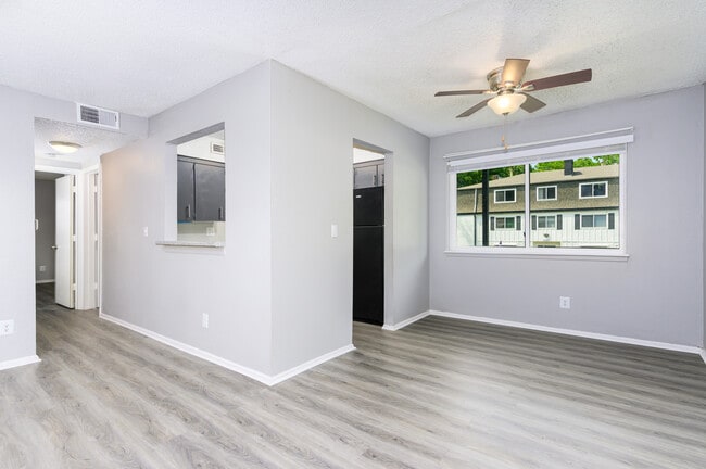
Indoor Features
- High Speed Internet Access
- Wi-Fi
- Air Conditioning
- Heating
- Ceiling Fans
- Cable Ready
- Storage Space
- Tub/Shower
- Framed Mirrors
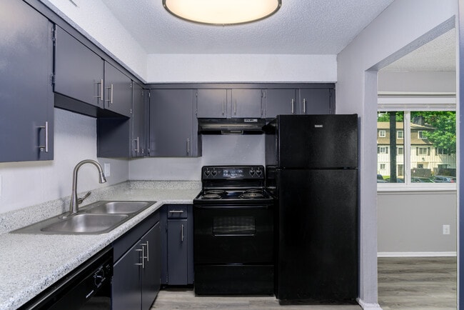
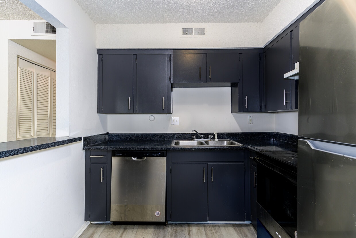
Kitchen Features & Appliances
- Dishwasher
- Disposal
- Pantry
- Kitchen
- Oven
- Range
- Refrigerator
- Freezer
- Breakfast Nook
Model Details
- Carpet
- Vinyl Flooring
- Dining Room
- Views
- Linen Closet
- Double Pane Windows
- Window Coverings
- Large Bedrooms
- Balcony
- Patio
Located in Platte County, just north of Kansas City, is the riverfront neighborhood of Riverside. Due to its convenient location, residents are close to many city attractions such as the Kansas City Zoo, Kauffman Stadium – home of the Kansas City Royals pro-baseball team – theaters and so much more. Riverside and its neighboring towns have exquisite dining options, including a handful of Michelin-star restaurants.
EH Young Park is right on the river, adjacent to the Argosy Casino Hotel & Spa. Beyond the casino, you’ll find the Missouri Riverfront Trail that expands 3.25 miles and is suitable for walking and biking. Thanks to Kansas City Area Transportation Authority (KCATA), I-635, and Route 9, residents can travel through Riverside to surrounding areas with ease.
Learn more about living in RiversideCompare neighborhood and city base rent averages by bedroom.
| Northland | Riverside, MO | |
|---|---|---|
| Studio | - | $812 |
| 1 Bedroom | $1,197 | $910 |
| 2 Bedrooms | $1,326 | $968 |
| 3 Bedrooms | $1,295 | $2,037 |
- Package Service
- Wi-Fi
- Laundry Facilities
- Maintenance on site
- Property Manager on Site
- 24 Hour Access
- Online Services
- Planned Social Activities
- Public Transportation
- Clubhouse
- Storage Space
- Courtyard
- Grill
- Picnic Area
- Pool
- Modern Color Scheme And Accents
- Monthly Early Bird Rent Incentive
- Picnic & BBQ Areas
- Top Floor with a City View
- Pet Of The Month Rewards
- New Flooring Throughout
- Pet Park - Coming Soon!
- Free WiFi at ClubHouse & Pool
- New Energy Efficient Appliances
- 24hr. Emergency maintenance
- Outdoor Picnic Dining
- Resident Referral Bonus
- Courtyard
- Planned Social Activities
- Air conditioning - central air
- Balconies In Select Units
- Pet Stations
- Resident Activities
- Resident Of The Month Rewards
- High Speed Internet Access
- Wi-Fi
- Air Conditioning
- Heating
- Ceiling Fans
- Cable Ready
- Storage Space
- Tub/Shower
- Framed Mirrors
- Dishwasher
- Disposal
- Pantry
- Kitchen
- Oven
- Range
- Refrigerator
- Freezer
- Breakfast Nook
- Carpet
- Vinyl Flooring
- Dining Room
- Views
- Linen Closet
- Double Pane Windows
- Window Coverings
- Large Bedrooms
- Balcony
- Patio
| Monday | 9am - 6pm |
|---|---|
| Tuesday | 9am - 6pm |
| Wednesday | 9am - 6pm |
| Thursday | 9am - 6pm |
| Friday | 9am - 6pm |
| Saturday | Closed |
| Sunday | Closed |
| Colleges & Universities | Distance | ||
|---|---|---|---|
| Colleges & Universities | Distance | ||
| Drive: | 11 min | 5.8 mi | |
| Drive: | 18 min | 9.2 mi | |
| Drive: | 21 min | 10.6 mi | |
| Drive: | 19 min | 12.3 mi |


View GreatSchools Rating Methodology
Data provided by GreatSchools.org © 2026. All rights reserved.
Transportation options available in Riverside include North Loop On Main At 7Th St Sb, located 6.4 miles from Riverside Heights. Riverside Heights is near Kansas City International, located 13.3 miles or 19 minutes away.
| Transit / Subway | Distance | ||
|---|---|---|---|
| Transit / Subway | Distance | ||
| Drive: | 11 min | 6.4 mi | |
| Drive: | 12 min | 6.5 mi | |
| Drive: | 12 min | 6.6 mi | |
| Drive: | 12 min | 6.6 mi | |
| Drive: | 12 min | 6.6 mi |
| Commuter Rail | Distance | ||
|---|---|---|---|
| Commuter Rail | Distance | ||
|
|
Drive: | 17 min | 8.1 mi |
|
|
Drive: | 30 min | 16.6 mi |
|
|
Drive: | 42 min | 27.0 mi |
| Airports | Distance | ||
|---|---|---|---|
| Airports | Distance | ||
|
Kansas City International
|
Drive: | 19 min | 13.3 mi |
Time and distance from Riverside Heights.
| Shopping Centers | Distance | ||
|---|---|---|---|
| Shopping Centers | Distance | ||
| Drive: | 3 min | 1.3 mi | |
| Drive: | 6 min | 2.0 mi | |
| Drive: | 8 min | 3.2 mi |
| Parks and Recreation | Distance | ||
|---|---|---|---|
| Parks and Recreation | Distance | ||
|
Frank Vaydik Park
|
Drive: | 7 min | 2.5 mi |
|
English Landing Park
|
Drive: | 9 min | 5.2 mi |
|
Parkville Nature Sanctuary
|
Drive: | 10 min | 5.6 mi |
|
Park Forest
|
Drive: | 11 min | 5.9 mi |
|
Richard Berkley Riverfront Park
|
Drive: | 17 min | 8.1 mi |
| Hospitals | Distance | ||
|---|---|---|---|
| Hospitals | Distance | ||
| Drive: | 13 min | 6.8 mi | |
| Drive: | 13 min | 6.8 mi | |
| Drive: | 11 min | 6.9 mi |
| Military Bases | Distance | ||
|---|---|---|---|
| Military Bases | Distance | ||
| Drive: | 44 min | 25.4 mi |
Riverside Heights Photos
-
Riverside Heights
-
Laundry Facilities
-
-
-
-
-
-
-
Nearby Apartments
Within 50 Miles of Riverside Heights
-
Englewood Vista
5700 N Main St
Gladstone, MO 64118
$1,050 - $1,350
1-2 Br 2.6 mi
-
Falcon Point Apartments
829 NW 79th Ter
Kansas City, MO 64118
$1,175 - $1,750
1-3 Br 4.5 mi
-
The Edison at Tiffany Springs
7441 NW Old Tiffany Springs Rd
Kansas City, MO 64153
$1,035 - $1,695
1-2 Br 6.3 mi
-
The Edison at Bridlespur
350 W 104th Ter
Kansas City, MO 64114
$1,450 - $1,750
1-2 Br 16.4 mi
-
Autumn Place
1300 NW Candletree Dr
Blue Springs, MO 64015
$850 - $1,300
1-3 Br 19.8 mi
-
The Edison at Blue Springs
101 NW Mock Ave
Blue Springs, MO 64014
$1,280 - $1,895
1-3 Br 21.7 mi
While Riverside Heights does not provide in‑unit laundry, on‑site laundry facilities are available for shared resident use.
Utilities are not included in rent. Residents should plan to set up and pay for all services separately.
Parking is available at Riverside Heights and is free of charge for residents.
Riverside Heights has one to two-bedrooms with rent ranges from $925/mo. to $1,100/mo.
Yes, Riverside Heights welcomes pets. Breed restrictions, weight limits, and additional fees may apply. View this property's pet policy.
A good rule of thumb is to spend no more than 30% of your gross income on rent. Based on the lowest available rent of $925 for a one-bedroom, you would need to earn about $37,000 per year to qualify. Want to double-check your budget? Calculate how much rent you can afford with our Rent Affordability Calculator.
Riverside Heights is not currently offering any rent specials. Check back soon, as promotions change frequently.
Yes! Riverside Heights offers 4 Matterport 3D Tours. Explore different floor plans and see unit level details, all without leaving home.
What Are Walk Score®, Transit Score®, and Bike Score® Ratings?
Walk Score® measures the walkability of any address. Transit Score® measures access to public transit. Bike Score® measures the bikeability of any address.
What is a Sound Score Rating?
A Sound Score Rating aggregates noise caused by vehicle traffic, airplane traffic and local sources
4424 NW Hon Dr
Riverside, MO 64150