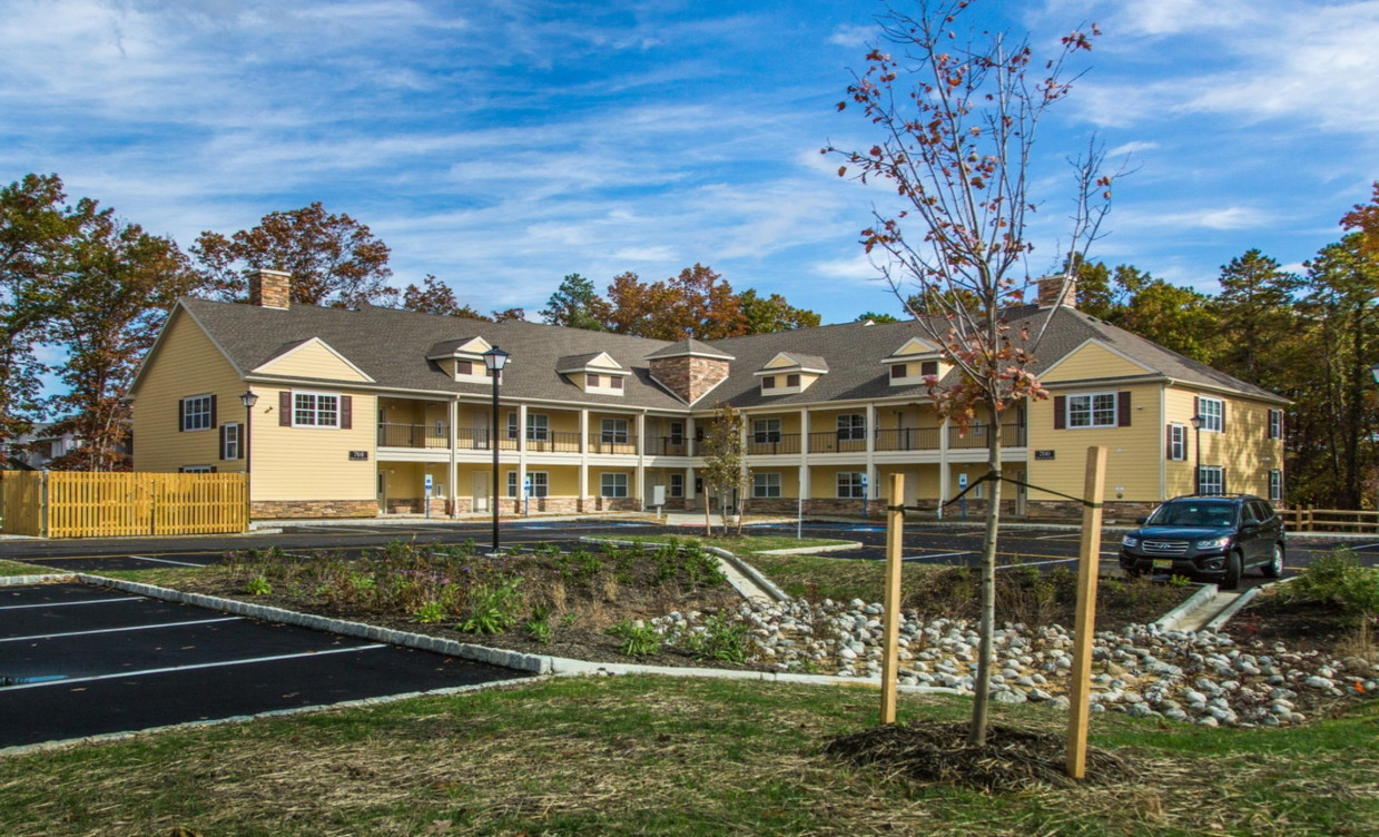
16 Wosniak Ct
16 Wosniak Ct,
Lawrence Township, NJ 08648
$2,800
3 Beds


Discover your new place in Lawrence Township, NJ. You'll enjoy this great location at 700 Freedom Blvd in Lawrence Township and the shops and restaurants nearby. With this great space, you're home. Let us assist you! Contact us now to discuss the next steps!
Project Freedom at West Windsor is an apartment community located in Mercer County and the 08648 ZIP Code. This area is served by the Lawrence Township Public attendance zone.
A hotspot for intellectuals and world-changers alike, the Princeton/Lawrenceville neighborhood remains a stimulating combination of lush town beauty and academic achievements. The honorable Ivy League halls of Princeton University reside here, and its art museum and Gothic chapel bring serious history and culture to the area.
An energetic downtown area featuring shops, bookstores, coffeehouses, and boutiques accompanies a thriving arts and culture scene. Palmer Square is a convenient shopping district next to campus that houses gourmet restaurants and trendy retail stores.
Princeton/Lawrenceville residents and students will appreciate the bountiful selection of wholesale and organic markets. Need a place to chill after class? Princeton Forrestal Village is the perfect setting to wine and dine.
Learn more about living in Princeton/Lawrenceville| Colleges & Universities | Distance | ||
|---|---|---|---|
| Colleges & Universities | Distance | ||
| Drive: | 5 min | 2.5 mi | |
| Drive: | 7 min | 3.2 mi | |
| Drive: | 9 min | 3.9 mi | |
| Drive: | 17 min | 6.5 mi |
 The GreatSchools Rating helps parents compare schools within a state based on a variety of school quality indicators and provides a helpful picture of how effectively each school serves all of its students. Ratings are on a scale of 1 (below average) to 10 (above average) and can include test scores, college readiness, academic progress, advanced courses, equity, discipline and attendance data. We also advise parents to visit schools, consider other information on school performance and programs, and consider family needs as part of the school selection process.
Transportation options available in Lawrence Township include Trenton, located 2.6 miles from Project Freedom at West Windsor. Project Freedom at West Windsor is near Trenton Mercer, located 5.9 miles or 12 minutes away.
| Transit / Subway | Distance | ||
|---|---|---|---|
| Transit / Subway | Distance | ||
|
|
Drive: | 5 min | 2.6 mi |
|
|
Drive: | 6 min | 3.3 mi |
|
|
Drive: | 9 min | 5.2 mi |
|
|
Drive: | 16 min | 8.7 mi |
|
|
Drive: | 20 min | 12.5 mi |
| Commuter Rail | Distance | ||
|---|---|---|---|
| Commuter Rail | Distance | ||
| Drive: | 5 min | 2.6 mi | |
|
|
Drive: | 7 min | 2.9 mi |
|
|
Drive: | 8 min | 3.1 mi |
|
|
Drive: | 10 min | 5.1 mi |
|
|
Drive: | 12 min | 6.2 mi |
| Airports | Distance | ||
|---|---|---|---|
| Airports | Distance | ||
|
Trenton Mercer
|
Drive: | 12 min | 5.9 mi |
Time and distance from Project Freedom at West Windsor.
| Shopping Centers | Distance | ||
|---|---|---|---|
| Shopping Centers | Distance | ||
| Walk: | 4 min | 0.2 mi | |
| Walk: | 12 min | 0.7 mi | |
| Walk: | 15 min | 0.8 mi |
| Parks and Recreation | Distance | ||
|---|---|---|---|
| Parks and Recreation | Distance | ||
|
Drexel Woods Park
|
Drive: | 2 min | 1.2 mi |
|
Lawrence Nature Center
|
Drive: | 2 min | 1.2 mi |
|
New Jersey State Museum Planetarium
|
Drive: | 4 min | 2.6 mi |
|
Sayen House & Gardens
|
Drive: | 13 min | 6.1 mi |
|
Terhune Orchards
|
Drive: | 13 min | 7.5 mi |
| Hospitals | Distance | ||
|---|---|---|---|
| Hospitals | Distance | ||
| Walk: | 20 min | 1.1 mi | |
| Drive: | 5 min | 3.0 mi |
| Military Bases | Distance | ||
|---|---|---|---|
| Military Bases | Distance | ||
| Drive: | 32 min | 20.5 mi | |
| Drive: | 38 min | 21.9 mi |
What Are Walk Score®, Transit Score®, and Bike Score® Ratings?
Walk Score® measures the walkability of any address. Transit Score® measures access to public transit. Bike Score® measures the bikeability of any address.
What is a Sound Score Rating?
A Sound Score Rating aggregates noise caused by vehicle traffic, airplane traffic and local sources