
$2,500
Total Monthly Price
12 Month Lease
110 Clay St Unit 4
Quincy, MA 02170
Today
|
Edit
Favorites
-
Bedrooms
2
-
Bathrooms
1
-
Square Feet
925 sq ft
-
Available
Available Now
Highlights
- Hardwood Floors
- Basement
110 Clay St Unit 4

Favorites
About This Home
12 Month Lease
,
Available Now
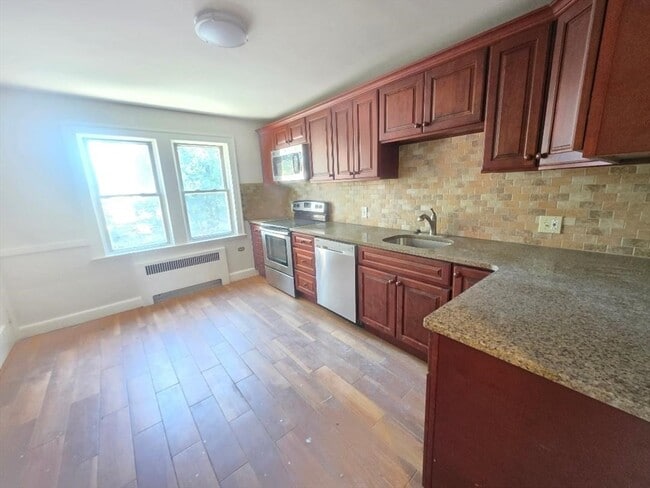
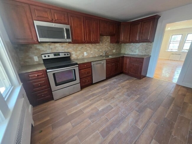
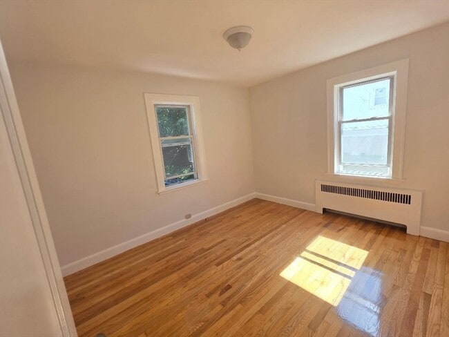
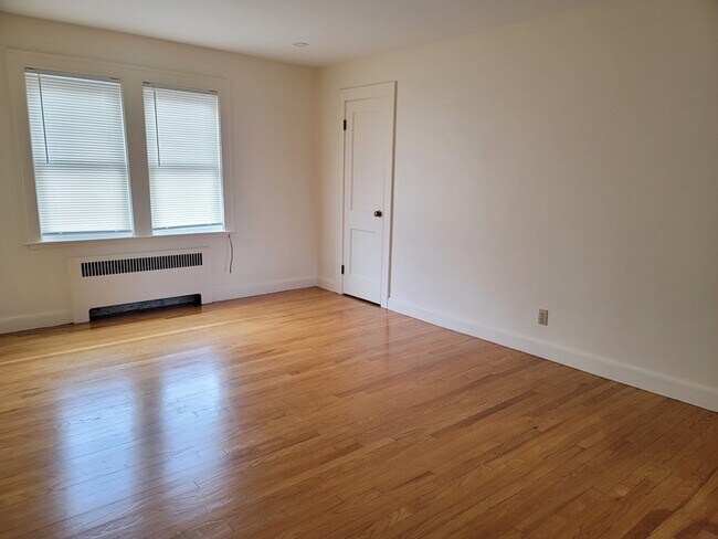
Bright 2 bedroom, 1 bath on 2/F level. Updated kitchen, hardwood floors with custom tile bathroom, coin operated washer/dryer, extra storage room in basement, located on a quiet side street in a 4 unit building, very close to Wollaston Train Station, highway access, parks, beaches, supermarket, restaurants and everything. Tenants require good credit and references. Pet friendly.
110 Clay St is a condo located in Norfolk County and the 02170 ZIP Code. This area is served by the Quincy School District attendance zone.
* Price shown is total price based on community-supplied monthly required fees. Excludes user-selected optional fees and variable or usage-based fees and required charges due at or prior to move-in or at move-out. Price, availability, fees, and any applicable rent special are subject to change without notice.
* Square footage definitions vary. Displayed square footage is approximate.
Condo Features
- Kitchen
- Hardwood Floors
- Basement
Fees and Policies
The fees listed below are community-provided and may exclude utilities or add-ons. All payments are made directly to the property and are non-refundable unless otherwise specified.
Contact
- Contact
Location
Get Directions
Welcome to Quincy, Massachusetts, a historic coastal city eight miles south of Boston. As the "City of Presidents," Quincy combines centuries of American history with contemporary city living. The rental market remains competitive, with current average rents ranging from $2,252 for studios to $4,758 for four-bedroom units, reflecting modest year-over-year changes between -2.9% and 2% depending on unit size.
Each Quincy neighborhood offers its own distinctive appeal. Marina Bay features waterfront living with a scenic harbor and walking paths, while Wollaston encompasses residential streets alongside international markets and restaurants. The Blue Hills Reservation provides 2,485 acres of protected space for hiking, mountain biking, and seasonal skiing. For commuters, four Red Line T stations offer convenient access to downtown Boston. History enthusiasts can explore significant landmarks including the Adams National Historical Park, home to the birthplaces of two U.S. presidents.
Learn more about living in Quincy
Education
| Colleges & Universities | Distance | ||
|---|---|---|---|
| Colleges & Universities | Distance | ||
| Drive: | 11 min | 4.8 mi | |
| Drive: | 16 min | 6.6 mi | |
| Drive: | 14 min | 7.2 mi | |
| Drive: | 14 min | 7.3 mi |
110 Clay St Unit 4 is within 11 minutes or 4.8 miles from UMass Boston. It is also near Curry College and Northeastern University.
Schools


Public Elementary School
Grades K-5
Nearby
Public Elementary School
Grades K-5
Attendance Zone
Public Middle School
Grades 6-8
Attendance Zone
Public High School
Grades 9-12
Attendance Zone
Private Elementary & Middle School
Grades PK-8
Nearby
Private Middle & High School
Grades 6-12
Nearby
School data provided by
 The GreatSchools Rating helps parents compare schools within a state based on a variety of school quality indicators and provides a helpful picture of how effectively each school serves all of its students. Ratings are on a scale of 1 (below average) to 10 (above average) and can include test scores, college readiness, academic progress, advanced courses, equity, discipline and attendance data. We also advise parents to visit schools, consider other information on school performance and programs, and consider family needs as part of the school selection process.
View GreatSchools Rating Methodology
Data provided by GreatSchools.org © 2026. All rights reserved.
View GreatSchools Rating Methodology
Data provided by GreatSchools.org © 2026. All rights reserved.
Transportation options available in Quincy include Wollaston Station, located 0.5 mile from 110 Clay St Unit 4. 110 Clay St Unit 4 is near General Edward Lawrence Logan International, located 10.2 miles or 19 minutes away.
| Transit / Subway | Distance | ||
|---|---|---|---|
| Transit / Subway | Distance | ||
|
|
Walk: | 9 min | 0.5 mi |
|
|
Drive: | 4 min | 1.4 mi |
|
|
Drive: | 7 min | 2.8 mi |
|
|
Drive: | 7 min | 3.4 mi |
|
|
Drive: | 9 min | 4.0 mi |
| Commuter Rail | Distance | ||
|---|---|---|---|
| Commuter Rail | Distance | ||
|
|
Drive: | 3 min | 1.1 mi |
| Drive: | 9 min | 4.6 mi | |
|
|
Drive: | 9 min | 4.7 mi |
|
|
Drive: | 9 min | 4.7 mi |
| Drive: | 10 min | 4.9 mi |
| Airports | Distance | ||
|---|---|---|---|
| Airports | Distance | ||
|
General Edward Lawrence Logan International
|
Drive: | 19 min | 10.2 mi |
Getting Around
 What do Walkability, Transit, Drivability, and Bikeability mean?
Walkability measures the walking distance to day-to-day needs.
Transit measures access to public transportation.
Drivability measures congestion, parking availability, and access to major roads.
Bikeability measures the suitability for cycling.
How It Works
What do Walkability, Transit, Drivability, and Bikeability mean?
Walkability measures the walking distance to day-to-day needs.
Transit measures access to public transportation.
Drivability measures congestion, parking availability, and access to major roads.
Bikeability measures the suitability for cycling.
How It Works
Moderately Walkable
Walkability
60
/ 100
Some Public Transit
Transit
50
/ 100
Moderately Drivable
Drivability
70
/ 100
Fairly Bikeable
Bikeability
50
/ 100
Scores provided by
Active
Soundscore™
71
/ 100
Traffic
ActiveAirport
CalmBusinesses
ActiveScores provided by
HowLoud What is a Sound Score Rating? A Sound Score Rating aggregates noise caused by vehicle traffic, airplane traffic and local sources. How It WorksTime and distance from 110 Clay St Unit 4.
| Shopping Centers | Distance | ||
|---|---|---|---|
| Shopping Centers | Distance | ||
| Walk: | 13 min | 0.7 mi | |
| Drive: | 4 min | 1.4 mi | |
| Drive: | 4 min | 1.7 mi |
110 Clay St Unit 4 has 3 shopping centers within 1.7 miles, which is about a 4-minute drive. The miles and minutes will be for the farthest away property.
| Parks and Recreation | Distance | ||
|---|---|---|---|
| Parks and Recreation | Distance | ||
|
Adams National Historical Park
|
Drive: | 3 min | 1.1 mi |
|
Squantum Point Park
|
Drive: | 9 min | 3.0 mi |
|
Dorchester Shores Reservation
|
Drive: | 10 min | 4.7 mi |
|
Franklin Park Zoo
|
Drive: | 12 min | 6.5 mi |
|
Lower Neponset River Trail
|
Drive: | 12 min | 6.6 mi |
110 Clay St Unit 4 has 5 parks within 6.6 miles, including Adams National Historical Park, Squantum Point Park, and Dorchester Shores Reservation.
| Hospitals | Distance | ||
|---|---|---|---|
| Hospitals | Distance | ||
| Drive: | 7 min | 3.7 mi | |
| Drive: | 9 min | 4.0 mi | |
| Drive: | 11 min | 6.3 mi |
110 Clay St Unit 4 has 3 hospitals within 6.3 miles, the nearest is Carney Hospital which is 3.7 miles away and a 7 minute drive.
Amenities
- Kitchen
- Hardwood Floors
- Basement
110 Clay St Unit 4 Photos
What Are Walk Score®, Transit Score®, and Bike Score® Ratings?
Walk Score® measures the walkability of any address. Transit Score® measures access to public transit. Bike Score® measures the bikeability of any address.
What is a Sound Score Rating?
A Sound Score Rating aggregates noise caused by vehicle traffic, airplane traffic and local sources.

110 Clay St
Quincy, MA 02170