
The Station Apartments
5959 Broadway,
Bronx, NY 10463
$1,750 - $2,300
Studio - 1 Bed
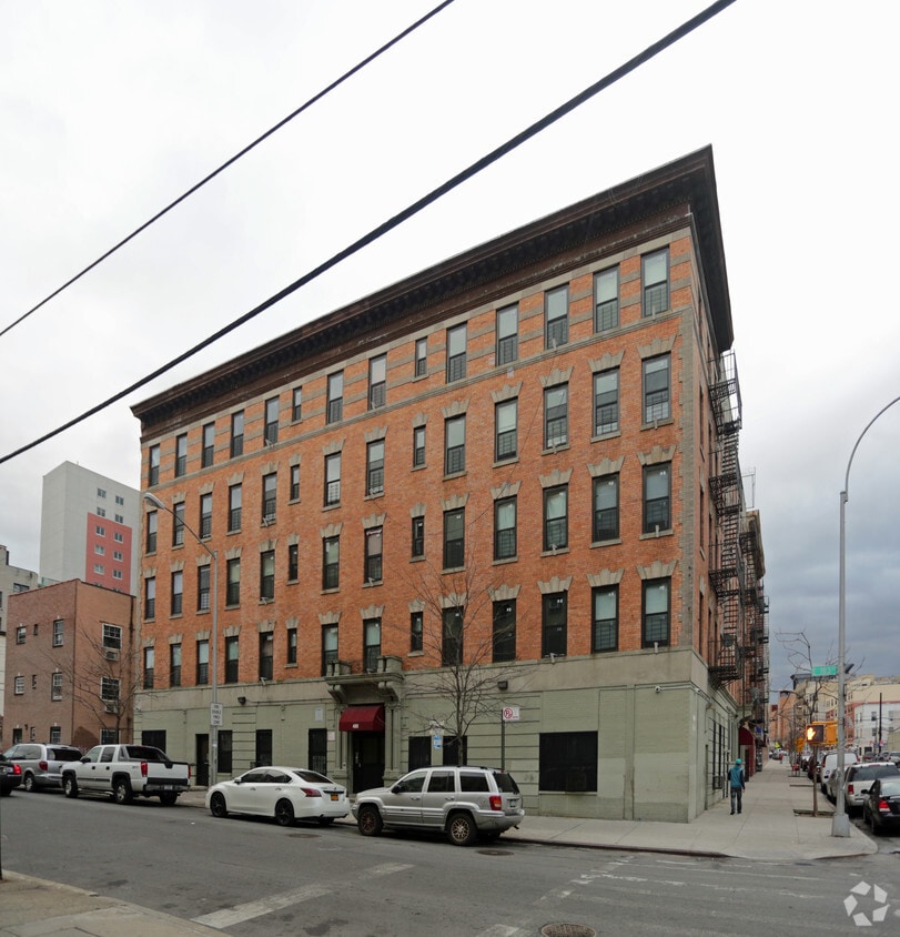
Find your next place to live at Primrose in Bronx, NY. Come by to check out the current floorplan options. This community has a variety of available amenities and features like high-speed internet access, smoke free options, and convenient on-site parking options. The professional leasing staff is ready to help you in finding your perfect new apartment. Experience a new standard at Primrose.
Primrose is an apartment community located in Bronx County and the 10458 ZIP Code. This area is served by the New York City Geographic District #10 attendance zone.
Air Conditioning
High Speed Internet Access
Refrigerator
Tub/Shower
Tremont is a hilly neighborhood that features a variety of historic homes and low to mid-rise apartment buildings. Adjacent to the Bronx Park and the Bronx Zoo, this neighborhood sits just south of 181st Street and just north of Interstate 95 and Crotona Park. With several parks in and around the neighborhood, Tremont provides just enough green space to offset its urban setting. Similar to many New York neighborhoods, Tremont features brick buildings adorned with fire escapes, corner markets, locally owned shops, and wide, pedestrian-friendly streets.
With Manhattan just seven miles southwest of Tremont, commuting into the city is simple, especially with easy access to mass transit. Yankee Stadium, Fordham University, and New York Botanical Garden sit near Tremont as well.
Learn more about living in TremontCompare neighborhood and city base rent averages by bedroom.
| Tremont | Bronx, NY | |
|---|---|---|
| Studio | $1,283 | $1,613 |
| 1 Bedroom | $1,722 | $1,636 |
| 2 Bedrooms | $1,825 | $2,097 |
| 3 Bedrooms | $2,077 | $2,358 |
| Colleges & Universities | Distance | ||
|---|---|---|---|
| Colleges & Universities | Distance | ||
| Walk: | 13 min | 0.7 mi | |
| Drive: | 4 min | 1.2 mi | |
| Drive: | 5 min | 1.8 mi | |
| Drive: | 6 min | 1.9 mi |


Transportation options available in Bronx include 182-183 Streets, located 0.6 mile from Primrose. Primrose is near LaGuardia, located 10.4 miles or 22 minutes away, and John F Kennedy International, located 19.4 miles or 29 minutes away.
| Transit / Subway | Distance | ||
|---|---|---|---|
| Transit / Subway | Distance | ||
|
|
Walk: | 11 min | 0.6 mi |
|
|
Walk: | 13 min | 0.7 mi |
|
|
Walk: | 14 min | 0.8 mi |
|
|
Drive: | 4 min | 1.1 mi |
|
|
Drive: | 4 min | 1.2 mi |
| Commuter Rail | Distance | ||
|---|---|---|---|
| Commuter Rail | Distance | ||
|
|
Walk: | 9 min | 0.5 mi |
|
|
Walk: | 14 min | 0.8 mi |
|
|
Drive: | 4 min | 1.4 mi |
|
|
Drive: | 6 min | 1.9 mi |
|
|
Drive: | 7 min | 2.4 mi |
| Airports | Distance | ||
|---|---|---|---|
| Airports | Distance | ||
|
LaGuardia
|
Drive: | 22 min | 10.4 mi |
|
John F Kennedy International
|
Drive: | 29 min | 19.4 mi |
Scores provided by
Traffic
-Airport
-Businesses
-Scores provided by
HowLoud What is a Sound Score Rating? A Sound Score Rating aggregates noise caused by vehicle traffic, airplane traffic and local sources. How It WorksTime and distance from Primrose.
| Shopping Centers | Distance | ||
|---|---|---|---|
| Shopping Centers | Distance | ||
| Walk: | 11 min | 0.6 mi | |
| Walk: | 14 min | 0.8 mi | |
| Walk: | 15 min | 0.8 mi |
| Parks and Recreation | Distance | ||
|---|---|---|---|
| Parks and Recreation | Distance | ||
|
Poe Park
|
Drive: | 3 min | 1.1 mi |
|
St. James Park
|
Drive: | 3 min | 1.2 mi |
|
Crotona Park
|
Drive: | 5 min | 1.5 mi |
|
Bronx Zoo
|
Drive: | 6 min | 1.8 mi |
|
New York Botanical Garden
|
Drive: | 8 min | 1.8 mi |
| Hospitals | Distance | ||
|---|---|---|---|
| Hospitals | Distance | ||
| Walk: | 4 min | 0.2 mi | |
| Drive: | 6 min | 2.3 mi | |
| Drive: | 7 min | 2.5 mi |
| Military Bases | Distance | ||
|---|---|---|---|
| Military Bases | Distance | ||
| Drive: | 19 min | 9.9 mi | |
| Drive: | 33 min | 15.4 mi | |
| Drive: | 37 min | 23.6 mi |
What Are Walk Score®, Transit Score®, and Bike Score® Ratings?
Walk Score® measures the walkability of any address. Transit Score® measures access to public transit. Bike Score® measures the bikeability of any address.
What is a Sound Score Rating?
A Sound Score Rating aggregates noise caused by vehicle traffic, airplane traffic and local sources.


