
Kinect at Southport
2301 Jefferson Blvd,
Sacramento, CA 95691
$1,550 - $3,044
Studio - 3 Beds
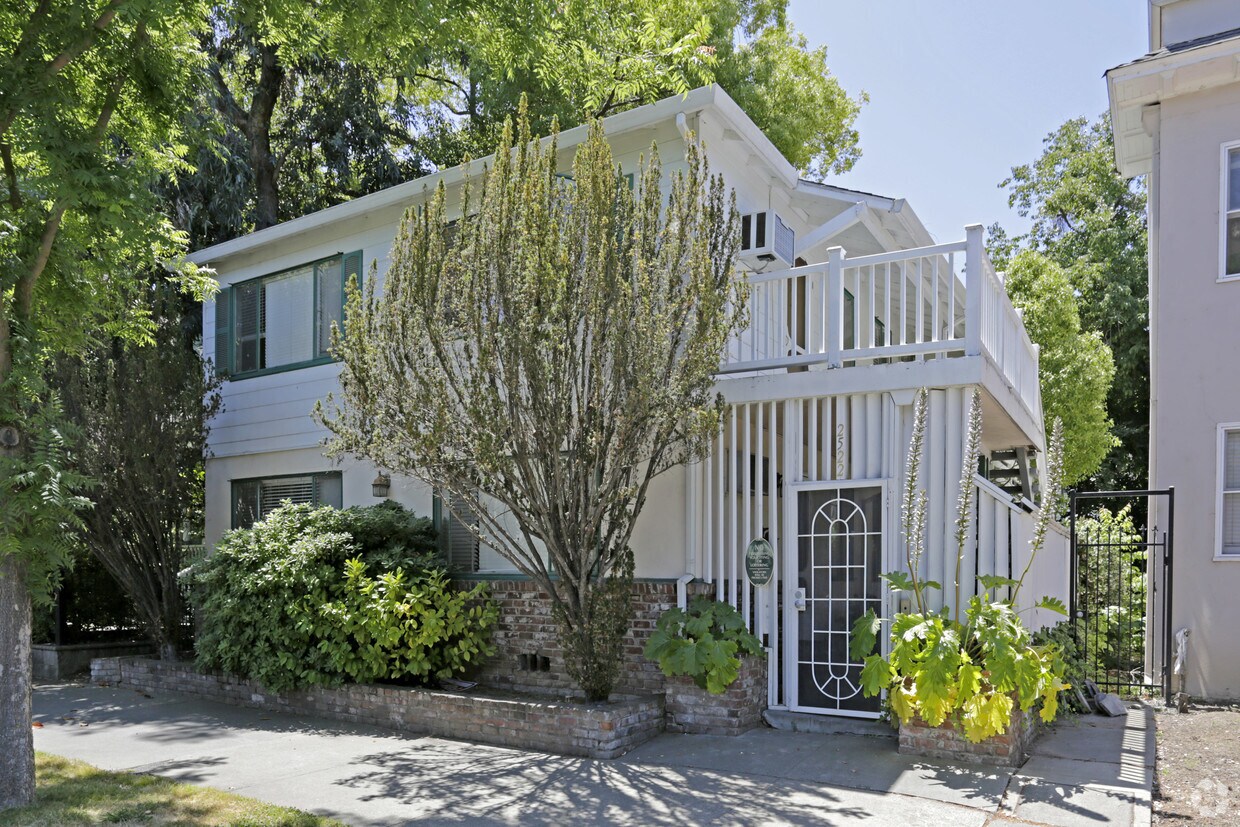
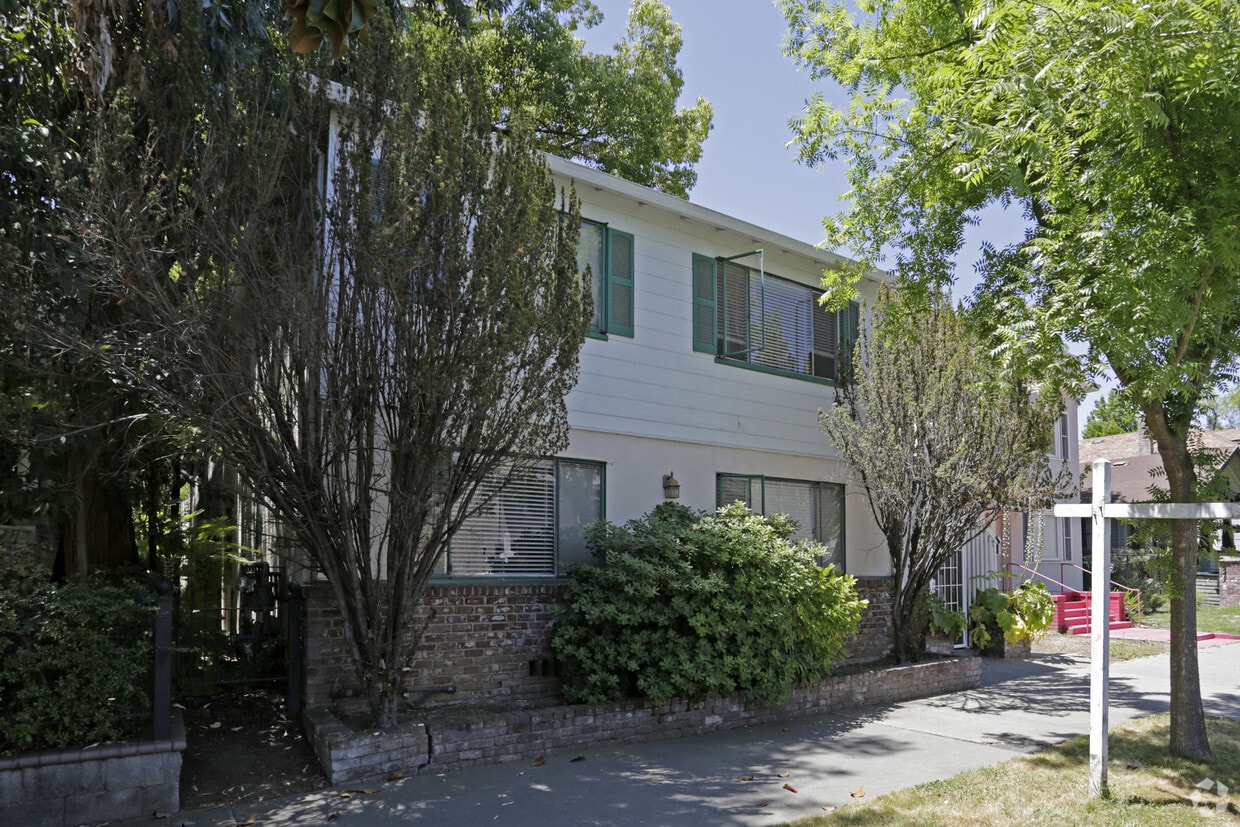

Check out Powell Place in Sacramento, CA. In the 95816 area of Sacramento on N. St, you have a quick connection to enjoyable attractions within a few miles. The leasing staff is waiting to show you all that this community has in store. Come for a visit to check out the current floorplan options. Visit Powell Place today.
Powell Place is an apartment community located in Sacramento County and the 95816 ZIP Code. This area is served by the Sacramento City Unified School District attendance zone.
As the oldest neighborhood in the city, Midtown Sacramento combines historic charm with vibrant urban personality. Midtown features a robust nightlife scene that draws partiers from all across the city to the local bars and clubs, but the majority of the landscape is filled with charming homes (including many beautifully preserved Victorians) along its tree-lined streets. The neighborhood’s extensive and well-maintained network of sidewalks and bike paths makes the area very friendly to pedestrians and cyclists.
Just a few blocks from the State Capitol and the Downtown business district and with a major hospital on the east side, Midtown is the perfect location for government employees, corporate professionals, and healthcare workers who want the convenience of getting to work on foot or by bicycle. For weekends and off-hours, the capital city’s popular attractions (including the waterfront and the Golden 1 Center) are just a short stroll away.
Learn more about living in Midtown SacramentoCompare neighborhood and city base rent averages by bedroom.
| Midtown Sacramento | Sacramento, CA | |
|---|---|---|
| Studio | $1,532 | $1,495 |
| 1 Bedroom | $1,561 | $1,576 |
| 2 Bedrooms | $2,242 | $1,875 |
| 3 Bedrooms | $2,896 | $2,423 |
| Colleges & Universities | Distance | ||
|---|---|---|---|
| Colleges & Universities | Distance | ||
| Drive: | 6 min | 3.1 mi | |
| Drive: | 7 min | 3.6 mi | |
| Drive: | 15 min | 9.8 mi | |
| Drive: | 16 min | 10.3 mi |


Transportation options available in Sacramento include 23Rd Street, located 0.4 mile from Powell Place. Powell Place is near Sacramento International, located 13.2 miles or 20 minutes away.
| Transit / Subway | Distance | ||
|---|---|---|---|
| Transit / Subway | Distance | ||
|
|
Walk: | 8 min | 0.4 mi |
|
|
Walk: | 10 min | 0.6 mi |
|
|
Drive: | 2 min | 1.1 mi |
|
|
Drive: | 3 min | 1.3 mi |
|
|
Drive: | 3 min | 1.4 mi |
| Commuter Rail | Distance | ||
|---|---|---|---|
| Commuter Rail | Distance | ||
| Drive: | 5 min | 2.2 mi | |
| Drive: | 20 min | 16.3 mi | |
|
|
Drive: | 26 min | 18.9 mi |
|
|
Drive: | 27 min | 21.1 mi |
|
|
Drive: | 40 min | 33.3 mi |
| Airports | Distance | ||
|---|---|---|---|
| Airports | Distance | ||
|
Sacramento International
|
Drive: | 20 min | 13.2 mi |
Scores provided by
Traffic
-Airport
-Businesses
-Scores provided by
HowLoud What is a Sound Score Rating? A Sound Score Rating aggregates noise caused by vehicle traffic, airplane traffic and local sources. How It WorksTime and distance from Powell Place.
| Shopping Centers | Distance | ||
|---|---|---|---|
| Shopping Centers | Distance | ||
| Walk: | 7 min | 0.4 mi | |
| Walk: | 11 min | 0.6 mi | |
| Walk: | 12 min | 0.7 mi |
| Parks and Recreation | Distance | ||
|---|---|---|---|
| Parks and Recreation | Distance | ||
|
Sutter's Fort State Historical Monument
|
Walk: | 5 min | 0.3 mi |
|
California State Capitol Museum
|
Drive: | 3 min | 1.3 mi |
|
Leland Stanford Mansion State Historic Park
|
Drive: | 3 min | 1.3 mi |
|
Governor's Mansion State Historic Park
|
Drive: | 3 min | 1.4 mi |
|
California Native Plant Demonstration Garden
|
Drive: | 5 min | 2.3 mi |
| Hospitals | Distance | ||
|---|---|---|---|
| Hospitals | Distance | ||
| Walk: | 6 min | 0.4 mi | |
| Drive: | 3 min | 1.5 mi | |
| Drive: | 4 min | 1.7 mi |
| Military Bases | Distance | ||
|---|---|---|---|
| Military Bases | Distance | ||
| Drive: | 24 min | 11.2 mi | |
| Drive: | 55 min | 42.2 mi | |
| Drive: | 69 min | 49.9 mi |
What Are Walk Score®, Transit Score®, and Bike Score® Ratings?
Walk Score® measures the walkability of any address. Transit Score® measures access to public transit. Bike Score® measures the bikeability of any address.
What is a Sound Score Rating?
A Sound Score Rating aggregates noise caused by vehicle traffic, airplane traffic and local sources.


