
Park Hacienda
5650 Owens Dr,
Pleasanton, CA 94588
$2,500 - $3,985
1-3 Beds
Bedrooms
1 bd
Bathrooms
1 ba
Square Feet
560 sq ft
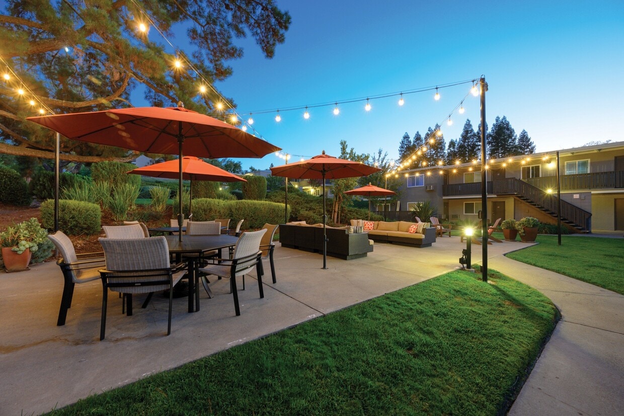
A gorgeous Pleasanton, CA apartment community nestled in a scenic hillside, Pleasanton Heights has spectacular curb appeal. Enjoy the convenience of assigned covered parking, on-site laundry facilities, a fitness center and professional management. Please note, our prices and availability are subject to change. Please talk to a leasing consultant for the most current information!
A gorgeous Pleasanton, CA apartment community nestled in a scenic hillside, Pleasanton Heights has spectacular curb appeal. Enjoy the convenience of assigned covered parking, on-site laundry facilities, a fitness center and professional management. Please note, our prices and availability are subject to change. Please talk to a leasing consultant for the most current information!
Pleasanton Heights is an apartment community located in Alameda County and the 94566 ZIP Code. This area is served by the Pleasanton Unified School District attendance zone.
Unique Features
Pool
Fitness Center
Laundry Facilities
Grill
Air Conditioning
Dishwasher
High Speed Internet Access
Microwave
The cities of Livermore, Dublin and Pleasanton form a loosely shaped triangle within California's Tri-Valley region, a cluster of three small valleys about 33 miles east of San Francisco and 35 miles northeast of San Jose. Known for its Mediterranean climate, rolling hills and historic vineyards, this once bucolic region now boasts three separate downtown areas, a bustling business community and some of the best wineries in the state.
At the eastern end of the region lies the city of Livermore. Once known as Livermores, Livermore Ranch and Nottingham, the city sits at the center of Livermore Valley, a historic region dotted with more than 5,000 acres of mostly family-owned vineyards. A pastoral neighborhood known for its charming yet functional hilltop windmills, Livermore hosts the internationally recognized and sometimes controversial center of scientific research, Lawrence Livermore National Laboratories.
Learn more about living in Dublin/Pleasanton/LivermoreCompare neighborhood and city base rent averages by bedroom.
| Dublin/Pleasanton/Livermore | Pleasanton, CA | |
|---|---|---|
| Studio | $2,389 | $2,240 |
| 1 Bedroom | $2,582 | $2,644 |
| 2 Bedrooms | $3,098 | $3,128 |
| 3 Bedrooms | $3,702 | $4,011 |
| Colleges & Universities | Distance | ||
|---|---|---|---|
| Colleges & Universities | Distance | ||
| Drive: | 14 min | 7.4 mi | |
| Drive: | 17 min | 8.3 mi | |
| Drive: | 20 min | 12.2 mi | |
| Drive: | 29 min | 18.3 mi |


Transportation options available in Pleasanton include Dublin Pleasanton Station, located 4.6 miles from Pleasanton Heights. Pleasanton Heights is near Metro Oakland International, located 24.6 miles or 34 minutes away, and Norman Y Mineta San Jose International, located 27.1 miles or 37 minutes away.
| Transit / Subway | Distance | ||
|---|---|---|---|
| Transit / Subway | Distance | ||
|
|
Drive: | 10 min | 4.6 mi |
|
|
Drive: | 11 min | 6.2 mi |
|
|
Drive: | 24 min | 14.6 mi |
|
|
Drive: | 30 min | 16.5 mi |
| Commuter Rail | Distance | ||
|---|---|---|---|
| Commuter Rail | Distance | ||
| Drive: | 4 min | 1.6 mi | |
| Drive: | 10 min | 6.1 mi | |
| Drive: | 19 min | 11.6 mi | |
| Drive: | 26 min | 16.3 mi | |
| Drive: | 27 min | 16.3 mi |
| Airports | Distance | ||
|---|---|---|---|
| Airports | Distance | ||
|
Metro Oakland International
|
Drive: | 34 min | 24.6 mi |
|
Norman Y Mineta San Jose International
|
Drive: | 37 min | 27.1 mi |
Scores provided by
Traffic
-Airport
-Businesses
-Scores provided by
HowLoud What is a Sound Score Rating? A Sound Score Rating aggregates noise caused by vehicle traffic, airplane traffic and local sources. How It WorksTime and distance from Pleasanton Heights.
| Shopping Centers | Distance | ||
|---|---|---|---|
| Shopping Centers | Distance | ||
| Walk: | 9 min | 0.5 mi | |
| Walk: | 9 min | 0.5 mi | |
| Walk: | 10 min | 0.6 mi |
| Parks and Recreation | Distance | ||
|---|---|---|---|
| Parks and Recreation | Distance | ||
|
Shadow Cliffs Regional Recreation Area
|
Drive: | 6 min | 2.0 mi |
|
Dublin Hills Regional Parks
|
Drive: | 21 min | 9.1 mi |
|
Niles Canyon Railway
|
Drive: | 24 min | 13.6 mi |
|
Pleasanton Ridge Regional Park
|
Drive: | 24 min | 15.3 mi |
|
Garin/Dry Creek Pioneer Parks
|
Drive: | 30 min | 16.9 mi |
| Hospitals | Distance | ||
|---|---|---|---|
| Hospitals | Distance | ||
| Drive: | 6 min | 2.7 mi | |
| Drive: | 20 min | 12.8 mi | |
| Drive: | 24 min | 14.9 mi |
| Military Bases | Distance | ||
|---|---|---|---|
| Military Bases | Distance | ||
| Drive: | 42 min | 29.9 mi | |
| Drive: | 46 min | 32.1 mi | |
| Drive: | 46 min | 32.3 mi |

Pets Allowed Fitness Center Pool In Unit Washer & Dryer Patio Stainless Steel Appliances Hardwood Floors

Pets Allowed Fitness Center Pool High-Speed Internet Concierge
What Are Walk Score®, Transit Score®, and Bike Score® Ratings?
Walk Score® measures the walkability of any address. Transit Score® measures access to public transit. Bike Score® measures the bikeability of any address.
What is a Sound Score Rating?
A Sound Score Rating aggregates noise caused by vehicle traffic, airplane traffic and local sources.

3800-3850 Vineyard Ave
Pleasanton, CA 94566


