
Holmes Townhomes
535 Holmes Ln,
Oregon City, OR 97045
2-3 Beds $3,124
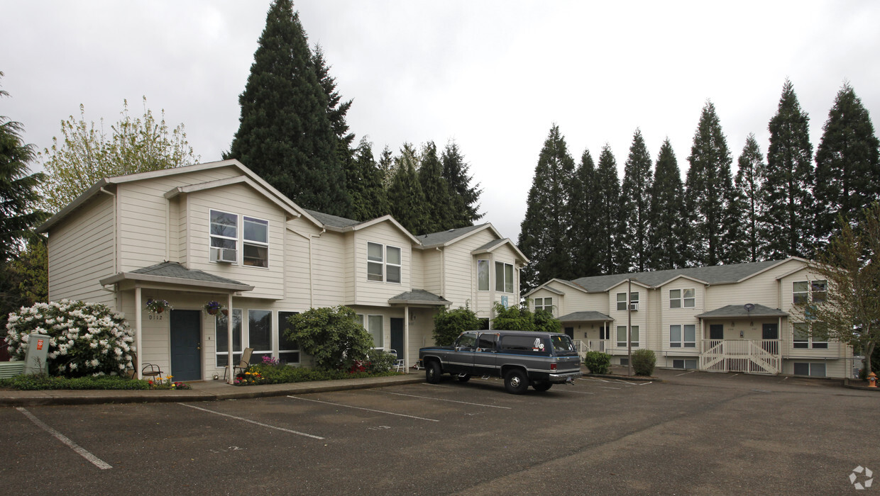
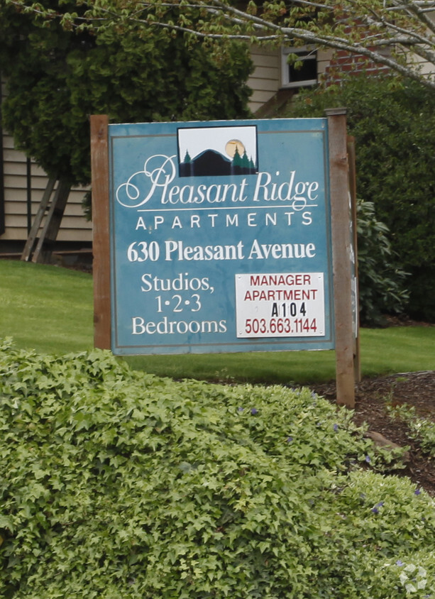
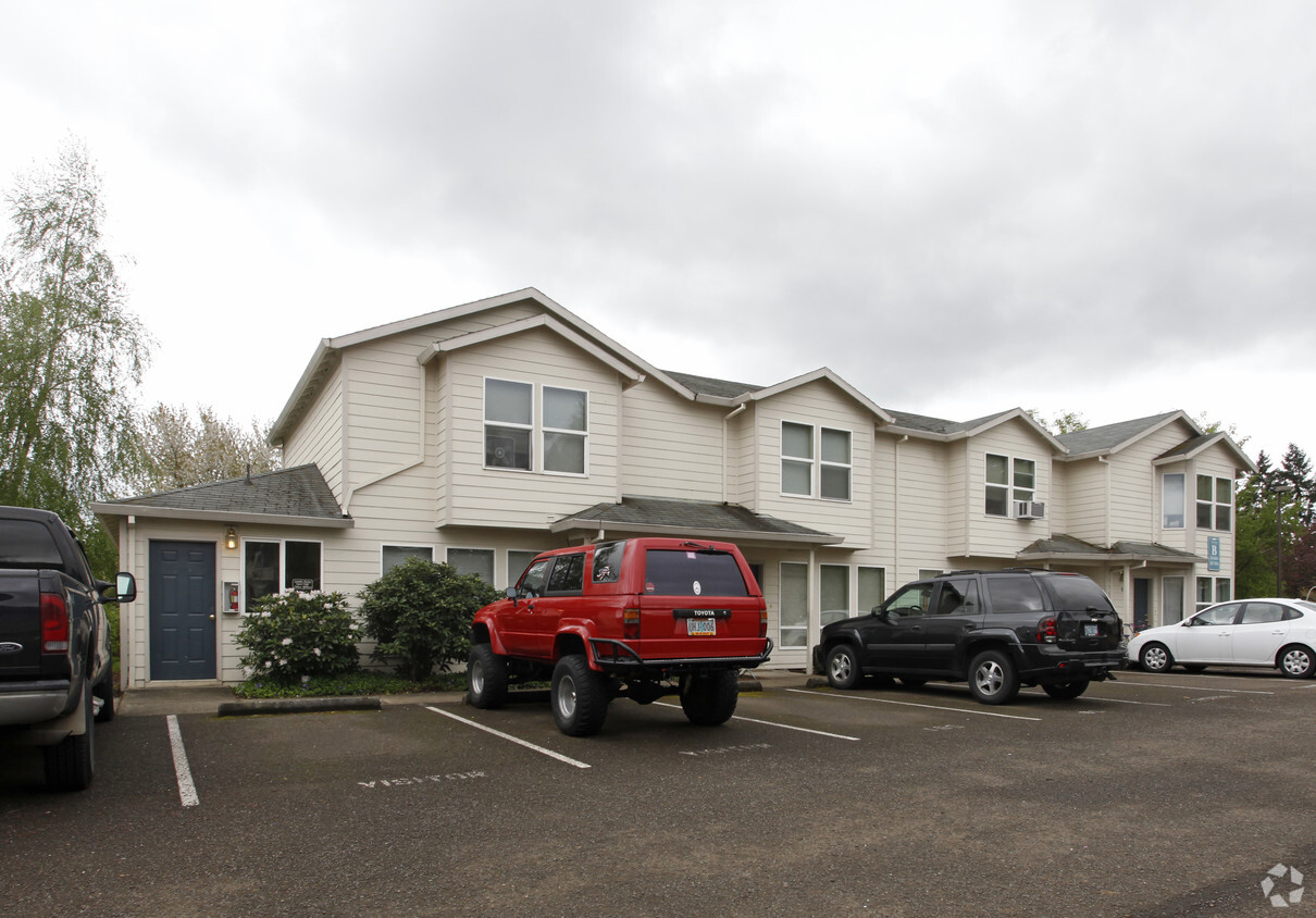

At Pleasant Ridge Apartments in Oregon City, OR, experience fine living. The 630 Pleasant Ave location in Oregon City's 97045 area is an ideal place to move. Make a visit to check out the current floorplan options. Here at this community, the leasing staff will assist you in finding the perfect floorplan option. Life is great at Pleasant Ridge Apartments. Stop by the leasing office to find out current pricing.
Pleasant Ridge Apartments is an apartment community located in Clackamas County and the 97045 ZIP Code. This area is served by the Oregon City School District 62 attendance zone.
Located just under two miles south of downtown Oregon City, Barclay Hills lies near the Trails End Highway. Residents who rent an apartment along Molalla Avenue have plenty of access to shopping areas and restaurants, from Loncheria Mitzil Mexican Eatery to New China. Locals enjoy exploring the wooded areas around Newell Creek, which runs through the neighborhood, or hanging out in Singer Creek Park. Running and hiking trails thread the 18-acre area, which features fruit orchards and a disk golf course.
For a little more action, make your way north to the downtown area, where you can walk along the Willamette River or dine at one of the many eateries overlooking the water, such as McMenamins or the Verdict Bar and Grill.
Learn more about living in Barclay Hills| Colleges & Universities | Distance | ||
|---|---|---|---|
| Colleges & Universities | Distance | ||
| Drive: | 6 min | 2.6 mi | |
| Drive: | 14 min | 7.3 mi | |
| Drive: | 23 min | 9.8 mi | |
| Drive: | 25 min | 16.3 mi |


Transportation options available in Oregon City include Se Park Ave Max Station, located 6.7 miles from Pleasant Ridge Apartments. Pleasant Ridge Apartments is near Portland International, located 19.7 miles or 32 minutes away.
| Transit / Subway | Distance | ||
|---|---|---|---|
| Transit / Subway | Distance | ||
| Drive: | 13 min | 6.7 mi | |
|
|
Drive: | 15 min | 7.7 mi |
| Drive: | 15 min | 7.8 mi | |
| Drive: | 19 min | 9.1 mi | |
|
|
Drive: | 16 min | 9.1 mi |
| Commuter Rail | Distance | ||
|---|---|---|---|
| Commuter Rail | Distance | ||
|
|
Drive: | 5 min | 1.9 mi |
|
|
Drive: | 19 min | 12.3 mi |
|
|
Drive: | 25 min | 16.6 mi |
|
|
Drive: | 26 min | 16.7 mi |
|
|
Drive: | 27 min | 17.8 mi |
| Airports | Distance | ||
|---|---|---|---|
| Airports | Distance | ||
|
Portland International
|
Drive: | 32 min | 19.7 mi |
Time and distance from Pleasant Ridge Apartments.
| Shopping Centers | Distance | ||
|---|---|---|---|
| Shopping Centers | Distance | ||
| Walk: | 18 min | 1.0 mi | |
| Drive: | 3 min | 1.2 mi | |
| Drive: | 3 min | 1.3 mi |
| Parks and Recreation | Distance | ||
|---|---|---|---|
| Parks and Recreation | Distance | ||
|
McLoughlin House
|
Walk: | 20 min | 1.1 mi |
|
John Inskeep Environmental Learning Center
|
Drive: | 6 min | 2.3 mi |
|
Haggart Observatory
|
Drive: | 6 min | 2.3 mi |
|
Mary S. Young State Recreation Area
|
Drive: | 10 min | 3.8 mi |
|
Luscher Farm
|
Drive: | 17 min | 6.6 mi |
| Hospitals | Distance | ||
|---|---|---|---|
| Hospitals | Distance | ||
| Drive: | 3 min | 1.2 mi | |
| Drive: | 13 min | 7.4 mi | |
| Drive: | 17 min | 8.4 mi |
| Military Bases | Distance | ||
|---|---|---|---|
| Military Bases | Distance | ||
| Drive: | 32 min | 19.0 mi | |
| Drive: | 56 min | 33.7 mi |
What Are Walk Score®, Transit Score®, and Bike Score® Ratings?
Walk Score® measures the walkability of any address. Transit Score® measures access to public transit. Bike Score® measures the bikeability of any address.
What is a Sound Score Rating?
A Sound Score Rating aggregates noise caused by vehicle traffic, airplane traffic and local sources

630 Pleasant Ave
Oregon City, OR 97045


