
Enclave
13801 Paramount Blvd,
Paramount, CA 90723
$2,276 - $2,804 Total Monthly Price
1-2 Beds 12 Month Lease
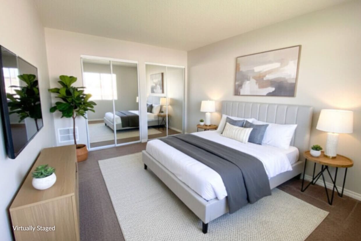
Welcome to Petrol West Apartments, a charming and well-kept community in the heart of Paramount. Located just south of Downtown LA and minutes from Long Beach, our address offers the perfect blend of urban convenience and coastal accessibility. With quick access to the 710 and 105 freeways, commuting is simple. Nearby Lakewood, Long Beach, and Compton Station also provide easy public transit options within a 5-mile radius. Our spacious floor plans feature beautiful finishes and practical comforts. Select homes include large private balconies with fresh air and neighborhood views. Every apartment comes equipped with a refrigerator, gas range, stovetop, and garbage disposal, with air conditioning available in select layouts. Browse our photo gallery to get a closer look at life at Petrol West. If a home catches your eye, our team would be happy to schedule a personal tour. Make sure to follow us on FB (@californiapop) and IG (@pop.calif) for the latest updates and resident contests!
Petrol West is an apartment community located in Los Angeles County and the 90723 ZIP Code. This area is served by the Paramount Unified School District attendance zone.
Air Conditioning
Hardwood Floors
Walk-In Closets
Refrigerator
Paramount, California is a homey urban area that’s situated just 15 miles southeast of Los Angeles. With such a convenient location, many residents find it easy to live in Paramount and commute to nearby areas for work. Families appreciate the city for its great schools in the Paramount Unified School District, along with the safe, walkable streets.
Single-family homes, townhomes, and apartments are available for rent in this charming town. Local businesses are abundant in Paramount, so be sure to shop local and explore retailers and restaurants like Horchateria Rio Luna on Downey Avenue. Looking for something fun to do with the family? Visit the popular Paramount Drive-In Theatre for a classic drive-in experience. And for more fun outdoors, explore Paramount Park, a happening community park with an outdoor pool, basketball courts, baseball fields, and picnic areas that are perfect for enjoying some outdoor green space in an otherwise busy urban area.
Learn more about living in Paramount| Colleges & Universities | Distance | ||
|---|---|---|---|
| Colleges & Universities | Distance | ||
| Drive: | 10 min | 4.8 mi | |
| Drive: | 12 min | 5.5 mi | |
| Drive: | 15 min | 7.2 mi | |
| Drive: | 13 min | 7.5 mi |


Transportation options available in Paramount include Lakewood Station, located 2.9 miles from Petrol West. Petrol West is near Long Beach (Daugherty Field), located 6.3 miles or 13 minutes away, and Los Angeles International, located 16.7 miles or 24 minutes away.
| Transit / Subway | Distance | ||
|---|---|---|---|
| Transit / Subway | Distance | ||
|
|
Drive: | 6 min | 2.9 mi |
|
|
Drive: | 7 min | 3.3 mi |
|
|
Drive: | 8 min | 4.2 mi |
|
|
Drive: | 10 min | 4.5 mi |
|
|
Drive: | 9 min | 5.2 mi |
| Commuter Rail | Distance | ||
|---|---|---|---|
| Commuter Rail | Distance | ||
|
|
Drive: | 17 min | 7.5 mi |
|
|
Drive: | 15 min | 7.8 mi |
|
|
Drive: | 19 min | 10.0 mi |
|
|
Drive: | 21 min | 14.4 mi |
| Drive: | 26 min | 18.6 mi |
| Airports | Distance | ||
|---|---|---|---|
| Airports | Distance | ||
|
Long Beach (Daugherty Field)
|
Drive: | 13 min | 6.3 mi |
|
Los Angeles International
|
Drive: | 24 min | 16.7 mi |
Scores provided by
Traffic
-Airport
-Businesses
-Scores provided by
HowLoud What is a Sound Score Rating? A Sound Score Rating aggregates noise caused by vehicle traffic, airplane traffic and local sources. How It WorksTime and distance from Petrol West.
| Shopping Centers | Distance | ||
|---|---|---|---|
| Shopping Centers | Distance | ||
| Drive: | 3 min | 1.2 mi | |
| Drive: | 3 min | 1.2 mi | |
| Drive: | 3 min | 1.4 mi |
| Parks and Recreation | Distance | ||
|---|---|---|---|
| Parks and Recreation | Distance | ||
|
Compton Creek Natural Park at George Washington Elementary
|
Drive: | 9 min | 4.7 mi |
|
Watts Towers-Rodia State Park
|
Drive: | 12 min | 6.6 mi |
|
Watts Senior Center & Rose Garden
|
Drive: | 12 min | 7.1 mi |
|
Augustus Hawkins Natural Park
|
Drive: | 16 min | 9.5 mi |
|
El Dorado Nature Center
|
Drive: | 17 min | 11.4 mi |
| Hospitals | Distance | ||
|---|---|---|---|
| Hospitals | Distance | ||
| Drive: | 7 min | 3.8 mi | |
| Drive: | 8 min | 4.0 mi | |
| Drive: | 8 min | 4.7 mi |
| Military Bases | Distance | ||
|---|---|---|---|
| Military Bases | Distance | ||
| Drive: | 28 min | 15.6 mi | |
| Drive: | 25 min | 15.8 mi |
What Are Walk Score®, Transit Score®, and Bike Score® Ratings?
Walk Score® measures the walkability of any address. Transit Score® measures access to public transit. Bike Score® measures the bikeability of any address.
What is a Sound Score Rating?
A Sound Score Rating aggregates noise caused by vehicle traffic, airplane traffic and local sources.

7214-7218 Petrol St
Paramount, CA 90723


