
11615 185th St
11615 185th St,
Artesia, CA 90701
$2,200
1 Bed
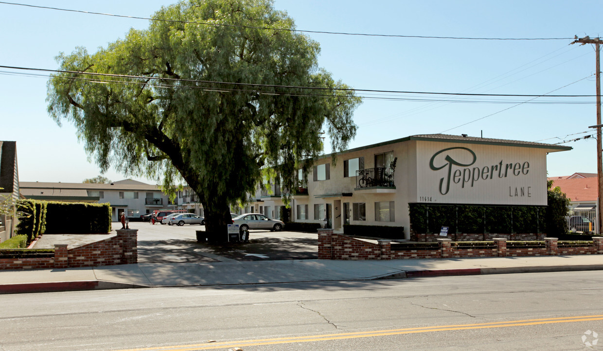
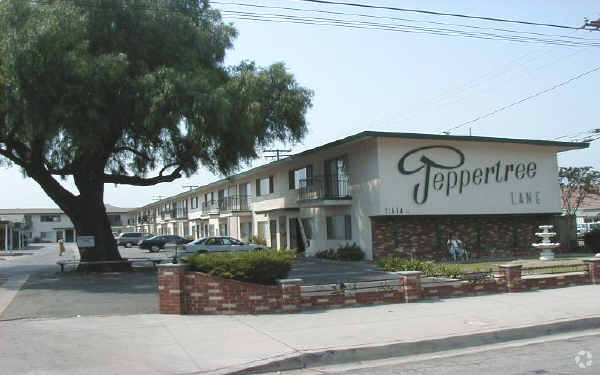
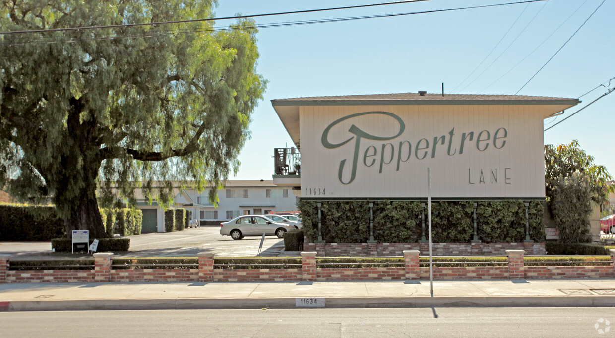

At Peppertree Lane in Artesia, CA, experience great living. With a location on 183rd St. in Artesia's 90701 Zip code, you can easily connect with a number of attractions in the surrounding area. This community offers amenities and features that you'll enjoy. These include: convenient on-site parking options, smoke free options, and balconies. From amenities to availability, the professional leasing staff will be ready to help you find the perfect floorplan option. Stop by to schedule your tour.
Peppertree Lane is an apartment community located in Los Angeles County and the 90701 ZIP Code. This area is served by the Abc Unified School District attendance zone.
High Speed Internet Access
Smoke Free
Heating
Kitchen
ABC is a lively neighborhood conveniently located 15 miles north of Long Beach and 20 miles south of Los Angeles. The area has a dense population with an abundance of apartments and single-family homes for rent, as well as premier shopping destinations. The Los Cerritos Center, conveniently situated off Interstate 605, attracts shoppers from the surrounding areas. On the other side of town off Highway 91, Cerritos Towne Center provides more retail and dining choices. Quaint boutiques and local eateries are located off Pioneer Boulevard, offering a nice contrast to the large retail centers. More great amenities in town include a few peaceful parks and trails that dot the neighborhood like Liberty Park and Fitness Center.
Learn more about living in ABCCompare neighborhood and city base rent averages by bedroom.
| ABC | Artesia, CA | |
|---|---|---|
| Studio | $2,273 | $1,674 |
| 1 Bedroom | $2,265 | $2,135 |
| 2 Bedrooms | $2,572 | $2,360 |
| 3 Bedrooms | $2,978 | $1,537 |
| Colleges & Universities | Distance | ||
|---|---|---|---|
| Colleges & Universities | Distance | ||
| Drive: | 6 min | 2.0 mi | |
| Drive: | 12 min | 6.1 mi | |
| Drive: | 13 min | 7.1 mi | |
| Drive: | 12 min | 7.3 mi |


Transportation options available in Artesia include Norwalk, located 5.0 miles from Peppertree Lane. Peppertree Lane is near Long Beach (Daugherty Field), located 9.0 miles or 16 minutes away, and John Wayne/Orange County, located 22.2 miles or 30 minutes away.
| Transit / Subway | Distance | ||
|---|---|---|---|
| Transit / Subway | Distance | ||
|
|
Drive: | 7 min | 5.0 mi |
|
|
Drive: | 11 min | 7.4 mi |
|
|
Drive: | 15 min | 10.2 mi |
|
|
Drive: | 18 min | 11.0 mi |
|
|
Drive: | 19 min | 11.3 mi |
| Commuter Rail | Distance | ||
|---|---|---|---|
| Commuter Rail | Distance | ||
|
|
Drive: | 10 min | 4.9 mi |
|
|
Drive: | 13 min | 6.5 mi |
|
|
Drive: | 17 min | 10.5 mi |
|
|
Drive: | 19 min | 11.8 mi |
|
|
Drive: | 17 min | 11.9 mi |
| Airports | Distance | ||
|---|---|---|---|
| Airports | Distance | ||
|
Long Beach (Daugherty Field)
|
Drive: | 16 min | 9.0 mi |
|
John Wayne/Orange County
|
Drive: | 30 min | 22.2 mi |
Scores provided by
Traffic
-Airport
-Businesses
-Scores provided by
HowLoud What is a Sound Score Rating? A Sound Score Rating aggregates noise caused by vehicle traffic, airplane traffic and local sources. How It WorksTime and distance from Peppertree Lane.
| Shopping Centers | Distance | ||
|---|---|---|---|
| Shopping Centers | Distance | ||
| Walk: | 4 min | 0.2 mi | |
| Walk: | 4 min | 0.2 mi | |
| Walk: | 4 min | 0.2 mi |
| Parks and Recreation | Distance | ||
|---|---|---|---|
| Parks and Recreation | Distance | ||
|
El Dorado Nature Center
|
Drive: | 9 min | 5.2 mi |
|
El Dorado East Regional Park
|
Drive: | 12 min | 6.4 mi |
|
Earl Burns Miller Japanese Garden
|
Drive: | 14 min | 8.2 mi |
|
Colorado Lagoon
|
Drive: | 15 min | 9.8 mi |
|
Los Cerritos Wetlands Trust
|
Drive: | 16 min | 10.0 mi |
| Hospitals | Distance | ||
|---|---|---|---|
| Hospitals | Distance | ||
| Drive: | 6 min | 2.4 mi | |
| Drive: | 8 min | 4.5 mi | |
| Drive: | 7 min | 4.9 mi |
| Military Bases | Distance | ||
|---|---|---|---|
| Military Bases | Distance | ||
| Drive: | 17 min | 9.8 mi | |
| Drive: | 32 min | 20.6 mi |
Pets Allowed Fitness Center Pool In Unit Washer & Dryer Clubhouse Balcony
What Are Walk Score®, Transit Score®, and Bike Score® Ratings?
Walk Score® measures the walkability of any address. Transit Score® measures access to public transit. Bike Score® measures the bikeability of any address.
What is a Sound Score Rating?
A Sound Score Rating aggregates noise caused by vehicle traffic, airplane traffic and local sources.

11634 183rd St
Artesia, CA 90701


 - Violet on Virgil")


