
Presidential Towers
555 W Madison St,
Chicago, IL 60661
$1,631 - $6,395
Studio - 2 Beds
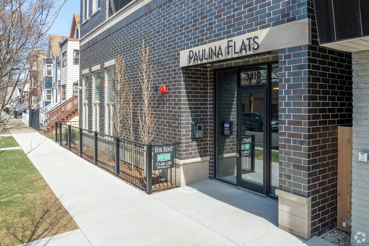
Brand New luxury rentals in the heart of West Lakeview, step away from the Paulina Brown Line Station. Condo-quality unit with transitional finishes throughout. Features 1, 2, and 3 bedroom units with large kitchens with stainless steel appliances, quartz countertops with waterfall edges, washer/dryer in unit, master bedroom with attached bath, walk-in showers, and private outdoor decks. Building amenities include an elevator, soundproof window, bike storage room, large common turf and paver rooftop deck with outdoor patio furniture, great views, and a gas grill area. Close to shops, restaurants, schools, and public transportation. Walk Score of 91. Parking is available for an additional monthly fee. Occupancy starting March 2024
Paulina Flats is an apartment community located in Cook County and the 60657 ZIP Code. This area is served by the Chicago Public Schools attendance zone.
Elevator
Roof Terrace
Grill
Bicycle Storage
Washer/Dryer
Air Conditioning
Dishwasher
High Speed Internet Access
Island Kitchen
Microwave
Refrigerator
Disposal
Chicago sprawls across roughly 228 square miles on the southwestern shore of Lake Michigan, with nearly 28 miles of lakefront where glass towers catch the morning light and commuter trains rumble through neighborhoods shaped by more than a century of reinvention. This is a city built on bold architecture and bolder ambition, where you can stand beneath the steel ribs of the “L” tracks one moment and find yourself strolling through Grant Park’s open lawns the next.
Renters here choose between classic greystone walk-ups in Lakeview, converted lofts in the West Loop’s Fulton Market district, and sleek high-rises with lake views in Streeterville. Logan Square draws crowds to its Milwaukee Avenue dining scene and the elevated 606 trail, while Lincoln Park offers tree-lined streets near the free zoo. River North packs art galleries alongside bustling restaurants, and Hyde Park anchors the South Side with the Museum of Science and Industry nearby.
Learn more about living in Chicago| Colleges & Universities | Distance | ||
|---|---|---|---|
| Colleges & Universities | Distance | ||
| Drive: | 4 min | 1.7 mi | |
| Drive: | 4 min | 2.1 mi | |
| Drive: | 5 min | 2.5 mi | |
| Drive: | 7 min | 3.6 mi |


Transportation options available in Chicago include Paulina Station, located 0.0 mile from Paulina Flats. Paulina Flats is near Chicago Midway International, located 13.5 miles or 24 minutes away, and Chicago O'Hare International, located 13.6 miles or 22 minutes away.
| Transit / Subway | Distance | ||
|---|---|---|---|
| Transit / Subway | Distance | ||
|
|
Walk: | 0 min | 0.0 mi |
|
|
Walk: | 6 min | 0.3 mi |
|
|
Walk: | 8 min | 0.4 mi |
|
|
Walk: | 16 min | 0.9 mi |
|
|
Drive: | 3 min | 1.6 mi |
| Commuter Rail | Distance | ||
|---|---|---|---|
| Commuter Rail | Distance | ||
|
|
Drive: | 3 min | 1.9 mi |
|
|
Drive: | 4 min | 2.1 mi |
| Drive: | 8 min | 3.7 mi | |
|
|
Drive: | 6 min | 3.7 mi |
|
|
Drive: | 9 min | 4.4 mi |
| Airports | Distance | ||
|---|---|---|---|
| Airports | Distance | ||
|
Chicago Midway International
|
Drive: | 24 min | 13.5 mi |
|
Chicago O'Hare International
|
Drive: | 22 min | 13.6 mi |
Scores provided by
Traffic
-Airport
-Businesses
-Scores provided by
HowLoud What is a Sound Score Rating? A Sound Score Rating aggregates noise caused by vehicle traffic, airplane traffic and local sources. How It WorksTime and distance from Paulina Flats.
| Shopping Centers | Distance | ||
|---|---|---|---|
| Shopping Centers | Distance | ||
| Walk: | 7 min | 0.4 mi | |
| Walk: | 10 min | 0.6 mi | |
| Walk: | 11 min | 0.6 mi |
| Parks and Recreation | Distance | ||
|---|---|---|---|
| Parks and Recreation | Distance | ||
|
Wrightwood Park
|
Drive: | 3 min | 1.4 mi |
|
Chase Park
|
Drive: | 4 min | 2.1 mi |
|
Winnemac Park
|
Drive: | 5 min | 2.5 mi |
|
Oz Park
|
Drive: | 6 min | 2.7 mi |
|
Notebaert Nature Museum
|
Drive: | 6 min | 2.8 mi |
| Hospitals | Distance | ||
|---|---|---|---|
| Hospitals | Distance | ||
| Drive: | 3 min | 1.4 mi | |
| Drive: | 4 min | 2.1 mi | |
| Drive: | 5 min | 2.5 mi |
| Military Bases | Distance | ||
|---|---|---|---|
| Military Bases | Distance | ||
| Drive: | 30 min | 21.3 mi | |
| Drive: | 48 min | 32.2 mi | |
| Drive: | 43 min | 32.2 mi |
What Are Walk Score®, Transit Score®, and Bike Score® Ratings?
Walk Score® measures the walkability of any address. Transit Score® measures access to public transit. Bike Score® measures the bikeability of any address.
What is a Sound Score Rating?
A Sound Score Rating aggregates noise caused by vehicle traffic, airplane traffic and local sources.

3419 N Paulina St
Chicago, IL 60657


