
Kinect at Southport
2301 Jefferson Blvd,
Sacramento, CA 95691
$1,550 - $3,044
Studio - 3 Beds


Experience Sacramento living at McKinley Manor. The 3644 H St. location in the 95816 neighborhood of Sacramento is a terrific place to live. This community offers a selection of amenities and features. Some of these include: smoke-free options, fireplaces, and convenient on-site parking options. So get a head start on your move. Contact or stop by McKinley Manor to schedule a tour!
McKinley Manor is an apartment community located in Sacramento County and the 95816 ZIP Code. This area is served by the Sacramento City Unified School District attendance zone.
Air Conditioning
Dishwasher
High Speed Internet Access
Granite Countertops
East Sacramento offers renters a breath of fresh air in the city. Known for tree-lined streets and great parks, East Sacramento is one of the city’s best neighborhoods. The community features lavish apartments, condos, townhomes, and houses. Join your new friends and neighbors at popular McKinley Park, known for its elegant rose garden, food trucks, festivals, concerts, and outdoor movie nights. The neighborhood is also known for its stellar dining and nightlife scene. While living in East Sacramento, you’ll have easy access to craft breweries, trendy coffee shops, quaint boutiques, sports bars, and diverse eateries. Great for students as well, the community borders California State University, Sacramento. This vibrant neighborhood also offers close proximity to Midtown and Downtown Sacramento, which are both about four miles away.
Learn more about living in East SacramentoCompare neighborhood and city base rent averages by bedroom.
| East Sacramento | Sacramento, CA | |
|---|---|---|
| Studio | $1,394 | $1,487 |
| 1 Bedroom | $1,508 | $1,574 |
| 2 Bedrooms | $1,672 | $1,876 |
| 3 Bedrooms | $2,380 | $2,426 |
| Colleges & Universities | Distance | ||
|---|---|---|---|
| Colleges & Universities | Distance | ||
| Drive: | 5 min | 2.3 mi | |
| Drive: | 7 min | 3.9 mi | |
| Drive: | 16 min | 10.0 mi | |
| Drive: | 16 min | 10.7 mi |


Transportation options available in Sacramento include 39Th Street, located 1.0 miles from McKinley Manor. McKinley Manor is near Sacramento International, located 13.8 miles or 21 minutes away.
| Transit / Subway | Distance | ||
|---|---|---|---|
| Transit / Subway | Distance | ||
|
|
Walk: | 20 min | 1.0 mi |
|
|
Drive: | 2 min | 1.4 mi |
|
|
Drive: | 4 min | 1.5 mi |
|
|
Drive: | 4 min | 1.9 mi |
|
|
Drive: | 5 min | 2.2 mi |
| Commuter Rail | Distance | ||
|---|---|---|---|
| Commuter Rail | Distance | ||
| Drive: | 6 min | 3.1 mi | |
| Drive: | 21 min | 17.1 mi | |
|
|
Drive: | 25 min | 18.6 mi |
|
|
Drive: | 26 min | 20.8 mi |
|
|
Drive: | 39 min | 33.0 mi |
| Airports | Distance | ||
|---|---|---|---|
| Airports | Distance | ||
|
Sacramento International
|
Drive: | 21 min | 13.8 mi |
Scores provided by
Traffic
-Airport
-Businesses
-Scores provided by
HowLoud What is a Sound Score Rating? A Sound Score Rating aggregates noise caused by vehicle traffic, airplane traffic and local sources. How It WorksTime and distance from McKinley Manor.
| Shopping Centers | Distance | ||
|---|---|---|---|
| Shopping Centers | Distance | ||
| Walk: | 10 min | 0.5 mi | |
| Walk: | 13 min | 0.7 mi |
| Parks and Recreation | Distance | ||
|---|---|---|---|
| Parks and Recreation | Distance | ||
|
Sutter's Fort State Historical Monument
|
Drive: | 2 min | 1.1 mi |
|
Paradise Beach County Recreation Area
|
Drive: | 3 min | 1.7 mi |
|
Governor's Mansion State Historic Park
|
Drive: | 4 min | 2.3 mi |
|
California State Capitol Museum
|
Drive: | 5 min | 2.7 mi |
|
Leland Stanford Mansion State Historic Park
|
Drive: | 5 min | 2.7 mi |
| Hospitals | Distance | ||
|---|---|---|---|
| Hospitals | Distance | ||
| Walk: | 8 min | 0.4 mi | |
| Walk: | 19 min | 1.0 mi | |
| Drive: | 4 min | 2.1 mi |
| Military Bases | Distance | ||
|---|---|---|---|
| Military Bases | Distance | ||
| Drive: | 23 min | 10.9 mi | |
| Drive: | 55 min | 43.0 mi | |
| Drive: | 71 min | 50.5 mi |
What Are Walk Score®, Transit Score®, and Bike Score® Ratings?
Walk Score® measures the walkability of any address. Transit Score® measures access to public transit. Bike Score® measures the bikeability of any address.
What is a Sound Score Rating?
A Sound Score Rating aggregates noise caused by vehicle traffic, airplane traffic and local sources.
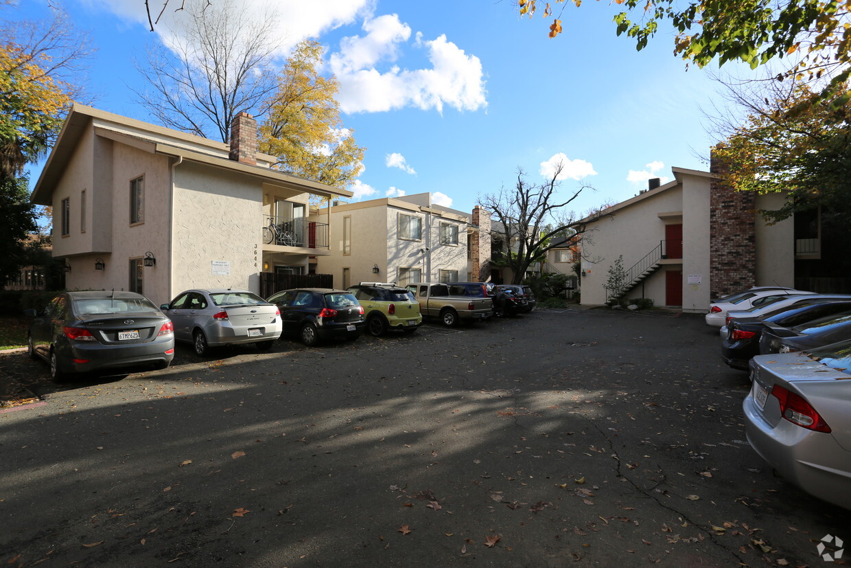
3644 H St
Sacramento, CA 95816


