
$3,500
/ Month
59 Marisa Cir Unit 1F
Staten Island, NY 10309
2 Weeks Ago
|
Edit
Favorites
MARISA CIRCLE

Favorites
Check Back Soon for Upcoming Availability
| Beds | Baths | Average SF |
|---|---|---|
| 3 Bedrooms 3 Bedrooms 3 Br | 2 Baths 2 Baths 2 Ba | — |
About This Property
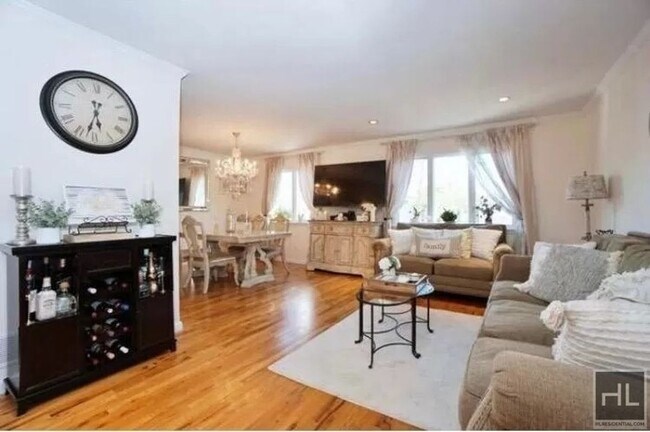
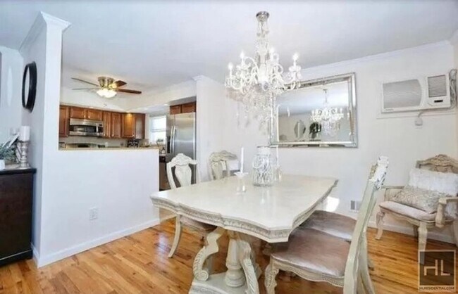
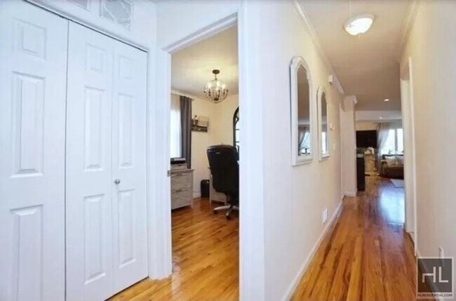
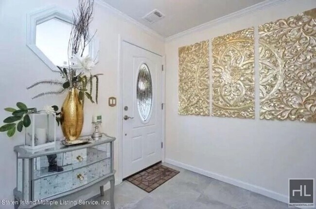
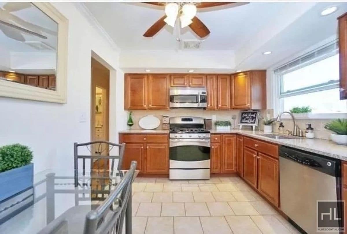
Description coming soon, please contact your Highline Residential agent for more information ===Ref:2015221===
MARISA CIRCLE is an apartment community located in Richmond County and the 10309 ZIP Code.
59 Marisa Cir,
Staten Island,
NY
10309
Staten Island occupies a singular position as New York City's southernmost borough, physically separate from the rest of the city yet firmly connected to it through the iconic, round-the-clock Staten Island Ferry. As the least densely populated of the five boroughs, it carries a noticeably quieter, more residential character than Manhattan or Brooklyn, covering roughly 59 square miles with a population near 490,000. The College of Staten Island anchors the borough's educational presence, while Snug Harbor Cultural Center and Botanical Garden reflects a deep commitment to the arts and green space. During the American Revolution, Staten Island served as a primary staging ground for British forces and remained under British control longer than any other part of what would become the United States.
Neighborhoods vary considerably across the island. St. George on the North Shore functions as the civic and cultural hub, while Tottenville anchors the quieter South Shore.
Learn more about living in Staten IslandBelow are rent ranges for similar nearby apartments
Education
| Colleges & Universities | Distance | ||
|---|---|---|---|
| Colleges & Universities | Distance | ||
| Drive: | 17 min | 7.8 mi | |
| Drive: | 22 min | 11.0 mi | |
| Drive: | 20 min | 11.1 mi | |
| Drive: | 27 min | 18.9 mi |
MARISA CIRCLE is within 17 minutes or 7.8 miles from Coll. of Staten Island, CUNY. It is also near Wagner College and Middlesex Co. Coll., Edison.
Transportation options available in Staten Island include 8Th Street Light Rail Station, located 10.7 miles from MARISA CIRCLE. MARISA CIRCLE is near Newark Liberty International, located 17.5 miles or 29 minutes away, and John F Kennedy International, located 33.7 miles or 52 minutes away.
| Transit / Subway | Distance | ||
|---|---|---|---|
| Transit / Subway | Distance | ||
| Drive: | 20 min | 10.7 mi | |
|
|
Drive: | 22 min | 12.0 mi |
| Commuter Rail | Distance | ||
|---|---|---|---|
| Commuter Rail | Distance | ||
|
|
Drive: | 4 min | 1.4 mi |
|
|
Drive: | 5 min | 2.1 mi |
|
|
Drive: | 5 min | 2.1 mi |
|
|
Drive: | 6 min | 2.5 mi |
|
|
Drive: | 8 min | 3.2 mi |
| Airports | Distance | ||
|---|---|---|---|
| Airports | Distance | ||
|
Newark Liberty International
|
Drive: | 29 min | 17.5 mi |
|
John F Kennedy International
|
Drive: | 52 min | 33.7 mi |
Walkability Near MARISA CIRCLE
Getting Around
 What do Walkability, Transit, Drivability, and Bikeability mean?
Walkability measures the walking distance to day-to-day needs.
Transit measures access to public transportation.
Drivability measures congestion, parking availability, and access to major roads.
Bikeability measures the suitability for cycling.
How It Works
What do Walkability, Transit, Drivability, and Bikeability mean?
Walkability measures the walking distance to day-to-day needs.
Transit measures access to public transportation.
Drivability measures congestion, parking availability, and access to major roads.
Bikeability measures the suitability for cycling.
How It Works
Fairly Walkable
Walkability
50
/ 100
Some Public Transit
Transit
40
/ 100
Moderately Drivable
Drivability
70
/ 100
Moderately Bikeable
Bikeability
60
/ 100
Scores provided by
-
Soundscore™
-
/ 100
Traffic
-Airport
-Businesses
-Scores provided by
HowLoud What is a Sound Score Rating? A Sound Score Rating aggregates noise caused by vehicle traffic, airplane traffic and local sources. How It WorksTime and distance from MARISA CIRCLE.
| Shopping Centers | Distance | ||
|---|---|---|---|
| Shopping Centers | Distance | ||
| Walk: | 14 min | 0.7 mi | |
| Walk: | 17 min | 0.9 mi | |
| Drive: | 6 min | 1.6 mi |
MARISA CIRCLE has 3 shopping centers within 1.6 miles, which is about a 6-minute drive. The miles and minutes will be for the farthest away property.
| Parks and Recreation | Distance | ||
|---|---|---|---|
| Parks and Recreation | Distance | ||
|
Clay Pit Ponds State Park Preserve
|
Drive: | 4 min | 1.2 mi |
|
Bloomingdale Park
|
Drive: | 4 min | 1.5 mi |
|
Lemon Creek Park
|
Drive: | 8 min | 3.1 mi |
|
Wolfes Pond Park
|
Drive: | 7 min | 3.1 mi |
|
Long Pond Park Preserve
|
Drive: | 8 min | 3.2 mi |
MARISA CIRCLE has 5 parks within 3.2 miles, including Clay Pit Ponds State Park Preserve, Bloomingdale Park, and Lemon Creek Park.
| Hospitals | Distance | ||
|---|---|---|---|
| Hospitals | Distance | ||
| Drive: | 21 min | 10.3 mi | |
| Drive: | 23 min | 10.8 mi | |
| Drive: | 21 min | 11.5 mi |
MARISA CIRCLE has 3 hospitals within 11.5 miles, the nearest is Staten Island University Hospital which is 10.3 miles away and a 21 minute drive.
| Military Bases | Distance | ||
|---|---|---|---|
| Military Bases | Distance | ||
| Drive: | 30 min | 15.7 mi | |
| Drive: | 27 min | 16.1 mi |
MARISA CIRCLE is 15.7 miles from Tamdques Reservation, and is convenient to other military bases, including Ash Brook Reservation.
You May Also Like
Similar Rentals Nearby
-
-
-
-
-
-
-
-
-
-
1 / 18
 3 Beds$6,932+Total Monthly PriceTotal Monthly Price NewPrices include all required monthly fees.
Pets Allowed Fitness Center Pool In Unit Washer & Dryer Stainless Steel Appliances


What Are Walk Score®, Transit Score®, and Bike Score® Ratings?
Walk Score® measures the walkability of any address. Transit Score® measures access to public transit. Bike Score® measures the bikeability of any address.
What is a Sound Score Rating?
A Sound Score Rating aggregates noise caused by vehicle traffic, airplane traffic and local sources.
59 Marisa Cir
Staten Island, NY 10309