Median Age
41 Years
Largest Age Group
30-39 Years
Approximately 14% of Residents
Under 20
22%
Over 65
21%


Avg Rent
$820
Population
12,731
Renter Mix
30% Rent
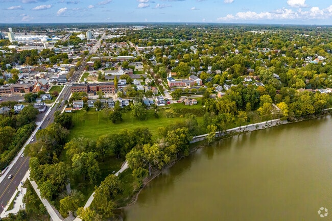
Maumee sits along the Maumee River about ten miles southwest of Toledo, carrying a sense of history that stretches back to the Ottawa people who first settled this river valley. The city played a role in the Northwest Indian War, and Fallen Timbers Battlefield Memorial Park stands as a tangible reminder of that past. Today, Maumee operates as a self-contained suburb with its own commercial core, including the Shops at Fallen Timbers, which draws residents from across the greater Toledo area. Side Cut Metropark and the Maumee River give the city a natural character that sets it apart from many suburban communities its size. The housing stock reflects that mix of history and practicality, with mid-rise apartment communities, townhomes, and single-family rentals available throughout the city. Renters drawn to walkable retail corridors and easy highway access to Toledo via Route 24 and the Ohio Turnpike find Maumee a practical base. The city earned an All-America City designation from the National Civic League in 2006, a distinction tied to its community engagement and local governance. With a population of roughly 13,000, Maumee offers a quieter pace without sacrificing proximity to Toledo's employment and cultural anchors.
Side Cut Metro Park offers the entire neighborhood of Maumee plenty of space to stretch out.
The Maumee River flows on the shores of Towpath Park.
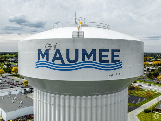
Welcome to the city of Maumee.
There is a wide variety of home styles in Maumee.
Tudor style homes in Maumee set the grand mood.
Maumee residents enjoy direct access to Interstate 475.
Median Household Income
$79,742
Average: $95,048
Education
4,125
Residents Have a Degree
Job Market
7,160
Workers Employed
Median Age
41 Years
Largest Age Group
30-39 Years
Approximately 14% of Residents
Under 20
22%
Over 65
21%
Housing Distribution
Maumee has more homeowners than renters.

Education Distribution
Review this city's overall education levels.

As of July 2026, the average apartment rent in Maumee, OH is $820 for one bedroom, $1,226 for two bedrooms, and $1,329 for three bedrooms. Apartment rent in Maumee has increased by 5.2% in the past year.
Explore how walkable, bikeable, drivable, and transit-friendly Maumee, OH is for everyday living.
Fairly Walkable
Walkability
Limited Public Transit
Transit
Exceptionally Drivable
Drivability
Fairly Bikeable
Bikeability
Public
Grades K-5
319 Students

Public
Grades K-5
349 Students

Public
Grades K-5
320 Students

Public
Grades K-5
320 Students
Wildwood Environmental Academy
Public
Grades K-12
342 Students

Public
Grades 6-8
494 Students
Wildwood Environmental Academy
Public
Grades K-12
342 Students
Public
Grades K-12
14,732 Students

Public
Grades 9-12
570 Students
Wildwood Environmental Academy
Public
Grades K-12
342 Students
Public
Grades K-12
14,732 Students
† Our analysis of utilities, groceries, transportation, healthcare, home prices, and other goods and services is sourced from the Cost of Living Index, a respected benchmark published by the Council for Community and Economic Research (C2ER) that provides a thorough overview of living expenses across different regions.
Rent data is provided by CoStar Group’s Market Trend reports. As the industry leader in commercial real estate information, analytics, and news, CoStar conducts extensive research to produce and maintain a comprehensive database of commercial real estate information. We combine this data with public record to provide the most up-to-date rental information available.
Consumer goods, services, and home prices are sourced from the Cost of Living Index published by the Council for Community and Economic Research (C2ER). The data on this page is updated quarterly. It was last published in June 2026.
Demographic information comes from Neustar and combines detailed address data with U.S. Census and American Community Survey statistics to produce reliable local estimates.


