
$3,000
/ Month
41 Potter St
Haddonfield, NJ 08033
Favorites
856-428-5150
-
Bedrooms
2
-
Bathrooms
2
-
Square Feet
--
-
Available
Available Now
41 Potter St

Favorites
About This Home
Available Now
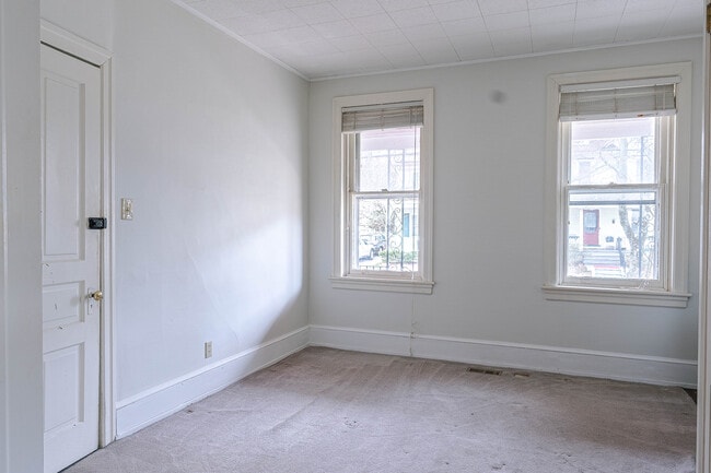
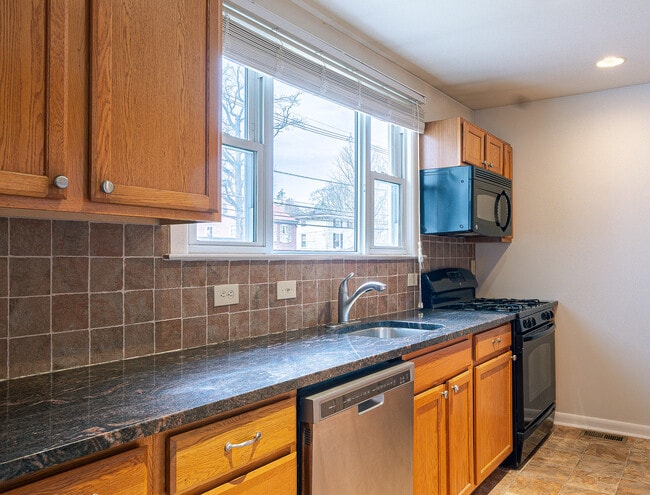
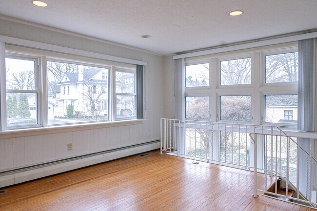
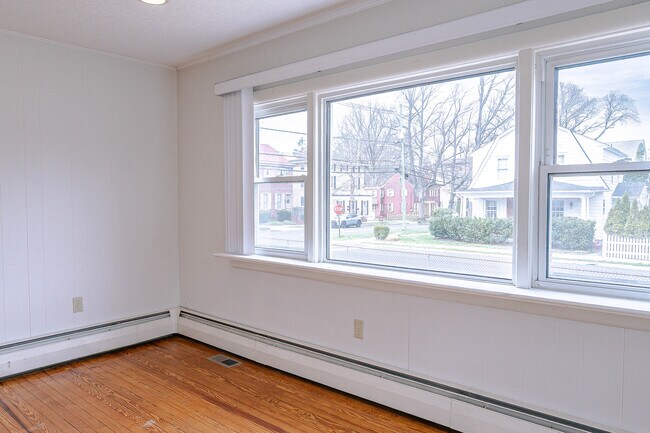
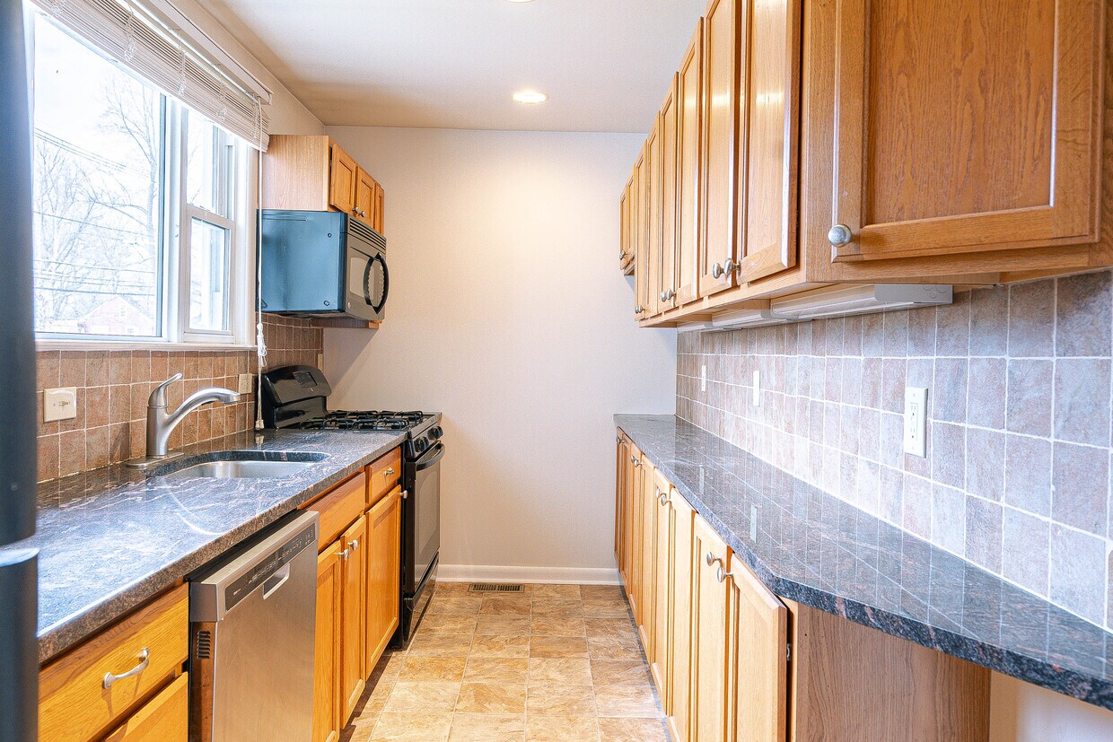
41 Potter Street, Haddonfield, NJ 08033 If you are looking for space in a prime Haddonfield location, 41 Potter Street 1st floor is for you. This two bed, two full bath home offers a large light filled living room, nicely appointed kitchen, dining room, lower level family room, game room, and storage, basement washer and dryer. Tenant has access to two off street parking spots as well as the back yard patio and partial garage storage.
41 Potter St is an apartment community located in Camden County and the 08033 ZIP Code.
* Price shown is base rent. Excludes user-selected optional fees and variable or usage-based fees and required charges due at or prior to move-in or at move-out. Price, availability, fees, and any applicable rent special are subject to change without notice.
* Square footage definitions vary. Displayed square footage is approximate.
Features
- Air Conditioning
- Hardwood Floors
- Tile Floors
- Package Service
- Laundry Facilities
- Controlled Access
Contact
- Listed by Gary Vermaat
- Phone Number
- Contact
Location
Get Directions
Cherry Hill is a close-knit community located 8 miles southeast of Philadelphia. Haddonfield, its neighbor immediately south, creates the border between the two towns. With a preserved historic district teeming with Victorian, colonial and federal-period houses, it's no wonder that Philadelphia Magazine chose Haddonfield as one of the best places to live in the Delaware Valley.
The close proximity to the city combined with safe neighborhoods, excellent school systems, and all the charm living in a historic town brings, checking out the area is a no-brainer to those contemplating a move in the area.
Learn more about living in Cherry Hill/Haddonfield
Amenities
- Air Conditioning
- Hardwood Floors
- Tile Floors
- Package Service
- Laundry Facilities
- Controlled Access
Education
| Colleges & Universities | Distance | ||
|---|---|---|---|
| Colleges & Universities | Distance | ||
| Drive: | 10 min | 6.2 mi | |
| Drive: | 11 min | 6.6 mi | |
| Drive: | 15 min | 9.4 mi | |
| Drive: | 17 min | 10.4 mi |
41 Potter St is within 10 minutes or 6.2 miles from Camden Co. Coll., Camden City. It is also near Rutgers, Camden Campus and Thomas Jefferson University.
Transportation options available in Haddonfield include Haddonfield, located 0.6 mile from 41 Potter St. 41 Potter St is near Philadelphia International, located 15.3 miles or 28 minutes away, and Trenton Mercer, located 38.5 miles or 54 minutes away.
| Transit / Subway | Distance | ||
|---|---|---|---|
| Transit / Subway | Distance | ||
|
|
Walk: | 12 min | 0.6 mi |
|
|
Drive: | 2 min | 1.3 mi |
|
|
Drive: | 4 min | 2.5 mi |
|
|
Drive: | 6 min | 2.6 mi |
|
|
Drive: | 8 min | 3.5 mi |
| Commuter Rail | Distance | ||
|---|---|---|---|
| Commuter Rail | Distance | ||
|
|
Drive: | 5 min | 2.9 mi |
|
|
Drive: | 10 min | 6.5 mi |
| Drive: | 12 min | 6.6 mi | |
|
|
Drive: | 15 min | 9.2 mi |
|
|
Drive: | 16 min | 11.0 mi |
| Airports | Distance | ||
|---|---|---|---|
| Airports | Distance | ||
|
Philadelphia International
|
Drive: | 28 min | 15.3 mi |
|
Trenton Mercer
|
Drive: | 54 min | 38.5 mi |
Getting Around
 What do Walkability, Transit, Drivability, and Bikeability mean?
Walkability measures the walking distance to day-to-day needs.
Transit measures access to public transportation.
Drivability measures congestion, parking availability, and access to major roads.
Bikeability measures the suitability for cycling.
How It Works
What do Walkability, Transit, Drivability, and Bikeability mean?
Walkability measures the walking distance to day-to-day needs.
Transit measures access to public transportation.
Drivability measures congestion, parking availability, and access to major roads.
Bikeability measures the suitability for cycling.
How It Works
Moderately Walkable
Walkability
60
/ 100
Limited Public Transit
Transit
30
/ 100
Very Drivable
Drivability
80
/ 100
Moderately Bikeable
Bikeability
60
/ 100
Scores provided by
Active
Soundscore™
77
/ 100
Traffic
ActiveAirport
CalmBusinesses
ActiveScores provided by
HowLoud What is a Sound Score Rating? A Sound Score Rating aggregates noise caused by vehicle traffic, airplane traffic and local sources. How It WorksTime and distance from 41 Potter St.
| Shopping Centers | Distance | ||
|---|---|---|---|
| Shopping Centers | Distance | ||
| Walk: | 4 min | 0.2 mi | |
| Walk: | 15 min | 0.8 mi | |
| Walk: | 16 min | 0.9 mi |
41 Potter St has 3 shopping centers within 0.9 mile, which is about a 16-minute walk. The miles and minutes will be for the farthest away property.
| Parks and Recreation | Distance | ||
|---|---|---|---|
| Parks and Recreation | Distance | ||
|
Croft Farm Nature Trail
|
Drive: | 3 min | 1.1 mi |
|
Erlton North Trails
|
Drive: | 4 min | 2.3 mi |
|
Downs Farms Trails
|
Drive: | 5 min | 2.5 mi |
|
Barclay Farmstead Nature Trail
|
Drive: | 6 min | 2.8 mi |
|
Kresson Nature Trails
|
Drive: | 8 min | 3.2 mi |
41 Potter St has 5 parks within 3.2 miles, including Croft Farm Nature Trail, Erlton North Trails, and Downs Farms Trails.
| Hospitals | Distance | ||
|---|---|---|---|
| Hospitals | Distance | ||
| Drive: | 7 min | 4.3 mi | |
| Drive: | 9 min | 6.3 mi | |
| Drive: | 17 min | 10.2 mi |
41 Potter St has 3 hospitals within 10.2 miles, the nearest is Virtua Our Lady of Lourdes Hospital which is 4.3 miles away and a 7 minute drive.
| Military Bases | Distance | ||
|---|---|---|---|
| Military Bases | Distance | ||
| Drive: | 18 min | 10.4 mi |
41 Potter St is 10.4 miles and a 18 minute drive from Philadelphia Naval Busi Center.
You May Also Like
How do I access Social Services in New Jersey?
Statewide service is free, confidential, multilingual and always open. Three easy ways to reach Social Services in NJ: Dial 2-1-1; text your zip code to 898-211; or chat at https://www.nj211.org
Similar Rentals Nearby


What Are Walk Score®, Transit Score®, and Bike Score® Ratings?
Walk Score® measures the walkability of any address. Transit Score® measures access to public transit. Bike Score® measures the bikeability of any address.
What is a Sound Score Rating?
A Sound Score Rating aggregates noise caused by vehicle traffic, airplane traffic and local sources.
41 Potter St
Haddonfield, NJ 08033