

$1,095
/ Month
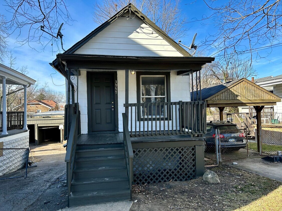
3957 Trevor Ave
Cheviot, OH 45211
2 Weeks Ago
|
Edit
Favorites
3957 Trevor Ave

Favorites
Check Back Soon for Upcoming Availability
| Beds | Baths | Average SF |
|---|---|---|
| 1 Bedroom 1 Bedroom 1 Br | 1 Bath 1 Bath 1 Ba | 800 SF |
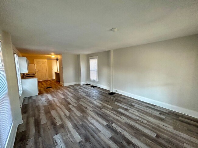
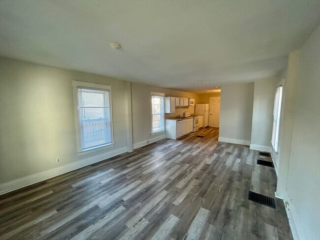
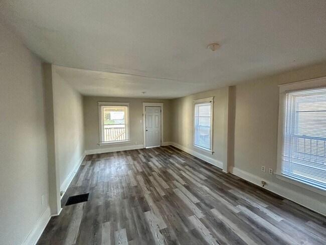
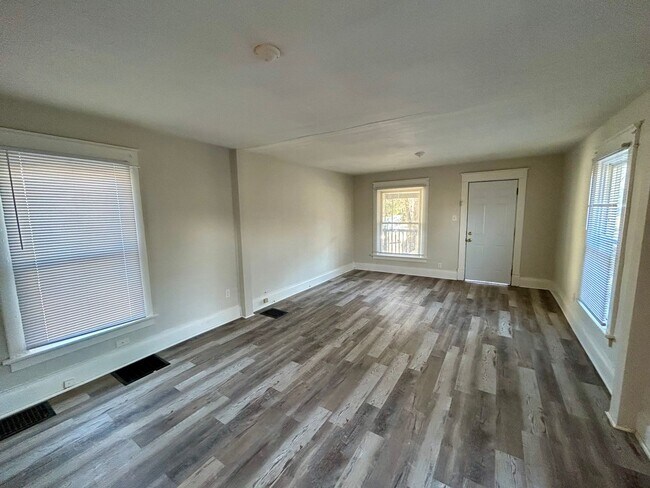
About This Property
Cute and cozy 1 bed bungalow home nestled on quiet street in Cheviot. Shared driveway with neighbor, 1 car detached garage in the back.
3957 Trevor Ave is a house located in Hamilton County and the 45211 ZIP Code. This area is served by the Cincinnati Public Schools attendance zone.
Unique Features
- NONE
Location
Get Directions
Below are rent ranges for similar nearby apartments
Amenities
- NONE
Education
| Colleges & Universities | Distance | ||
|---|---|---|---|
| Colleges & Universities | Distance | ||
| Drive: | 14 min | 5.9 mi | |
| Drive: | 16 min | 6.4 mi | |
| Drive: | 14 min | 6.7 mi | |
| Drive: | 16 min | 7.1 mi |
3957 Trevor Ave is within 16 minutes or 6.4 miles from Cincinnati State. It is also near College of Mount St. Joseph and University of Cincinnati.
Schools


Public Elementary & Middle School
Grades PK-7
569 Students
Attendance Zone
Public Middle & High School
Grades 7-12
897 Students
Attendance Zone
Public Middle & High School
Grades 7-12
760 Students
Attendance Zone
Private Elementary & Middle School
Grades K-8
189 Students
Nearby
Private Elementary & Middle School
Grades K-8
268 Students
Nearby
Private High School
Grades 9-12
495 Students
Nearby
School data provided by
 The GreatSchools Rating helps parents compare schools within a state based on a variety of school quality indicators and provides a helpful picture of how effectively each school serves all of its students. Ratings are on a scale of 1 (below average) to 10 (above average) and can include test scores, college readiness, academic progress, advanced courses, equity, discipline and attendance data. We also advise parents to visit schools, consider other information on school performance and programs, and consider family needs as part of the school selection process.
View GreatSchools Rating Methodology
Data provided by GreatSchools.org © 2025. All rights reserved.
View GreatSchools Rating Methodology
Data provided by GreatSchools.org © 2025. All rights reserved.
Transportation options available in Cheviot include Brewery District Station, Elm & Henry, located 7.4 miles from 3957 Trevor Ave. 3957 Trevor Ave is near Cincinnati/Northern Kentucky International, located 21.4 miles or 40 minutes away.
| Transit / Subway | Distance | ||
|---|---|---|---|
| Transit / Subway | Distance | ||
| Drive: | 16 min | 7.4 mi | |
| Drive: | 16 min | 7.5 mi | |
| Drive: | 16 min | 7.6 mi | |
| Drive: | 17 min | 7.6 mi | |
| Drive: | 17 min | 7.7 mi |
| Commuter Rail | Distance | ||
|---|---|---|---|
| Commuter Rail | Distance | ||
|
|
Drive: | 15 min | 7.4 mi |
| Airports | Distance | ||
|---|---|---|---|
| Airports | Distance | ||
|
Cincinnati/Northern Kentucky International
|
Drive: | 40 min | 21.4 mi |
Time and distance from 3957 Trevor Ave.
| Shopping Centers | Distance | ||
|---|---|---|---|
| Shopping Centers | Distance | ||
| Drive: | 4 min | 1.4 mi | |
| Drive: | 3 min | 1.4 mi | |
| Drive: | 5 min | 1.6 mi |
3957 Trevor Ave has 3 shopping centers within 1.6 miles, which is about a 5-minute drive. The miles and minutes will be for the farthest away property.
| Parks and Recreation | Distance | ||
|---|---|---|---|
| Parks and Recreation | Distance | ||
|
Mt. Airy Forest
|
Drive: | 6 min | 2.6 mi |
|
Mitchell Memorial Forest
|
Drive: | 12 min | 5.2 mi |
|
Buttercup Valley
|
Drive: | 13 min | 5.4 mi |
|
Imago Earth Center
|
Drive: | 15 min | 5.5 mi |
|
LaBoiteaux Woods
|
Drive: | 16 min | 6.6 mi |
3957 Trevor Ave has 5 parks within 6.6 miles, including Mt. Airy Forest, Mitchell Memorial Forest, and Buttercup Valley.
| Hospitals | Distance | ||
|---|---|---|---|
| Hospitals | Distance | ||
| Drive: | 6 min | 2.2 mi | |
| Drive: | 13 min | 5.9 mi | |
| Drive: | 16 min | 7.2 mi |
3957 Trevor Ave has 3 hospitals within 7.2 miles, the nearest is Mercy Health - West Hospital which is 2.2 miles away and a 6 minute drive.
| Military Bases | Distance | ||
|---|---|---|---|
| Military Bases | Distance | ||
| Drive: | 76 min | 56.2 mi | |
| Drive: | 82 min | 61.2 mi | |
| Drive: | 84 min | 64.5 mi |
3957 Trevor Ave has 3 military bases within 64.5 miles, the nearest is Gentile Air Force Station which is 56.2 miles away and a 76 minute drive.
You May Also Like
Similar Rentals Nearby


What Are Walk Score®, Transit Score®, and Bike Score® Ratings?
Walk Score® measures the walkability of any address. Transit Score® measures access to public transit. Bike Score® measures the bikeability of any address.
What is a Sound Score Rating?
A Sound Score Rating aggregates noise caused by vehicle traffic, airplane traffic and local sources
3957 Trevor Ave
Cheviot, OH 45211