
The Alamitos
101 Alamitos Ave,
Long Beach, CA 90802
$2,175 - $5,415
Studio - 2 Beds
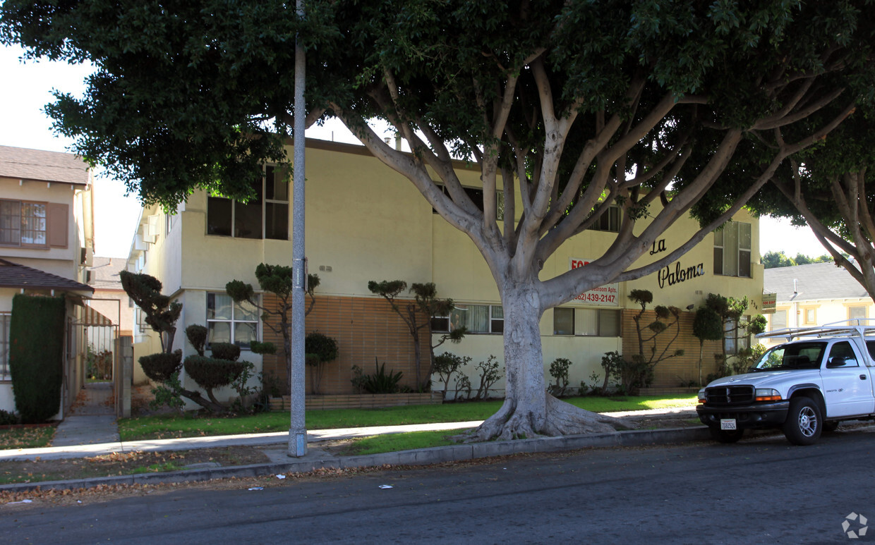
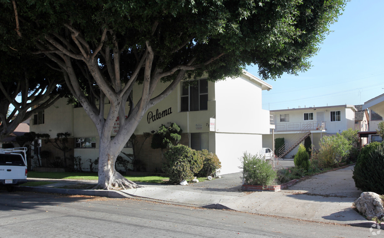
At La Paloma, experience fine living. Located in Long Beach's 90804 Zip code, living at this community offers a variety of nearby points of interest. From pricing to features, the leasing staff is ready to help you find your perfect floorplan. Schedule a time to check out the current floorplan options. Contact us or stop by today.
La Paloma is an apartment community located in Los Angeles County and the 90804 ZIP Code. This area is served by the Long Beach Unified attendance zone.
The area defined as Eastside Long Beach puts you just two blocks from the white-sand beaches along the Pacific Ocean, two miles from Downtown Long Beach, and only 25 minutes from the heart of Los Angeles. You'll also be within easy reach of California State University-Long Beach, which is adjacent to the neighborhood. Eastside is just east of Alamitos Avenue with the Pacific Coast Highway forming the northern border. Recreation Park is on the neighborhood's southeast side. There’s a plethora of coastal rentals in a variety of styles here, ensuring you’ll find your perfect fit in one of SoCal’s most vibrant areas.
Learn more about living in Eastside Long Beach| Colleges & Universities | Distance | ||
|---|---|---|---|
| Colleges & Universities | Distance | ||
| Drive: | 6 min | 2.5 mi | |
| Drive: | 7 min | 2.9 mi | |
| Drive: | 11 min | 5.0 mi | |
| Drive: | 19 min | 8.4 mi |


Transportation options available in Long Beach include 5Th Street Station, located 2.5 miles from La Paloma. La Paloma is near Long Beach (Daugherty Field), located 4.4 miles or 9 minutes away, and John Wayne/Orange County, located 18.8 miles or 26 minutes away.
| Transit / Subway | Distance | ||
|---|---|---|---|
| Transit / Subway | Distance | ||
|
|
Drive: | 6 min | 2.5 mi |
|
|
Drive: | 7 min | 2.8 mi |
|
|
Drive: | 7 min | 2.9 mi |
|
|
Drive: | 8 min | 3.2 mi |
|
|
Drive: | 8 min | 3.4 mi |
| Commuter Rail | Distance | ||
|---|---|---|---|
| Commuter Rail | Distance | ||
|
|
Drive: | 24 min | 16.3 mi |
|
|
Drive: | 27 min | 16.5 mi |
| Drive: | 27 min | 18.3 mi | |
|
|
Drive: | 31 min | 19.9 mi |
|
|
Drive: | 28 min | 20.1 mi |
| Airports | Distance | ||
|---|---|---|---|
| Airports | Distance | ||
|
Long Beach (Daugherty Field)
|
Drive: | 9 min | 4.4 mi |
|
John Wayne/Orange County
|
Drive: | 26 min | 18.8 mi |
Time and distance from La Paloma.
| Shopping Centers | Distance | ||
|---|---|---|---|
| Shopping Centers | Distance | ||
| Walk: | 6 min | 0.3 mi | |
| Walk: | 10 min | 0.5 mi | |
| Walk: | 11 min | 0.6 mi |
| Parks and Recreation | Distance | ||
|---|---|---|---|
| Parks and Recreation | Distance | ||
|
Colorado Lagoon
|
Drive: | 3 min | 1.3 mi |
|
Earl Burns Miller Japanese Garden
|
Drive: | 6 min | 2.6 mi |
|
Aquarium of the Pacific
|
Drive: | 8 min | 3.4 mi |
|
Los Cerritos Wetlands Trust
|
Drive: | 7 min | 3.7 mi |
|
El Dorado East Regional Park
|
Drive: | 11 min | 5.2 mi |
| Hospitals | Distance | ||
|---|---|---|---|
| Hospitals | Distance | ||
| Drive: | 5 min | 2.3 mi | |
| Drive: | 7 min | 2.6 mi | |
| Drive: | 9 min | 4.4 mi |
| Military Bases | Distance | ||
|---|---|---|---|
| Military Bases | Distance | ||
| Drive: | 16 min | 8.7 mi | |
| Drive: | 22 min | 9.2 mi |
What Are Walk Score®, Transit Score®, and Bike Score® Ratings?
Walk Score® measures the walkability of any address. Transit Score® measures access to public transit. Bike Score® measures the bikeability of any address.
What is a Sound Score Rating?
A Sound Score Rating aggregates noise caused by vehicle traffic, airplane traffic and local sources


