
Glenmore Place Apartments
312 E Baltimore Ave,
Clifton Heights, PA 19018
$1,299 - $1,449
1-2 Beds

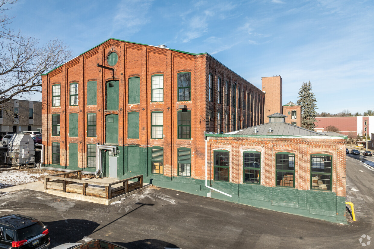
Welcome to Kent Mills in Clifton Heights, PA. This property is situated on E Broadway Ave in the 19018 area of Clifton Heights. The professional leasing team is excited to help you find the best floor plan for your lifestyle. Give us a call now to check the current floor plan availability.
Kent Mills is an apartment community located in Delaware County and the 19018 ZIP Code. This area is served by the Upper Darby School District attendance zone.
Controlled Access
24 Hour Access
Package Service
Maintenance on site
Air Conditioning
Refrigerator
Tub/Shower
Freezer
Clifton Heights is a compact borough in Delaware County, Pennsylvania, sitting about eight miles southwest of Philadelphia along Darby Creek. Despite covering just one square mile, it holds a dense, close-knit residential character that draws people who want suburban quiet with genuine proximity to a major city. Delaware County is the oldest settled section of Pennsylvania, and Clifton Heights grew out of that deep regional history as rail and road connections made suburban living practical in the early 20th century. The borough sits roughly midway between Philadelphia and the borough of Media, giving residents access to employment, culture, and services in both directions. A rail stop at Clifton-Aldan Station connects commuters directly to the city, and Interstate 476 runs just to the west. The rental market skews toward smaller apartment communities and multi-unit buildings rather than high-rises, reflecting the borough's modest footprint.
Learn more about living in Clifton Heights| Colleges & Universities | Distance | ||
|---|---|---|---|
| Colleges & Universities | Distance | ||
| Drive: | 11 min | 4.6 mi | |
| Drive: | 15 min | 5.0 mi | |
| Drive: | 15 min | 5.1 mi | |
| Drive: | 17 min | 5.7 mi |


Transportation options available in Clifton Heights include Penn St, located 0.4 mile from Kent Mills. Kent Mills is near Philadelphia International, located 7.7 miles or 19 minutes away, and Trenton Mercer, located 41.7 miles or 69 minutes away.
| Transit / Subway | Distance | ||
|---|---|---|---|
| Transit / Subway | Distance | ||
| Walk: | 7 min | 0.4 mi | |
| Walk: | 8 min | 0.4 mi | |
| Walk: | 10 min | 0.5 mi | |
| Walk: | 11 min | 0.6 mi | |
| Walk: | 12 min | 0.6 mi |
| Commuter Rail | Distance | ||
|---|---|---|---|
| Commuter Rail | Distance | ||
|
|
Walk: | 10 min | 0.5 mi |
|
|
Walk: | 10 min | 0.6 mi |
|
|
Walk: | 15 min | 0.8 mi |
|
|
Drive: | 4 min | 1.1 mi |
|
|
Drive: | 5 min | 1.5 mi |
| Airports | Distance | ||
|---|---|---|---|
| Airports | Distance | ||
|
Philadelphia International
|
Drive: | 19 min | 7.7 mi |
|
Trenton Mercer
|
Drive: | 69 min | 41.7 mi |
Scores provided by
Traffic
-Airport
-Businesses
-Scores provided by
HowLoud What is a Sound Score Rating? A Sound Score Rating aggregates noise caused by vehicle traffic, airplane traffic and local sources. How It WorksTime and distance from Kent Mills.
| Shopping Centers | Distance | ||
|---|---|---|---|
| Shopping Centers | Distance | ||
| Walk: | 2 min | 0.1 mi | |
| Walk: | 9 min | 0.5 mi | |
| Walk: | 12 min | 0.6 mi |
| Parks and Recreation | Distance | ||
|---|---|---|---|
| Parks and Recreation | Distance | ||
|
Cobbs Creek Environmental Education Center
|
Drive: | 9 min | 3.2 mi |
|
Cobbs Creek Park
|
Drive: | 11 min | 4.0 mi |
|
Scott Arboretum
|
Drive: | 13 min | 4.5 mi |
|
John Heinz National Wildlife Refuge
|
Drive: | 12 min | 4.6 mi |
|
Bartram's Garden
|
Drive: | 15 min | 5.0 mi |
| Hospitals | Distance | ||
|---|---|---|---|
| Hospitals | Distance | ||
| Drive: | 6 min | 2.0 mi | |
| Drive: | 9 min | 2.5 mi | |
| Drive: | 17 min | 5.9 mi |
| Military Bases | Distance | ||
|---|---|---|---|
| Military Bases | Distance | ||
| Drive: | 23 min | 10.2 mi | |
| Drive: | 49 min | 29.9 mi | |
| Drive: | 54 min | 31.9 mi |
What Are Walk Score®, Transit Score®, and Bike Score® Ratings?
Walk Score® measures the walkability of any address. Transit Score® measures access to public transit. Bike Score® measures the bikeability of any address.
What is a Sound Score Rating?
A Sound Score Rating aggregates noise caused by vehicle traffic, airplane traffic and local sources.
500 E Broadway Ave
Clifton Heights, PA 19018


