
Bright Oaks
300 Old Mill Rd,
Oakdale, PA 15071
$1,085 - $2,540
Studio - 3 Beds
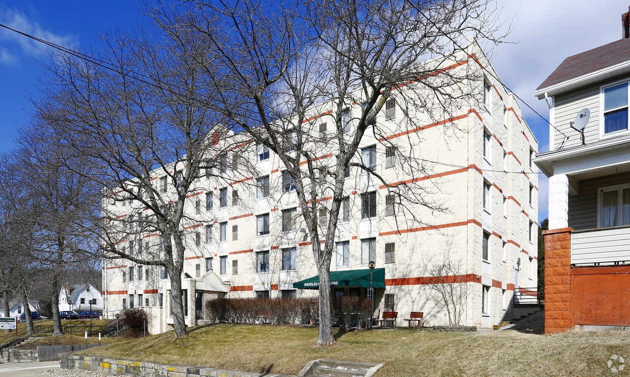
Experience Mcdonald living at HaveLoch Commons. You'll find this community at 105 Coal St in the 15057 area of Mcdonald. From amenities to availability, the leasing team is ready to help you find the best floor plan for your lifestyle. It's time to come home to HaveLoch Commons. Contact us or stop by the leasing office to schedule a tour.
HaveLoch Commons is an apartment community located in Washington County and the 15057 ZIP Code. This area is served by the Pittsburgh Public Schools attendance zone.
| Colleges & Universities | Distance | ||
|---|---|---|---|
| Colleges & Universities | Distance | ||
| Drive: | 13 min | 5.8 mi | |
| Drive: | 28 min | 15.5 mi | |
| Drive: | 30 min | 16.4 mi | |
| Drive: | 33 min | 17.4 mi |


Transportation options available in Mc Donald include South Hills Village, located 13.3 miles from HaveLoch Commons. HaveLoch Commons is near Pittsburgh International, located 14.8 miles or 28 minutes away.
| Transit / Subway | Distance | ||
|---|---|---|---|
| Transit / Subway | Distance | ||
|
|
Drive: | 29 min | 13.3 mi |
| Commuter Rail | Distance | ||
|---|---|---|---|
| Commuter Rail | Distance | ||
|
|
Drive: | 32 min | 17.3 mi |
| Airports | Distance | ||
|---|---|---|---|
| Airports | Distance | ||
|
Pittsburgh International
|
Drive: | 28 min | 14.8 mi |
Scores provided by
Traffic
-Airport
-Businesses
-Scores provided by
HowLoud What is a Sound Score Rating? A Sound Score Rating aggregates noise caused by vehicle traffic, airplane traffic and local sources. How It WorksTime and distance from HaveLoch Commons.
| Shopping Centers | Distance | ||
|---|---|---|---|
| Shopping Centers | Distance | ||
| Drive: | 16 min | 7.6 mi | |
| Drive: | 16 min | 7.6 mi | |
| Drive: | 16 min | 7.7 mi |
| Parks and Recreation | Distance | ||
|---|---|---|---|
| Parks and Recreation | Distance | ||
|
Settler's Cabin Park
|
Drive: | 15 min | 6.4 mi |
|
Hillman State Park
|
Drive: | 20 min | 11.3 mi |
|
Moon Park
|
Drive: | 25 min | 12.9 mi |
|
Robin Hill Park
|
Drive: | 30 min | 15.6 mi |
| Hospitals | Distance | ||
|---|---|---|---|
| Hospitals | Distance | ||
| Drive: | 22 min | 11.1 mi | |
| Drive: | 24 min | 11.5 mi |
| Military Bases | Distance | ||
|---|---|---|---|
| Military Bases | Distance | ||
| Drive: | 24 min | 13.3 mi |
What Are Walk Score®, Transit Score®, and Bike Score® Ratings?
Walk Score® measures the walkability of any address. Transit Score® measures access to public transit. Bike Score® measures the bikeability of any address.
What is a Sound Score Rating?
A Sound Score Rating aggregates noise caused by vehicle traffic, airplane traffic and local sources.

105 Coal St
Mc Donald, PA 15057


