
The Pinewood Estates
511 E Gibbsboro Rd,
Lindenwold, NJ 08021
$1,400 - $1,700
1-2 Beds

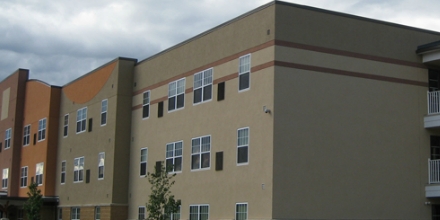
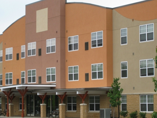
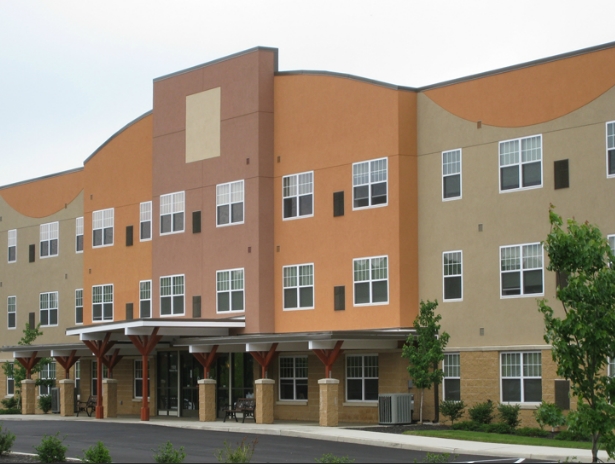
At Harvest House Apartments, you've discovered your new place. Based in Lindenwold's 08021 Zip code, living at this community offers a wide variety of nearby experiences. Here at this community, the leasing team will assist you in finding the perfect fit. Come for a visit to see the current floorplan options. Contact us or stop by today.
Harvest House Apartments is an apartment community located in Camden County and the 08021 ZIP Code. This area is served by the Lindenwold Board Of Education School District attendance zone.
Laundry Facilities
Clubhouse
Gated
Trash Pickup - Curbside
Air Conditioning
High Speed Internet Access
Walk-In Closets
Refrigerator
Tucked into Camden County in South Jersey, Lindenwold is a small borough that punches well above its size when it comes to accessibility and everyday livability. Incorporated in 1929, the borough sits close enough to Philadelphia to make cross-river commuting straightforward, thanks to the PATCO Speedline, which runs its main operations facility right out of Lindenwold Station. New Jersey Transit's Atlantic City Line also stops here, giving residents two distinct transit corridors without the congestion of a major city.
The borough carries a settled, low-key character across its four square miles. Lindenwold Memorial Park draws outdoor enthusiasts with baseball and soccer fields, fitness circuits, and walking trails, while Timber Creek Park stretches 128 acres into neighboring Gloucester Township. For broader retail and dining options, the Voorhees Town Center sits just next door.
Learn more about living in Lindenwold| Colleges & Universities | Distance | ||
|---|---|---|---|
| Colleges & Universities | Distance | ||
| Drive: | 13 min | 6.0 mi | |
| Drive: | 21 min | 10.7 mi | |
| Drive: | 26 min | 13.9 mi | |
| Drive: | 24 min | 15.0 mi |


Transportation options available in Lindenwold include Lindenwold (Patco), located 2.3 miles from Harvest House Apartments. Harvest House Apartments is near Philadelphia International, located 21.9 miles or 36 minutes away, and Trenton Mercer, located 42.8 miles or 61 minutes away.
| Transit / Subway | Distance | ||
|---|---|---|---|
| Transit / Subway | Distance | ||
|
|
Drive: | 7 min | 2.3 mi |
|
|
Drive: | 11 min | 4.9 mi |
|
|
Drive: | 13 min | 5.8 mi |
|
|
Drive: | 14 min | 7.4 mi |
|
|
Drive: | 15 min | 8.1 mi |
| Commuter Rail | Distance | ||
|---|---|---|---|
| Commuter Rail | Distance | ||
|
|
Drive: | 7 min | 2.3 mi |
|
|
Drive: | 12 min | 7.1 mi |
|
|
Drive: | 19 min | 10.0 mi |
| Drive: | 26 min | 13.6 mi | |
|
|
Drive: | 28 min | 18.0 mi |
| Airports | Distance | ||
|---|---|---|---|
| Airports | Distance | ||
|
Philadelphia International
|
Drive: | 36 min | 21.9 mi |
|
Trenton Mercer
|
Drive: | 61 min | 42.8 mi |
Scores provided by
Traffic
CalmAirport
CalmBusinesses
CalmScores provided by
HowLoud What is a Sound Score Rating? A Sound Score Rating aggregates noise caused by vehicle traffic, airplane traffic and local sources. How It WorksTime and distance from Harvest House Apartments.
| Shopping Centers | Distance | ||
|---|---|---|---|
| Shopping Centers | Distance | ||
| Walk: | 14 min | 0.8 mi | |
| Walk: | 18 min | 0.9 mi | |
| Drive: | 5 min | 2.0 mi |
| Parks and Recreation | Distance | ||
|---|---|---|---|
| Parks and Recreation | Distance | ||
|
Downs Farms Trails
|
Drive: | 11 min | 5.1 mi |
|
Kresson Nature Trails
|
Drive: | 11 min | 5.3 mi |
|
Croft Farm Nature Trail
|
Drive: | 13 min | 6.8 mi |
|
Garden State Discovery Museum
|
Drive: | 15 min | 7.2 mi |
|
Barclay Farmstead Nature Trail
|
Drive: | 17 min | 9.3 mi |
| Hospitals | Distance | ||
|---|---|---|---|
| Hospitals | Distance | ||
| Drive: | 8 min | 3.8 mi | |
| Drive: | 12 min | 5.4 mi | |
| Drive: | 14 min | 5.5 mi |
| Military Bases | Distance | ||
|---|---|---|---|
| Military Bases | Distance | ||
| Drive: | 27 min | 17.0 mi | |
| Drive: | 51 min | 30.8 mi | |
| Drive: | 57 min | 30.9 mi |
What Are Walk Score®, Transit Score®, and Bike Score® Ratings?
Walk Score® measures the walkability of any address. Transit Score® measures access to public transit. Bike Score® measures the bikeability of any address.
What is a Sound Score Rating?
A Sound Score Rating aggregates noise caused by vehicle traffic, airplane traffic and local sources.
1101 E Gibbsboro Rd
Lindenwold, NJ 08021


